Sucunduri State Forest

Last updated
Sucunduri State Forest
Floresta Estadual do Sucunduri
IUCN category VI (protected area with sustainable use of natural resources)
Relief Map of Brazil.jpg
Red pog.svg
Nearest city Apuí, Amazonas
Coordinates 8°18′19″S59°20′34″W / 8.305384°S 59.342847°W / -8.305384; -59.342847 Coordinates: 8°18′19″S59°20′34″W / 8.305384°S 59.342847°W / -8.305384; -59.342847
Area492,905 hectares (1,217,990 acres)
Designation State forest
Created20 January 2005

The Sucunduri State Forest (Portuguese : Floresta Estadual do Sucunduri) is a state forest in the state of Amazonas, Brazil.

Portuguese language Romance language that originated in Portugal

Portuguese is a Western Romance language originating in the Iberian Peninsula. It is the sole official language of Portugal, Brazil, Cape Verde, Guinea-Bissau, Mozambique, Angola and São Tomé and Príncipe. It also has co-official language status in East Timor, Equatorial Guinea and Macau in China. As the result of expansion during colonial times, a cultural presence of Portuguese and Portuguese creole speakers are also found in Goa, Daman and Diu in India; in Batticaloa on the east coast of Sri Lanka; in the Indonesian island of Flores; in the Malacca state of Malaysia; and the ABC islands in the Caribbean where Papiamento is spoken, while Cape Verdean Creole is the most widely spoken Portuguese-based Creole. A Portuguese-speaking person or nation is referred to as "Lusophone" (Lusófono).

State forest (Brazil) type of protected area in Brazil

A state forest in Brazil is a type of sustainable use protected area managed at the state level. The primary purpose is sustainable exploitation of the forest, subject to various limits. These include a requirement to preserve at least 50% of the original forest, to preserve forest along watercourses and on steep slopes, and so on.

Amazonas (Brazilian state) State of Brazil

Amazonas is a state of Brazil, located in the North Region in the northwestern corner of the country. It is the largest Brazilian state by area and the 9th largest country subdivision in the world, and is greater than the areas of Uruguay, Paraguay, and Chile combined. Mostly located in the Southern Hemisphere, it is the third largest country subdivision in the Southern Hemisphere after the Australian states of Western Australia and Queensland. It would be the sixteenth largest country in land area, slightly larger than Mongolia. Neighbouring states are Roraima, Pará, Mato Grosso, Rondônia, and Acre. It also borders the nations of Peru, Colombia and Venezuela. This includes the Departments of Amazonas, Vaupés and Guainía in Colombia, as well as the Amazonas state in Venezuela, and the Loreto Region in Peru.

Contents

Location

The Sucunduri State Forest is in the municipality of Apuí, Amazonas. It has an area of 492,905 hectares (1,217,990 acres). [1] It adjoins the Aripuanã Sustainable Development Reserve to the west, which lies on either side of the Aripuanã River. To the south, the border with the state of Mato Grosso separates the forest from the Igarapés do Juruena State Park and the overlapping Juruena National Park. To the east the forest adjoins the Sucunduri State Park. Part of the northern boundary separates it from the Jatuarana National Forest. [2]

Apuí Municipality in North, Brazil

Apuí is a municipality located in the Brazilian state of Amazonas. Its population was 18,790 (2005) and its area is 54,240 km2.

Aripuanã Sustainable Development Reserve

The Aripuanã Sustainable Development Reserve is a sustainable development reserve in the state of Amazonas, Brazil.

Aripuanã River river in Brazil

Aripuanã River is a river in the Mato Grosso and Amazonas states in north-western Brazil. It is a tributary of the Madeira River in the Amazon Basin. The town of Novo Aripuanã is located on its banks where it merges into the Madeira River. The town of Aripuanã is also on its banks, but on the upper (southern) section of the river.

History

The park was created by Amazonas governor decree 24808 of 20 January 2005 with the objective of promoting sustainable multiple use of forest resources and scientific research with emphasis on methods of using native forest resources in a sustainable way. [3]

Conservation

The forest is an integral part of the Apuí Mosaic, which totals 2,467,243 hectares (6,096,690 acres) in area and contains the Guariba and Sucunduri State Parks; Bararati and Aripuana sustainable development reserves; Guariba Extractive Reserve; and Sucunduri, Aripuana, Apuí and Manicoré state forests. [4]

Apuí Mosaic

The Apuí Mosaic is a protected area mosaic in the state of Amazonas, Brazil.

Guariba State Park

The Guariba State Park is a State park in the state of Amazonas, Brazil.

Bararati Sustainable Development Reserve

The Bararati Sustainable Development Reserve' is a sustainable development reserve in the state of Amazonas, Brazil.

Notes

    1. FES do Sucunduri – ISA, Informações gerais.
    2. FES do Sucunduri – ISA, Informações gerais (mapa).
    3. FES do Sucunduri – ISA, Historico Juridico.
    4. Saiba mais sobre o Mosaico de Apuí – WWF.

    Sources

    Related Research Articles

    Juruena River river in Brazil

    The Juruena River is a 1,240 km (770 mi) long river in west-central Brazil, in the state of Mato Grosso.

    Novo Aripuanã Municipality in North, Brazil

    Novo Aripuanã is a municipality located in the Brazilian state of Amazonas.

    Guariba River river in Brazil

    Guariba River is a river of the Mato Grosso and Amazonas states in north-western Brazil. It is a tributary of the Aripuanã River.

    Sucunduri River river in Brazil

    Sucunduri River is a river of Amazonas state in north-western Brazil, one of the main headwaters of the Canumã River.
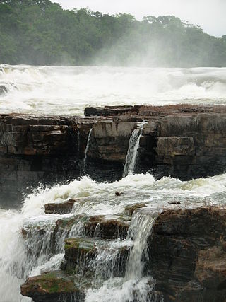
    Juruena National Park National park in Brazil (declared 2006)

    Juruena National Park, declared in 2006, is the third largest national park of Brazil. It is located along the Juruena River, in the north of Mato Grosso state and the south of Amazonas state. It forms part of a corridor of protected areas that is meant to contain agricultural expansion into the Amazon rainforest.

    Acari National Park

    Acari National Park is a national park in the state of Amazonas, Brazil.

    Urupadi National Forest

    Urupadi National Forest is a national forest (Brazil) in the state of Amazonas, Brazil.

    Sucunduri State Park

    Sucunduri State Park is a state park in the state of Amazonas, Brazil.

    Igarapés do Juruena State Park state park in Mato Grosso, Brazil

    The Igarapés do Juruena State Park is a state park in the state of Mato Grosso, Brazil.

    Manicoré State Forest State Forest in Brazil

    The Manicoré State Forest is a state forest in the state of Amazonas, Brazil.

    Aripuanã State Forest

    The Aripuanã State Forest is a State forest in the state of Amazonas, Brazil.

    Southern Amazon Mosaic

    The Southern Amazon Mosaic is a protected area mosaic in Brazil.

    Guariba Extractive Reserve extractive reserve in the state of Amazonas, Brazil

    The Guariba Extractive Reserve is an extractive reserve in the state of Amazonas, Brazil.

    Apuí State Forest

    The Apuí State Forest is a state forest in the state of Amazonas, Brazil.