Sucunduri State Park

Last updated
Sucunduri State Park
Parque Estadual do Sucunduri
IUCN category II (national park)
Relief Map of Brazil.jpg
Red pog.svg
Nearest city Apuí, Amazonas
Coordinates 8°18′46″S58°45′45″W / 8.31278°S 58.762391°W / -8.31278; -58.762391 Coordinates: 8°18′46″S58°45′45″W / 8.31278°S 58.762391°W / -8.31278; -58.762391
Area808,312 hectares (1,997,380 acres)
Designation State park
AdministratorIpaam - Instituto de Proteção Ambiental do Amazonas

Sucunduri State Park (Portuguese : Parque Estadual do Sucunduri) is a state park in the state of Amazonas, Brazil.

Portuguese language Romance language that originated in Portugal

Portuguese is a Western Romance language originating in the Iberian Peninsula. It is the sole official language of Portugal, Brazil, Cape Verde, Guinea-Bissau, Mozambique, Angola and São Tomé and Príncipe. It also has co-official language status in East Timor, Equatorial Guinea and Macau in China. As the result of expansion during colonial times, a cultural presence of Portuguese and Portuguese creole speakers are also found in Goa, Daman and Diu in India; in Batticaloa on the east coast of Sri Lanka; in the Indonesian island of Flores; in the Malacca state of Malaysia; and the ABC islands in the Caribbean where Papiamento is spoken, while Cape Verdean Creole is the most widely spoken Portuguese-based Creole. A Portuguese-speaking person or nation is referred to as "Lusophone" (Lusófono).

State park (Brazil)

A state park in Brazil is a legally defined type of protected area operated by one of the states. Their goal is to preserve important or beautiful natural ecosystems. Public access is allowed subject to regulations defined by the responsible agency.

Amazonas (Brazilian state) State of Brazil

Amazonas is a state of Brazil, located in the North Region in the northwestern corner of the country. It is the largest Brazilian state by area and the 9th largest country subdivision in the world, and is greater than the areas of Uruguay, Paraguay, and Chile combined. Mostly located in the Southern Hemisphere, it is the third largest country subdivision in the Southern Hemisphere after the Australian states of Western Australia and Queensland. It would be the sixteenth largest country in land area, slightly larger than Mongolia. Neighbouring states are Roraima, Pará, Mato Grosso, Rondônia, and Acre. It also borders the nations of Peru, Colombia and Venezuela. This includes the Departments of Amazonas, Vaupés and Guainía in Colombia, as well as the Amazonas state in Venezuela, and the Loreto Region in Peru.

Contents

Location

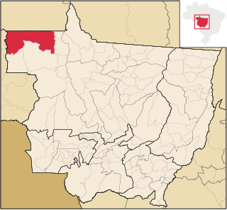
The Sucunduri State Park is in the municipality of Apuí, Amazonas. It has an area of 808,312 hectares (1,997,380 acres). [1] The Juruena River forms the eastern boundary of the park, separating it from the Juruena National Park in the state of Mato Grosso. [2] To the north the Sucunduri State Park adjoins the Bararati Sustainable Development Reserve, Apuí State Forest, the portion of the Juruena National Park that lies in Amazonas and the Jatuarana National Forest. The park adjoins the Sucunduri State Forest to the west and the Igarapés do Juruena State Park in Mato Grosso to the south. [2]

Apuí Municipality in North, Brazil

Apuí is a municipality located in the Brazilian state of Amazonas. Its population was 18,790 (2005) and its area is 54,240 km2.

Juruena River river in Brazil

The Juruena River is a 1,240 km (770 mi) long river in west-central Brazil, in the state of Mato Grosso.

Juruena National Park National park in Brazil (declared 2006)

Juruena National Park, declared in 2006, is the third largest national park of Brazil. It is located along the Juruena River, in the north of Mato Grosso state and the south of Amazonas state. It forms part of a corridor of protected areas that is meant to contain agricultural expansion into the Amazon rainforest.

History

The Sucunduri State Park was created by Amazonas state governor decree 24.810 of 21 January 2005 with the objectives of preserving natural ecosystems of great relevance and scenic beauty, allowing scientific research, education, environmental interpretation, recreation in contact with nature and ecotourism. The state park excluded private property whose owners could prove legal title. [3] It is administered by Ipaam: Instituto de Proteção Ambiental do Amazonas. [4]

In 2014 the federal government was considering a proposal to declare the Juruena National Park an area of public utility in preparation for constructing two hydroelectric dams in the site, the São Simão Alto and Salto Augusto Baixo. The planned dams had a forecast capacity of 4,940 MW. [5] The National Council for Energy Policy (CNPE) had two seats for civil society members, but these had not been filled. WWF-Brasil led a campaign against the energy project, which would flood an area of over 40,000 hectares (99,000 acres). [6] In September 2014 the federal government withdrew its proposal. The dams would have flooded parts of the Juruena National Park, Igarapés do Juruena State Park and the Escondido and Apiaká do Pontal indigenous territories in Mato Grosso, and would have affected part of the Sucunduri State Park in Amazonas and other indigenous territories. [5]

On 17 March 2015 an agreement was made to compensate for the irreversible negative environmental impacts of the Teles Pires hydroelectric project through payment of R$500,000 for use by the park. [3]

Teles Pires Dam dam in Paranaíta, Mato Grosso and Pará, Brazil

The Teles Pires Dam is a run-of-the-river hydroelectric dam on the Teles Pires River, 330 km (205 mi) upstream of the confluence with the Tapajós river, on the border of the Brazilian states of Mato Grosso and Pará. The 80 metres (260 ft) dam impounds a 150 square kilometres (58 sq mi) reservoir, 84% in Mato Grosso state and 16% in Para state.

Environment

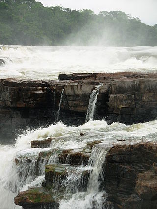
The state park contains the oldest geological domains of the Apuí mosaic, consisting of rocks from the Proterozoic and Paleozoic. These rocks form the Sucunduri Dome between the Aripuanã and Juruena rivers, and cause the many rapids and waterfalls on those rivers. [7] The Bararati River, a left tributary of the Juruena, flows through the park from south to north. The Sucunduri River rises in the park and flows north. It later joins the Acari River to form the Canumã River. [2] The Monte Cristo rapids and the Sucunduri River Falls (Saltos do Rio Sucunduri) are well-known attractions. [7] The Monte Cristo rapids on the Sucunduri is an area with great numbers and diversity of animals and birds. In 2006 it was also the location of an illegal mining settlement. [8] The Augusto Salto on the Juruena has high tourist potential. [9]

The Proterozoic is a geological eon spanning the time from the appearance of oxygen in Earth's atmosphere to just before the proliferation of complex life on the Earth. The name Proterozoic combines the two forms of ultimately Greek origin: protero- meaning "former, earlier", and -zoic, a suffix related to zoe "life". The Proterozoic Eon extended from 2500 mya to 541 mya, and is the most recent part of the Precambrian "supereon." The Proterozoic is the longest eon of the Earth's geologic time scale and it is subdivided into three geologic eras : the Paleoproterozoic, Mesoproterozoic, and Neoproterozoic.

The PaleozoicEra is the earliest of three geologic eras of the Phanerozoic Eon. It is the longest of the Phanerozoic eras, lasting from 541 to 251.902 million years ago, and is subdivided into six geologic periods : the Cambrian, Ordovician, Silurian, Devonian, Carboniferous, and Permian. The Paleozoic comes after the Neoproterozoic Era of the Proterozoic Eon and is followed by the Mesozoic Era.

Aripuanã River river in Brazil

Aripuanã River is a river in the Mato Grosso and Amazonas states in north-western Brazil. It is a tributary of the Madeira River in the Amazon Basin. The town of Novo Aripuanã is located on its banks where it merges into the Madeira River. The town of Aripuanã is also on its banks, but on the upper (southern) section of the river.

The park is in a contact zone between the Amazon rainforest and Cerrado biomes and has a wide diversity of flora including terra firma forest, flooded forest, campos rupestres, campina and campinarana. Vegetation is 52% open rainforest, 32% dense rainforest, 4% savanna-rainforest contact and 12% savannah-seasonal forest contact. [4] Tree species include mahogany, cedar, copaiba, andiroba, Brazil nut and rosewood. Rosewood is the most threatened due to its high economic value. [9] The region has more than 13 endemic species of primates. Surveys of the west of the mosaic have identified 850 tree species, 46 mammals, more than 300 birds, 27 reptiles, 30 amphibians and almost 100 species of fish. [4] Several previously unknown aquatic species have been found. [8]

Conservation

The park is an integral part of the Apuí Mosaic, which totals 2,467,243 hectares (6,096,690 acres) in area and contains the Guariba and Sucunduri State Parks; Bararati and Aripuana sustainable development reserves; Guariba Extractive Reserve; and Sucunduri, Aripuana, Apuí and Manicoré state forests. [9] It is part of the 90,000 square kilometres (35,000 sq mi) Southern Amazon Conservation Corridor, a region under strong deforestation pressure due to the advance of the agricultural frontier into the Brazilian Amazon region. [4] The conservation unit is supported by the Amazon Region Protected Areas Program. [10]

Notes

    1. PES do Sucunduri – ISA, Informações gerais.
    2. 1 2 3 PES do Sucunduri – ISA, Informações gerais (mapa).
    3. 1 2 PES do Sucunduri – ISA, Historico Juridico.
    4. 1 2 3 4 Parque Estadual do Sucunduri – Via Rural.
    5. 1 2 Daniele Bragança 2014.
    6. ONG afirma que Parque Nacional do Juruena corre risco.
    7. 1 2 PES do Sucunduri – ISA, Características.
    8. 1 2 Ana Cíntia Guazzelli & Cláudio Maretti 2006.
    9. 1 2 3 Saiba mais sobre o Mosaico de Apuí – WWF.
    10. Full list: PAs supported by ARPA.

    Sources

    Related Research Articles

    Novo Aripuanã Municipality in North, Brazil

    Novo Aripuanã is a municipality located in the Brazilian state of Amazonas.
    Guariba River river in Brazil

    Guariba River is a river of the Mato Grosso and Amazonas states in north-western Brazil. It is a tributary of the Aripuanã River.

    Sucunduri River river in Brazil

    Sucunduri River is a river of Amazonas state in north-western Brazil, one of the main headwaters of the Canumã River.
    Rio Roosevelt Ecological Station

    The Rio Roosevelt Ecological Station is an ecological station in the state of Mato Grosso, Brazil.

    Campos Amazônicos National Park

    The Campos Amazônicos National Park is a National park in the states of Rondônia, Amazonas and Mato Grosso, Brazil.

    Bararati River

    The Bararati River is a river in the state of Amazonas, Brazil. It is a tributary of the Juruena River.

    Igarapés do Juruena State Park state park in Mato Grosso, Brazil

    The Igarapés do Juruena State Park is a state park in the state of Mato Grosso, Brazil.

    Sucunduri State Forest A state forest in the state of Amazonas, Brazil.

    The Sucunduri State Forest is a state forest in the state of Amazonas, Brazil.

    Manicoré State Forest State Forest in Brazil

    The Manicoré State Forest is a state forest in the state of Amazonas, Brazil.

    Aripuanã Sustainable Development Reserve

    The Aripuanã Sustainable Development Reserve is a sustainable development reserve in the state of Amazonas, Brazil.

    Aripuanã State Forest

    The Aripuanã State Forest is a State forest in the state of Amazonas, Brazil.

    Apuí Mosaic

    The Apuí Mosaic is a protected area mosaic in the state of Amazonas, Brazil.

    Southern Amazon Mosaic

    The Southern Amazon Mosaic is a protected area mosaic in Brazil.

    Guariba State Park

    The Guariba State Park is a State park in the state of Amazonas, Brazil.

    Guariba Extractive Reserve extractive reserve in the state of Amazonas, Brazil

    The Guariba Extractive Reserve is an extractive reserve in the state of Amazonas, Brazil.

    Bararati Sustainable Development Reserve

    The Bararati Sustainable Development Reserve' is a sustainable development reserve in the state of Amazonas, Brazil.

    Apuí State Forest

    The Apuí State Forest is a state forest in the state of Amazonas, Brazil.