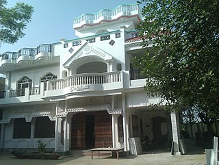
Sultanpur district is a district in the Awadh region of the Indian state of Uttar Pradesh. This district is a part of Ayodhya division in Uttar Pradesh. The administrative headquarters of the district is Sultanpur city. The total area of Sultanpur district is 2672.89 Sq. km.

Gautam Buddha Nagardistrict is a district of Uttar Pradesh, named after Gautama Buddha. It is a part of Delhi NCR and is divided into 3 sub-divisions (Tehsils) i.e. Noida, Dadri and Jewar. Greater Noida is the administrative headquarters of Gautam Buddha Nagar district. Noida, Greater Noida, Dadri, Jewar and Dankaur fall under this district.

Prayagraj district, previously known as Allahabad district, is the most populous district in the Indian state of Uttar Pradesh. Prayagraj city is the district headquarters of this district. The District is divided into blocks within tehsils. As of 2011, there are 20 blocks in eight tehsils. The Prayagraj division includes the districts of Pratapgarh, Fatehpur, Kaushambi and Prayagraj, with some western parts that had previously part of Allahabad District becoming part of the new Kaushambi District. The administrative divisions are Phulpur, Koraon, Meja, Sadar, Soraon, Handia, Bara, Shringverpur and Karchana.

Chandauli district is a district of Uttar Pradesh state of India, and Chandauli town is the district headquarters. Chandauli district is a part of Varanasi Division. Chandauli became a separate district for the first time on 20 May 1997.

Deoria district, one of the districts of eastern Uttar Pradesh, India has its headquarters located at Deoria and is a part of Gorakhpur division. It came into existence on 16 March 1946 from Gorakhpur district.

Etah district is one of the districts of Uttar Pradesh, India, since 1854. Etah City is the district headquarters. Etah district is a part of Aligarh Division.

Etawah district is one of the districts in the western portion of Uttar Pradesh state of India. Etawah town is the district headquarters. The district covers an area of 2311 km2. It has a population of 1,581,810.

Ayodhya district is an administrative district of the Indian state of Uttar Pradesh. The city of Ayodhya is its administrative headquarters. The district occupies an area of 2,522 square kilometres (974 sq mi), and had a population of 2,470,996 in the 2011 census. Ayodhya district shares its borders with 6 districts of Uttar Pradesh. It is bordered by Gonda and Basti districts on the northern side, Amethi and Sultanpur districts on the south, and Ambedkar Nagar and Barabanki districts share the border on the east and west.

Jalaun district is a district of Uttar Pradesh, India. The district is named after the town of Jalaun, which was the former headquarters of a Maratha governor, but the administrative headquarters of the district is at Orai.
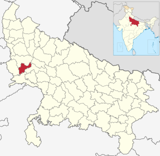
Hathras district is a district of Uttar Pradesh state of India. The city of Hathras is the district headquarters. Hathras district is a part of Aligarh division. The district occupies an area of 1,840 square kilometres (710 sq mi) and has a population of 1,564,708 as of the 2011 census.

Hamirpur district is one of the 75 districts of Uttar Pradesh state of India and Hamirpur town is the district headquarters. Hamirpur district is a part of Chitrakoot Division. The district occupies an area of 4,121.9 km². The district has a population of 1,104,285. As of 2011 it is the third least populous district of Uttar Pradesh, after Mahoba and Chitrakoot. Two major rivers Yamuna and Betwa meet here. On the banks of river Betwa lies the "Coarse sand" which is exported to many parts in U.P.

Shravasti district is one of the districts of the Uttar Pradesh state of India, with Bhinga town as its district headquarters. Shravasti district is a part of Devipatan Division. According to Government of India, it is among the 121 minority concentrated districts in India. It is the fourth most backward district in India, according to the 2018 Niti Aayog ranking. This district is the most poverty stricken district in the country.

Kanpur Nagar district, meaning Urban Kanpur District is one of the districts of the Uttar Pradesh state of India. It is a part of Kanpur division and its district headquarters is Kanpur. Kanpur was formerly spelled Cawnpore.
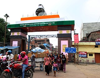
Maharajganj district is one of the 75 districts of Uttar Pradesh state in northern India, and the town of Maharajganj is the district headquarters. District is a part Gorakhpur division. It is located in Terai region of Himalayas, bordering Nepal in North. Gandak, Rapti, Rohin are some major river flowing through the district.

Meerut district, is one of the districts of Uttar Pradesh state of India, and Meerut is the district headquarters. Meerut district is also a part of the Meerut division. The administrative head of district of Meerut is a District Magistrate while the administrative head of Meerut Division is Divisional Commissioner, an IAS officer.
Bhadehari is a village in Kerakat nagar panchayat, Jaunpur, Uttar Pradesh, India.
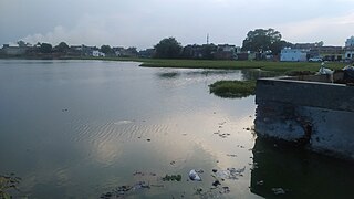
Shamli is a district in the Indian state of Uttar Pradesh. This district was carved out from Muzaffarnagar District on 28 September 2011 as Prabudh Nagar and renamed Shamli in July 2012. Shamli is the headquarters of the district. Shamli is located along the Delhi-Saharanpur-Dehradun Expressway, Ambala-Shamli Expressway, Gorakhpur-Shamli Expressway, Delhi–Saharanpur, Meerut-Karnal and Panipat-Khatima Highways.

Sambhal district is a district of Uttar Pradesh state in India. The district headquarter is Bahjoi town. 993 Villages and 16 Police stations fall under Sambhal district.
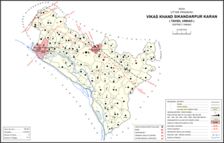
Maharamau is a small village in the Sikandarpur Karan block of Unnao district, Uttar Pradesh, India. As of 2011, its population was 550 in 106 households. It has one primary school and no healthcare facilities.

Taudhakpur, also known as Mirzapur Urf Taudhakpur, is a village located in Raebareli district, in the state of Uttar Pradesh, India. The village is 31 km from Raebareli and 87 km from Lucknow. As of 2011, the village had the population of 833 with 70.43% literacy rate. With the introduction of a digitized information center and modern-age communication facilities in 2018, Taudhakpur became the first smart village of India.


