Krasnoyarsk Krai is a federal subject of Russia located in Siberia. Its administrative center is the city of Krasnoyarsk, the third-largest city in Siberia, after Novosibirsk and Omsk. Comprising half of the Siberian Federal District, Krasnoyarsk Krai is the largest krai in Russia, the second-largest federal subject in the country after neighboring Sakha, and the third-largest country subdivision by area in the world. The krai covers an area of 2,366,797 square kilometers (913,825 sq mi), constituting roughly 13% of Russia's total area. Krasnoyarsk Krai has a population of 2,856,971 as of the 2021 Census.

Kansk is a town in Krasnoyarsk Krai, Russia, located on both banks of the Kan River. Population: 94,226 (2010 Census); 103,000 (2002 Census); 109,607 (1989 Census).
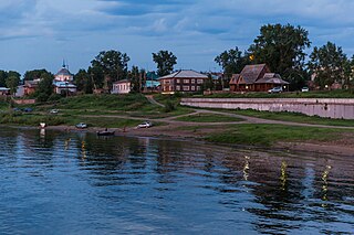
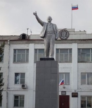
Yeniseysk is a town in Krasnoyarsk Krai, Russia, located on the Yenisei River. Population: 18,766 (2010 Census); 20,394 (2002 Census); 22,891 (1989 Census); 20,000 (1970).

Bogotol is a town in Krasnoyarsk Krai, Russia, located 6 kilometers (3.7 mi) of the Chulym River and 252 kilometers (157 mi) west of Krasnoyarsk, the administrative center of the krai. Population: 21,051 (2010 Census); 24,369 (2002 Census); 27,752 (1989 Census).

Lesosibirsk is a town in Krasnoyarsk Krai, Russia, located on the Yenisei River. Population: 61,139 (2010 Census); 65,374 (2002 Census); 68,349 (1989 Census)..

Turukhansk is a rural locality and the administrative center of Turukhansky District of Krasnoyarsk Krai, Russia, located 1,474 kilometers (916 mi) north of Krasnoyarsk, at the confluence of the Yenisey and Nizhnyaya Tunguska Rivers.

Zaozyorny is a town and the administrative center of Rybinsky District of Krasnoyarsk Krai, Russia, located on the Barga River, the affluent of the Kan, 166 kilometers (103 mi) east of Krasnoyarsk on the 4,263rd km of the Trans-Siberian Railway. Population: 10,681 (2010 Census); 12,476 (2002 Census); 15,714 (1989 Census).
Yugh people are a critically endangered Yeniseian people, an indigenous group who originally lived throughout central Siberia. The Yugh people live along the Yenisei River from Yeniseisk to the mouth of the Dupches River.
Sibirtsevo is an urban locality in Chernigovsky District of Primorsky Krai, Russia.
Dzerzhinsky District is an administrative and municipal district (raion), one of the forty-three in Krasnoyarsk Krai, Russia. It is located in the southeast of the krai and borders with Taseyevsky District in the north, Abansky District in the east, Kansky District in the south, and with Sukhobuzimsky District in the west. The area of the district is 3,569 square kilometers (1,378 sq mi). Its administrative center is the rural locality of Dzerzhinskoye. Population: 14,552 (2010 Census); 17,028 ; 20,485 (1989 Census). The population of Dzerzhinskoye accounts for 50.7% of the district's total population.

Kozulsky District is an administrative and municipal district (raion), one of the forty-three in Krasnoyarsk Krai, Russia. It is located in the southwest of the krai and borders with Birilyussky District in the north, Yemelyanovsky District in the east, Balakhtinsky District in the south, and with Nazarovsky, Achinsky and Bolsheuluysky Districts in the west. The area of the district is 5,305 square kilometers (2,048 sq mi). Its administrative center is the urban locality of Kozulka. Population: 16,689 (2010 Census); 19,010 ; 22,076 (1989 Census). The population of Kozulka accounts for 47.9% of the district's total population.

Nizhneingashsky District is an administrative and municipal district (raion), one of the forty-three in Krasnoyarsk Krai, Russia. It is located in the southeast of the krai and borders Abansky District in the north, Irkutsk Oblast in the east and southeast, and Ilansky District in the south and west. The area of the district is 6,143 square kilometers (2,372 sq mi). Its administrative center is the urban locality of Nizhny Ingash. As of the 2010 Census, the total population of the district was 33,439, with the population of Nizhny Ingash accounting for 22.7% of that number.
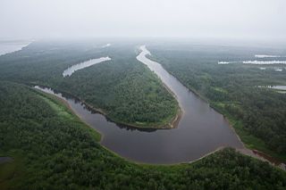
Turukhansky District is an administrative and municipal district (raion), one of the forty-three in Krasnoyarsk Krai, Russia. It is located in the west of the krai and borders with Taymyrsky Dolgano-Nenetsky District in the north, Evenkiysky District in the east, Yeniseysky District in the south, and with Tyumen Oblast in the west. The area of the district is 211,189 square kilometers (81,541 sq mi). Its administrative center is the rural locality of Turukhansk. Population: 18,708 (2010 Census); 12,439 ; 19,257 (1989 Census). The population of Turukhansk accounts for 24.9% of the district's total population.
Uyar is a town and the administrative center of Uyarsky District of Krasnoyarsk Krai, Russia, located on the Uyarka River 132 kilometers (82 mi) east of Krasnoyarsk. Population: 12,665 (2010 Census); 13,807 (2002 Census); 17,040 (1989 Census).
Poligus is a rural locality in Evenkiysky District of Krasnoyarsk Krai, Russia, located on the right bank of the Podkamennaya Tunguska River, 380 km from the district center. The village name is of Evenki origin, of a legendary Poligus shaman(Фёдор Полигус).

Beryozovka is an urban locality in Beryozovsky District of Krasnoyarsk Krai, Russia. Population: 20,887 (2010 Census); 21,346 (2002 Census); 20,766 (1989 Census).The settlement borders Krasnoyarsk and is a close part of its metro area. Beryozovka is being served by Krasnoyarsk city transit system as well as some regional bus routs.

Dubinino is an urban locality in Krasnoyarsk Krai, Russia. Population: 9,497 (2010 Census); 12,028 (2002 Census); 12,185 (1989 Census).
Yemelyanovo is an urban locality in Yemelyanovsky District of Krasnoyarsk Krai, Russia. Population: 12,055 (2010 Census); 11,919 (2002 Census); 15,408 (1989 Census).
Mazulsky is an urban locality in Krasnoyarsk Krai, Russia. Population: 1,293 (2010 Census); 1,326 (2002 Census); 1,638 (1989 Census).
Razdolinsk is an urban locality in Motyginsky District of Krasnoyarsk Krai, Russia. Population: 2,502 (2010 Census); 2,806 (2002 Census); 3,800 (1989 Census).