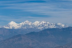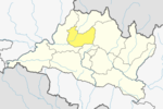
Prithvi Narayan Shah, was the last king of the Gorkha Kingdom and first king of the Kingdom of Nepal. Prithvi Narayan Shah started the unification of Nepal.

Manaslu is the eighth-highest mountain in the world at 8,163 metres (26,781 ft) above sea level. It is in the Mansiri Himal, part of the Nepalese Himalayas, in west-central Nepal. Manaslu means "mountain of the spirit" and the word is derived from the Sanskrit word manasa, meaning "intellect" or "soul". Manaslu was first climbed on May 9, 1956, by Toshio Imanishi and Gyalzen Norbu, members of a Japanese expedition. It is said that, given the many unsuccessful attempts by the British to climb Everest before Nepali Tenzing Norgay and New Zealander Edmund Hillary, "just as the British consider Everest their mountain, Manaslu has always been a Japanese mountain".

The Bagmati River flows through the Kathmandu valley of Nepal, separating the cities of Kathmandu and Patan, before flowing through Madesh Province of southern Nepal and joining the Kamla River in the Indian state of Bihar. It is considered holy by both Hindus and Buddhists. A number of Hindu temples are located on its banks.

Langtang Valley also known as Lamtang Valley is a Himalayan valley in the mountains of north-central Nepal, known for its trekking routes and natural environment.

Dhading District, a part of Bagmati Province, is one of the seventy-seven districts of Nepal. The district, with Dhading Besi as its district headquarters, covers an area of 1,926 square kilometres (744 sq mi), had a population of 338,658 in 2001 and 336,067 in 2011.
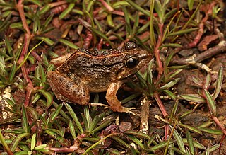
Minervarya syhadrensis, commonly known as long-legged cricket frog, Syhadra frog, Bombay wart frog, and many others, is a species of frog in the family Dicroglossidae found in India, Bangladesh, and Nepal at low to moderate elevations. It is the type species of genus Minervarya. In view of its wide distribution and stable population trend, IUCN assessors listed it as Least Concern in 2009 and 2016.

Helambu is a region of highland villages in Nepal, about 80 km from Kathmandu. It is the home of the Hyolmo people. The word Hyolmo derives from the word Helambu. The Helambu region begins at the Lauribina La pass and descends to the Melamchi valley. Helambu is famous for its sweet apples. and artistic Buddhist monasteries and it is a Buddhist pilgrimage site.

Nagarkot is a former Village Development Committee located 32 km east of Kathmandu, Nepal in Bhaktapur District in Bagmati Province and as of 2015 part of Nagarkot Municipality. At the time of the 2011 census it had a population of 4,571 and had 973 houses in it. At an elevation of 2,195 meters, it is considered one of the most scenic spots in Bhaktapur District. It is known for a sunrise view of the Himalayas including Mount Everest as well as other peaks of the Himalayan range of eastern Nepal. Nagarkot also offers views of the Kathmandu Valley. The scenery of the place makes it a popular hiking route for tourists. It is located approximately 7000 ft above sea level and 28 km from Kathmandu International Airport.
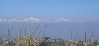
Dhulikhel is a municipality in Kavrepalanchok District of Nepal. Two major highway B.P. Highway and Araniko Highway passes through Dhulikhel. Araniko Highway connects Kathmandu, Nepal's capital city with Tibet's border town of Kodari. Dhulikhel is located at the Eastern rim of Kathmandu Valley, south of the Himalayas at 1550m above sea level and is situated 30 km southeast of Kathmandu and 74 km southwest of Kodari. The Majority of people in Dhulikhel are Newars, and Brahmin, Chhettri, Tamang and Dalit are also living in outer area of the town. Drinking water in Dhulikhel is some of the best water in Nepal. It was made with the help of the German NGO German Technical Cooperation.
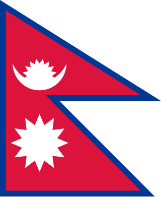
The following outline is provided as an overview of and topical guide to Nepal:

Dorje Lhakpa is a mountain in the Jugal Himal, southeast of Langtang valley in Nepal.

Yala Peak is a mountain in the Langtang area in Nepal.
Baluwa is a village and former Village Development Committee that is now part of Gokarneshwar Municipality in Kathmandu District in Bagmati Province of central Nepal. At the time of the 2011 Nepal census it had a population of 5,467 and had 1,204 houses in it. It is located at north-east side from the capital city of Nepal. It touch Nuwakot District to the north and Gorkna VDC to the south. In east side, there is Nayapati VDC and in west Kapan VDC.
Jhor Mahankal is a village and former village development committee which is part of the Tokha municipality in Kathmandu District, Bagmati Province of central Nepal. It had a population of 4,103 in the 2011 Nepal census, with 873 households. Jhor Mahankal is known for Baruneshwar Gufa and its waterfalls. A number of clans live there, primarily the Adhikaris, Lamichanne, Dulals, Bidari, and Tamang. Jhor Mahankal is 7 kilometres (4.3 mi) from Kathmandu, with bus service from the Jhor bus station to Simalchour Syampati and Samakhushi and Ratna Park in Kathmandu.
Naikap Purano Bhanjyang is a village and former Village Development Committee that is now part of Chandragiri Municipality in Kathmandu District in Province No. 3 of central Nepal. At the time of the 1991 Nepal census it had a population of 3,456. The highest terrains in this village locate westerly, in ward No.5. A panoramic beautiful scene of whole Kathmandu Valley from Sanga to Nagarkot and Swayambhunath to Kirtipur Chobar can be viewed very clearly. The height of this hilly region lies in between 1600 m to 1800 m. The whole Himalayan range from Langtang to Mahalangur can also be viewed.

Sundarijal is a village and former Village Development Committee that is now part of Gokarneshwar Municipality in Kathmandu district in Province No. 3 of central Nepal.

Langtang National Park is a national protected area in north-central Nepal. It was established in 1976 as Nepal's first Himalayan national park and the country's fourth protected area. It covers an area of 1,710 km2 (660 sq mi) in the Nuwakot, Rasuwa and Sindhulpalchok Districts of the central Himalayan region. It contains 26 village communities and includes the Langtang valley. In the north and east it is linked with Qomolangma National Nature Preserve in the Tibet Autonomous Region. The eastern and western boundaries follow the Bhote Koshi and the Trishuli river, respectively.

Shivapuri Nagarjun National Park is the ninth national park in Nepal and was established in 2002. It is located in the country's mid-hills on the northern fringe of the Kathmandu Valley and named after Shivapuri Peak at 2,732 m (8,963 ft) altitude. It covers an area of 159 km2 (61 sq mi) in the districts of Kathmandu, Nuwakot and Sindhupalchowk, adjoining 23 Village Development Committees. In the west, the protected area extends to the Dhading District.

Panch Pokharii is a group of 5 (panch) Hindu holy lakes in the Sindhupalchowk District of Nepal. The lakes are a popular destination for Hindu and Buddhist pilgrims during Janai Purnima.
