Swanders, Ohio

Last updated

Location of Swanders, Ohio OHMap-doton-Swanders.png
Location of Swanders, Ohio

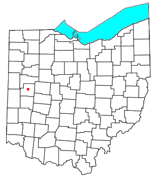
Swanders is a rural unincorporated community located on Fort Loramie-Swanders Road in Franklin Township, Shelby County, Ohio, United States. [1] It lies midway between the village of Anna and the city of Sidney.

Contents

History

In 1857 the Dayton and Michigan Railroad was constructed through James Swander's farm who gave the railroad the right of way through his farm; in 1867 a flag station of the D & M. R. R. and a Post Office was established in the village on the application of James Swander. The village was named in honor of James Swanders who was the town first postmaster and who also served as a railroad agent for the D & M R R. [2]

One of the 1965 Palm Sunday tornados narrowly missed the community.

For many years, Swanders was the location of a community-owned grain elevator, which has since been demolished with the silos and office remaining of the ag business which was purchased in the 1990s by Wapakoneta-based Auglaize-Provico. In 2010 Auglaize-Provico merged in with Trupointe Coopererative based in Piqua which also purchased the former Landmark grain terminal in nearby Sidney. As of 2020, the Sidney grain terminal is now owned by Cargill Inc.

In 2016, Fremont-based Sunrise Cooperative purchased Trupointe Cooperative with its Sidney Grain facility and neighboring Advanced Agri Solutions, a feed business both located in Swanders.

In 2018 after 161 years, Sunrise Cooperative closed down its Swanders operation.

Government

The Franklin Township hall is located in Swanders.[ citation needed ]

Transportation

A north-south CSX rail line passes through Swanders.

Because of its location near County Road 25-A (the former U.S. 25), Swanders can easily be accessed by road from the nearby Interstate 75 which runs parallel with 25-A. (Exit 94).

Related Research Articles

<span class="mw-page-title-main">Shelby County, Ohio</span> County in Ohio, United States

Shelby County is a county in the western portion of the U.S. state of Ohio. As of the 2020 United States Census, the population was 48,230. Its county seat is Sidney. Its name honors Isaac Shelby, first governor of Kentucky.

<span class="mw-page-title-main">Sidney, Ohio</span> City in Ohio, United States

Sidney is a city in and the county seat of Shelby County, Ohio, United States, located approximately 36 miles (58 km) north of Dayton and 100 miles (160 km) south of Toledo. The population was 20,421 at the time of the 2020 census. It is named after English poet Philip Sidney, and many of the city's elementary schools are named after famous writers, including Ralph Waldo Emerson, Henry Wadsworth Longfellow, and John Greenleaf Whittier. Sidney was the recipient of the 1964 All-America City Award. In 2009, it was the subject of the documentary film 45365.

<span class="mw-page-title-main">Saint Marys Township, Auglaize County, Ohio</span> Township in Ohio, United States

Saint Marys Township is one of the fourteen townships of Auglaize County, Ohio, United States. The 2020 census found 11,065 people in the township.

<span class="mw-page-title-main">German Township, Auglaize County, Ohio</span> Township in Ohio, United States

German Township is one of the fourteen townships of Auglaize County, Ohio, United States. The 2020 census found 3,751 people in the township.

<span class="mw-page-title-main">Houston, Ohio</span> Unincorporated community in Ohio, U.S.

Houston is an unincorporated community in northern Loramie Township, Shelby County, Ohio, United States. It has a post office, a dollar general, and a grain elevator.

<span class="mw-page-title-main">Marion Township, Mercer County, Ohio</span> Township in Ohio, United States

Marion Township is one of the fourteen townships of Mercer County, Ohio, United States. The 2020 census found 3,322 people in the township.

<span class="mw-page-title-main">Saint Johns, Ohio</span> Unincorporated community in Ohio, United States

Saint Johns is a census-designated place located along the border between the Union and Clay townships of Auglaize County, Ohio, United States. As of the 2010 census it had a population of 304.

<span class="mw-page-title-main">Ohio State Route 119</span> East-west state highway in Ohio, US

State Route 119 is an east–west highway serving rural sections of west-central Ohio. It begins just west of Fort Recovery at the eastern terminus of Indiana State Road 26. It travels through Mercer, Auglaize, and Shelby counties to end at SR 65 in Jackson Township, Shelby County. The route is 42-mile-long (68 km) and serves the medium-size villages of Fort Recovery, St. Henry, Minster, and Anna.

<span class="mw-page-title-main">Dinsmore Township, Ohio</span> Township in Ohio, United States

Dinsmore Township is one of the fourteen townships of Shelby County, Ohio, United States. The 2020 census found 3,379 people in the township.

<span class="mw-page-title-main">Franklin Township, Shelby County, Ohio</span> Township in Ohio, United States

Franklin Township is one of the fourteen townships of Shelby County, Ohio, United States. The 2020 census found 3,457 people in the township.

<span class="mw-page-title-main">Jackson Township, Shelby County, Ohio</span> Township in Ohio, United States

Jackson Township is one of the fourteen townships of Shelby County, Ohio, United States. The 2020 census found 2,414 people in the township.

<span class="mw-page-title-main">McLean Township, Shelby County, Ohio</span> Township in Ohio, United States

McLean Township is one of the fourteen townships of Shelby County, Ohio, United States. The 2020 census found 3,378 people in the township.

<span class="mw-page-title-main">Turtle Creek Township, Shelby County, Ohio</span> Township in Ohio, United States

Turtle Creek Township is one of the fourteen townships of Shelby County, Ohio, United States. The 2020 census found 1,605 people in the township.

<span class="mw-page-title-main">Van Buren Township, Shelby County, Ohio</span> Township in Ohio, United States

Van Buren Township is one of the fourteen townships of Shelby County, Ohio, United States. The 2020 census found 2,083 people in the township.

<span class="mw-page-title-main">Moulton, Ohio</span> Unincorporated community in Ohio, U.S.

Moulton is an unincorporated community located in southern Moulton Township, Auglaize County, Ohio, United States.

<span class="mw-page-title-main">Kossuth, Ohio</span> Unincorporated community in Ohio, U.S.

Kossuth is an unincorporated community located in eastern Salem Township, Auglaize County, Ohio, United States.

<span class="mw-page-title-main">Kirkwood, Ohio</span> Unincorporated community in Ohio, U.S.

Kirkwood is a rural unincorporated community located at the intersection of Kirkwood and River Roads in southwestern Orange Township, Shelby County, Ohio, United States.

<span class="mw-page-title-main">Geyer, Ohio</span> Unincorporated community in Ohio, U.S.

Geyer is an unincorporated community in southwestern Clay Township, Auglaize County, Ohio, United States.

<span class="mw-page-title-main">St. Patrick, Ohio</span> Unincorporated community in Ohio, United States

St. Patrick is an unincorporated community in northwestern Turtle Creek Township, Shelby County, Ohio, United States. It lies at the intersection of Hoying and Wright-Puthoff Roads, northwest of the city of Sidney, the county seat of Shelby County. Its elevation is 971 feet (296 m) and it is located at 40°22′15″N84°17′15″W.

Slater is an unincorporated community in Clay Township, Auglaize County, Ohio, United States. It is located southeast of Wapakoneta and just south of Saint Johns, on Geyer Road between Clay Road and Gutman Road, at 40°31′40″N84°04′24″W.

References

  1. U.S. Geological Survey Geographic Names Information System: Swanders, Ohio
  2. Hitchcock, Almon Baldwin Carrington (1913). History of Shelby County, Ohio, and representative citizens. p. 349.

40°21′38″N84°10′23″W / 40.36056°N 84.17306°W / 40.36056; -84.17306