
Uitenhage, officially renamed Kariega, is a South African town in the Eastern Cape Province. It is well known for the Volkswagen factory located there, which is the biggest car factory on the African continent. Along with the city of Port Elizabeth and the small town of Despatch, it forms the Nelson Mandela Bay Metropolitan Municipality.
The following lists events that happened during 1875 in South Africa.

The R61 is a long provincial route in South Africa that connects Beaufort West with Port Shepstone via Graaff-Reinet, Komani, Mthatha and Port Edward.
The R67 is a provincial route in Eastern Cape, South Africa that connects Port Alfred with Komani via Grahamstown.

The R75 is a provincial route in Eastern Cape, South Africa that connects Graaff-Reinet with Gqeberha via Despatch, Kariega and Jansenville.
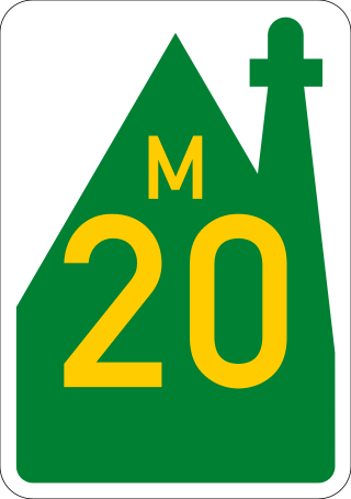
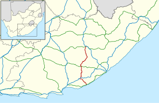
The R334 is a Regional Route in the Nelson Mandela Bay Metropolitan Municipality of South Africa that connects the N2 west of Gqeberha to the N2 at Coega north of Gqeberha via Uitenhage. The middle section of the route is also designated as the M20 metropolitan route.
The M19 is a metropolitan route in the Nelson Mandela Bay Municipality in South Africa that connects Swartkops with Uitenhage via Despatch.
The M10 is a metropolitan route in the Nelson Mandela Bay Municipality in South Africa that connects Gqeberha and Uitenhage.

The N2 is a national route in South Africa that runs from Cape Town through George, Gqeberha, East London, Mthatha, Port Shepstone and Durban to Ermelo. It is the main highway along the Indian Ocean coast of the country. Its current length of 2,255 kilometres (1,401 mi) makes it the longest numbered route in South Africa.
Metrorail Eastern Cape is the name given to the commuter rail services operated by Metrorail, a division of the Passenger Rail Agency of South Africa, in the Eastern Cape province of South Africa. There are two lines, one connecting Port Elizabeth, Despatch and Uitenhage, and the other connecting East London, Mdantsane and Berlin.
Despatch is a small town in the Eastern Cape Province of South Africa situated between Port Elizabeth and Uitenhage with an estimated population of 40 000. It forms part of the Nelson Mandela Bay Metropolitan Municipality which includes Port Elizabeth and Uitenhage, and has collectively a population of over 1.3 million.

Jansenville is a town in Sarah Baartman District Municipality in the Eastern Cape province of South Africa.
iBhayi is a large township near Port Elizabeth, South Africa. It is the largest township in the Eastern Cape province and the ninth largest in South Africa after Mitchells Plain near Cape Town in the Western Cape.
Motherwell is a fast growing township in the Eastern Cape province of South Africa. It forms part of the Nelson Mandela Bay Metropolitan Municipality which is the metropolitan area comprising Gqeberha, Despatch, Uitenhage and other surrounding towns.

The Cape Government Railways 0-4-0ST of 1873 was a South African steam locomotive from the pre-Union era in the Cape of Good Hope.

The Cape Government Railways 0-4-0ST of 1874 was a South African steam locomotive from the pre-Union era in the Cape of Good Hope.
In South Africa, as elsewhere in the world, the railways played a huge part in development and growth on nearly all terrains in the country. Conversely, events in South Africa and its neighbours over the years had a huge influence on the development of railways.
Bluewater Bay is a small seaside suburb located along the Algoa Bay between Port Elizabeth and Coega in the Eastern Cape, South Africa.
The M6 is a metropolitan route in the Nelson Mandela Bay Municipality in South Africa that connects the eastern part of Despatch with the Uitenhage (Kariega) town centre.
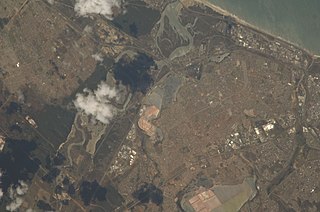
Swartkops River, also Zwartskop River, is a watercourse in the Eastern Cape province of South Africa. The source of the Swartkops is near Cockscombe Mountain, and it flows east into the Algoa Bay of the Indian Ocean in Bluewater Bay, just outside Gqeberha. Its two main tributaries are the northern Kwa-Zunga River and the southern Elands River. The river is also fed by Motherwell Canal, Markman Canal, and Chatty River, which are also sources of water pollution. The river's Groendal Dam was constructed in 1933. The Swartzkops watershed lies with the Uitenhage Artesian Basin. The river suffers from sewage pollution, litter, and algae blooms.


