Sweetwater is an extinct town in Lyon County, in the U.S. state of Nevada. [1]
Lyon County is a county in the U.S. state of Nevada. As of the 2010 census, the population was 51,980. Its county seat is Yerington.
In the United States, a state is a constituent political entity, of which there are currently 50. Bound together in a political union, each state holds governmental jurisdiction over a separate and defined geographic territory and shares its sovereignty with the federal government. Due to this shared sovereignty, Americans are citizens both of the federal republic and of the state in which they reside. State citizenship and residency are flexible, and no government approval is required to move between states, except for persons restricted by certain types of court orders. Four states use the term commonwealth rather than state in their full official names.
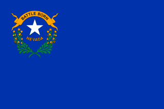
Nevada is a state in the Western United States. It is bordered by Oregon to the northwest, Idaho to the northeast, California to the west, Arizona to the southeast and Utah to the east. Nevada is the 7th most extensive, the 34th most populous, but the 9th least densely populated of the U.S. states. Nearly three-quarters of Nevada's people live in Clark County, which contains the Las Vegas–Paradise metropolitan area where three of the state's four largest incorporated cities are located. Nevada's capital, however, is Carson City.
A post office was established at Sweetwater in 1870, and remained in operation until 1925. [2] The community took its name from the Sweetwater Mountains. [3]
The Sweetwater Mountains is a small mountain range in northern Mono County, California and western Lyon County, Nevada, separating the West Walker River from the East Walker River. Most of the range is only accessible by four wheel drive vehicle, on foot, or pack animal. Most of the range is contained in the Toiyabe National Forest. The place name appears on the 1874 California Geologic Survey map of California and Nevada.
Woodfords is an unincorporated community in Alpine County, California, near Markleeville. For census purposes, it is included in Alpine Village. It is located 6 miles (9.7 km) north-northwest of Markleeville, at 38°46′40″N119°49′19″W.
Hazen is an unincorporated community in Churchill County, Nevada, United States, about 12 miles (19 km) southeast of Fernley and 16 miles (26 km) northwest of Fallon, on U.S. Route 50 Alternate.
Algiers is an unincorporated community in Jefferson Township, Pike County, in the U.S. state of Indiana.
Rand is an extinct town in Mineral County, in the U.S. state of Nevada.
Russell Center is an unincorporated community in Geauga County, in the U.S. state of Ohio.
Centerville is an unincorporated community in Douglas County, in the U.S. state of Nevada.
Holbrook Junction is an unincorporated community in Douglas County, in the U.S. state of Nevada.
Black Forest is an extinct town in Elko County, in the U.S. state of Nevada.
Gold Creek is an extinct town in Elko County, in the U.S. state of Nevada.
Tobar is an extinct town in Elko County, in the U.S. state of Nevada.
White Rock is an extinct town in Elko County, in the U.S. state of Nevada.
Gilbert is an extinct town in Esmeralda County, in the U.S. state of Nevada.
Amos is an unincorporated community in Humboldt County, in the U.S. state of Nevada.
National is an extinct town in Humboldt County, in the U.S. state of Nevada.
Rebel Creek is an unincorporated community in Humboldt County, in the U.S. state of Nevada.
Acoma is an extinct town in Lincoln County, in the U.S. state of Nevada. The GNIS classifies it as a populated place.
Joseco is an extinct town in Lincoln County, in the U.S. state of Nevada. The GNIS classifies it as a populated place.
Simpson is an unincorporated community in Lyon County, in the U.S. state of Nevada.
Omco is an extinct town in Mineral County, in the U.S. state of Nevada. The GNIS classifies it as a populated place.
Lodi is an extinct town in Nye County, in the U.S. state of Nevada. The GNIS classifies it as a populated place.
This Nevada state location article is a stub. You can help Wikipedia by expanding it. |