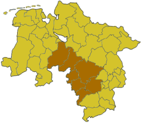
Hanover was a Regierungsbezirk of the German state of Lower Saxony from 1946 until 2004. It was located in the centre and the south of the state, centered on the Lower Saxon capital of Hanover.

Kosovo District was a district of Kosovo and Metohija between 1990 and the end of the Kosovo War in 1999. From the Serbian point of view, the district continues to be part of the Republic of Serbia. It had a population of 672,292 and its capital was Pristina.

Sentrum, meaning city-centre, is located on the southeast side of Oslo near the inner Oslofjord.
Barkal is an upazila (sub-district) of Rangamati District in the Division of Chittagong, Bangladesh. Tribal people call it as Borhol বড়হল.

Harirampur is an upazila of Manikganj District in the Division of Dhaka, Bangladesh.
Podalakur is a mandal in Nellore district in the state of Andhra Pradesh in India.
Dachepalle town is the Municipality in Palnadu district of the Indian state of Andhra Pradesh.Town is the second lime city of India. It is the headquarters of Dachepalle mandal. This is place is surrounded by good limestone resources.
Machavaram is a village in Palnadu district of the Indian state of Andhra Pradesh. It is the headquarters of Machavaram mandal in Gurazala revenue division.
Chitvel is a small town in Annamayya district of the Indian state of Andhra Pradesh. It is located in Chitvel mandal of Rajampet
Choppadandi is a town Choppadandi constituency of Karimnagar district in the state of Telangana in India.
Musakhel is a village and the center of Musakhel District, Khost Province, Afghanistan. It is located at 33.5333°N 69.7333°E at 1835 m altitude. The town is located within the heartland of the Ahmadzai tribe of Ghilji Pashtuns.
Waldburg-Wolfegg was a County ruled by the House of Waldburg, located in southeastern Baden-Württemberg, Germany. Waldburg-Wolfegg was a partition of Waldburg-Wolfegg-Zeil and was repartitioned in 1667, creating Waldburg-Waldsee, which annexed Waldburg-Wolfegg in 1798 and became the principality of Waldburg-Wolfegg and Waldsee.
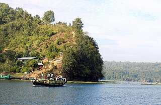
Manaung is a township of Kyaukpyu District in the Rakhine State of Western Myanmar. The principal town is Manaung. Manaung Township, situated on Manaung Island, consists of three islands: Manaung Island, Ye Kyun Island and Taik Kyun Island. Manaung is not only a township of Kyaukpyu District but also the second biggest island of Rakhine State in Myanmar.
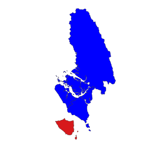
The Canton of La Trinité is a former canton in the Arrondissement of La Trinité on Martinique. It had 13,352 inhabitants (2012). It was disbanded in 2015. The canton comprised the commune of La Trinité.

The Taifa of Ronda was a medieval Berber taifa kingdom centered in Moorish al-Andalus in what is now southern Spain. It existed from 1039 to 1065. The taifa was ruled by a family from the Berber Banu Ifran tribe of North Africa. Its capital was the city of Ronda. From 1065 until 1091, the taifa was under the control of the Taifa of Seville, led by Abbad II al-Mu'tadid.
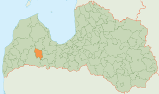
Brocēni Municipality was a municipality in Courland, Latvia. As of 2020, the population was 5,633.
Hanwada or Honwada is a Mandal in Mahbubnagar district, Telangana.
Moteh or Mothey is a village in Suryapet district of the Indian state of Telangana. It is located in Mothey mandal of Suryapet division.
Supauli is a village development committee in Parsa District in the Narayani Zone of southern Nepal. At the time of the 1991 Nepal census it had a population of 2352.
Nenkovo is a village situated in Kardzhali Municipality, Kardzhali Province, southern Bulgaria.


