Sykes Smelt Mill

Last updated

Sykes Smelt Mill
Trough Road as it passes Sykes Cottage - geograph.org.uk - 733048.jpg
Today's cottages, which are believed to have been built on the site of the mill
Location map United Kingdom Borough of Ribble Valley.svg
Red pog.svg
Location within the Borough of Ribble Valley
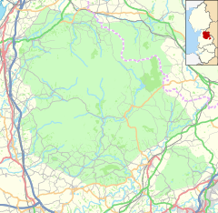
Location map United Kingdom Forest of Bowland.svg
Red pog.svg
Sykes Smelt Mill (the Forest of Bowland)
Coordinates 53°57′12″N2°33′09″W / 53.95326°N 2.55246°W / 53.95326; -2.55246 Coordinates: 53°57′12″N2°33′09″W / 53.95326°N 2.55246°W / 53.95326; -2.55246

Sykes Smelt Mill was a mediaeval mill located between Sykes and Hareden in Bowland Forest High, Lancashire, England. It stood on the banks of Langden Brook.

A "Smelt Mill Clough", but not the mill itself, appears on the 1841 tithe map for the Upper Division of the Trough of Bowland. The site is now believed to be occupied by a group of small buildings, known as "Smelt Mill Cottages", one of which is the home of Bowland Pennine Mountain Rescue Team. [1] One of the buildings sits on an old foundation. [2]

There is some evidence that smelting was being done in the early 17th century, during which period Bevis Bulmer was working at the King's Silver Mines on Brunghill Moor, near Newton-in-Bowland. It is possible that Bulmer also worked at Sykes mill (or nearby Ashnott) under a "blanket lease" held by the Society of Mines Royal. It is not known whether Bulmer had a smelt mill on his mines, but in 1630 Charles Coare, from Bashall Eaves, was the smelter at Thievley Mine. [1]

Related Research Articles

Pennines Range of uplands in Northern England

The Pennines, also known as the Pennine Chain or Pennine Hills, are a range of uplands running between three regions of Northern England: North West England on the west, and North East England and Yorkshire and the Humber on the east. Commonly described as the "backbone of England", the range stretches northwards from the Peak District at the southern end, through the South Pennines, the Yorkshire Dales and North Pennines to the Tyne Gap, which separates the range from the Cheviot Hills across the Anglo-Scottish border. South of the Aire Gap is a western spur into east Lancashire, comprising the Rossendale Fells, West Pennine Moors and the Bowland Fells in North Lancashire. The Howgill Fells and Orton Fells in Cumbria are sometimes considered to be Pennine spurs to the west of the range. The Pennines are an important water catchment area with numerous reservoirs in the head streams of the river valleys.

Forest of Bowland

The Forest of Bowland, also known as the Bowland Fells and formerly the Chase of Bowland, is an area of gritstone fells, deep valleys and peat moorland, mostly in north-east Lancashire, England, with a small part in North Yorkshire. It is a western outlier of the Pennines.

Nickel Centre Community in Ontario, Canada

Nickel Centre was a town in Ontario, Canada, which existed from 1973 to 2000.

River Wyre River in Lancashire, England

The River Wyre is a river in Lancashire, England, United Kingdom, which flows into the Irish Sea at Fleetwood. It is approximately 28 miles (45 km) in length. The river is a County Biological Heritage Site and has a sheltered estuary which, from its northwest corner, penetrates deep into the almost square peninsula of the Fylde.

Allendale, Northumberland Human settlement in England

Allendale, often marked on maps as Allendale Town, is a village and civil parish in south west Northumberland, England. It is located within the North Pennines Area of Outstanding Natural Beauty.

Nenthead Mining village in Cumbrian hills

Nenthead in the county of Cumbria is one of England's highest villages, at around 1,500 feet (457 m). It was not built until the middle of the 18th century and was one of the earliest purpose-built industrial villages in Britain.

Coalcleugh is a hamlet in Northumberland, England. It is situated in the Pennines between Penrith and Hexham. In the past it was well known as a lead mining centre. All of Coalcleugh's lead ore was smelted at Allenheads Mill at Dirtpot. At 1750ft (530m) above sea level, it is said to be the highest hamlet in England.

Arkengarthdale Dale in North Yorkshire, England

Arkengarthdale is a dale, or valley, on the east side of the Pennines in North Yorkshire, England. Running roughly north-west to south-east, it is the valley of the Arkle Beck, and is the northernmost of the Yorkshire Dales. It is a subsidiary dale to Swaledale, which it joins at Reeth. The history of the dale, its people, and farming, lead mining, and local crafts is displayed and documented in the Swaledale Museum in Reeth.

Alston Moor Human settlement in England

Alston Moor, formerly known as Alston with Garrigill, is a civil parish and electoral ward in Cumbria, England, based around the small town of Alston. It is set in the moorlands of the North Pennines, mostly at an altitude of over 1000 feet. The parish/ward had a population of 2,088 at the 2011 census. As well as the town of Alston, the parish includes the villages of Garrigill and Nenthead, along with the hamlets of Nenthall, Nentsberry, Galligill, Blagill, Ashgill, Leadgate, Bayles and Raise. Alston Moor is part of the North Pennines Area of Outstanding Natural Beauty (AONB), the second largest of the 40 AONBs in England and Wales.

Skirden Beck Minor river in Lancashire, England

Skirden Beck is a minor river in Lancashire, England. It is approximately 4.3 miles (6.85 km) long and has a catchment area of 18.87 square miles (48.882 km2).

Smeltmills were water-powered mills used to smelt lead or other metals.

South Pennines Region of moorland and hills in northern England

The South Pennines is a region of moorland and hill country in northern England lying towards the southern end of the Pennines. In the west it includes the Rossendale Valley and the West Pennine Moors. It is bounded by the Greater Manchester conurbation in the west and the Bowland Fells and Yorkshire Dales to the north. To the east it is fringed by the towns of West Yorkshire whilst to the south it is bounded by the Peak District. The rural South Pennine Moors constitutes both a Site of Special Scientific Interest and Special Area of Conservation.

Gisburn Human settlement in England

Gisburn is a village and civil parish within the Ribble Valley borough of Lancashire, England. Historically within the West Riding of Yorkshire, it lies 8 miles (13 km) northeast of Clitheroe and 11 miles (18 km) west of Skipton. The civil parish had a population of 506, recorded in the 2001 census, increasing to 521 at the 2011 Census.

Hilton, Cumbria Human settlement in England

Hilton is a village in Cumbria, England, in the civil parish of Murton, about 3 miles (4.8 km) east of Appleby-in-Westmorland and at an elevation of 752 feet (229 m). In 1870-72 the township had a population of 253. It has a rural economy, with much grazing of sheep, though the past was also home to lead mining.

Trough of Bowland

The Trough of Bowland is a valley and high pass in the Forest of Bowland Area of Outstanding Natural Beauty, Lancashire, England.

High Abbotside Civil parish in North Yorkshire, England

High Abbotside is a civil parish in the Richmondshire district of North Yorkshire, England. It is a rural parish on the north side of upper Wensleydale, and includes the settlements of Hardraw, Sedbusk and several hamlets.

North of England Lead Mining Museum Lead mining museum

The North of England Lead Mining Museum, better known as Killhope, is an industrial museum near the village of Cowshill, County Durham, England. The museum stands on the site of the former Park Level Mine, which is being restored to show the workings of a 19th-century lead mine.

Sir Bevis Bulmer (1536–1615) was an English mining engineer during the reigns of Elizabeth I and James I. He has been called "one of the great speculators of that era". Many of the events in his career were recorded by Stephen Atkinson in The Discoveries and Historie of the Gold Mynes in Scotland, compiled in part from a lost manuscript by Bulmer entitled Bulmer's Skill.

Grinton Smelt Mill Lead working site in Yorkshire, England

Grinton Smelt Mill is a ruined lead mining and processing site on Cogden Moor, south of Grinton in Swaledale, North Yorkshire, England. The site was built in its present form c. 1820 for the specific purpose of processing lead won by hushing and hydraulic mining. The buildings and stone flue are now grade II* listed structures and all are scheduled monuments. The site is recognised as being the best preserved lead mining site in the Yorkshire Dales.

Arn Gill (North Yorkshire) Ravine and river in North Yorkshire, England

Arn Gill is a ravine or gully containing a beck of the same name, near the village of Muker in Swaledale, North Yorkshire, England. The ravine and beck run steeply downhill from the stream's source in Arn Gill Head, and the beck disgorges into the River Swale below.

References

  1. 1 2 "Sykes Smelt Mill". www.nmrs.org.uk. Retrieved 6 May 2022.
  2. Raistrick, Arthur (1973). Lead Mining in the Mid-Pennines: The Mines of Nidderdale, Wharfedale, Airedale, Ribblesdale and Bowland. Barton Publishing. p. 163. ISBN   9780851531021.