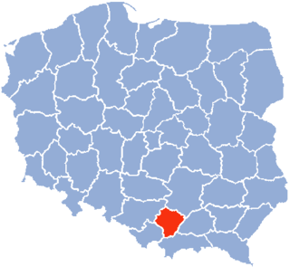
Kraków Voivodeship, refers to several historical Voivodeships of Poland in the surrounding regions, with the city of Kraków as its capital.

Skała is a town in southern Poland, situated in the Lesser Poland Voivodeship, previously in Kraków Voivodeship (1975-1998). On December 31, 2010, its population was 3,646.

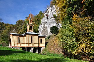
Pieskowa Skała, is a limestone cliff in the valley of river Prądnik, Poland, best known for its Renaissance castle. It is located within the boundaries of the Ojców National Park, 27 km north of Kraków, near the village of Sułoszowa. The castle was first mentioned in Latin documents of Polish king Władysław I the Elbow-high before 1315, as "castrum Peskenstein".
Ojców is a village in Gmina Skała, in Kraków County, Lesser Poland Voivodeship, in southern Poland. It is one of the sights of the Eagle Nests Trail, as there are the ruins of a gothic castle near the village. The village is where the authorities of the Ojców National Park have their headquarters. It lies approximately 4 kilometres (2 mi) south-west of Skała and 18 km (11 mi) north-west of the regional capital Kraków.
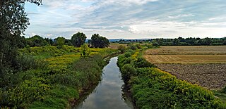
Dłubnia Landscape Park is a protected area in southern Poland, established in 1981, covering an area of 109.37 square kilometres (42.23 sq mi). Within the Landscape Park are two nature reserves.

Barbarka is a village in the administrative district of Gmina Skała, within Kraków County, Lesser Poland Voivodeship, in southern Poland. It lies approximately 3 kilometres (2 mi) north-east of Skała and 22 km (14 mi) north of the regional capital Kraków.

Cianowice Duże is a village in the administrative district of Gmina Skała, within Kraków County, Lesser Poland Voivodeship, in southern Poland. It lies approximately 4 kilometres (2 mi) south of Skała and 17 km (11 mi) north of the regional capital Kraków.
Cianowice Małe is a village in the administrative district of Gmina Skała, within Kraków County, Lesser Poland Voivodeship, in southern Poland. It lies approximately 4 kilometres (2 mi) south of Skała and 16 km (10 mi) north of the regional capital Kraków.
Gołyszyn is a village in the administrative district of Gmina Skała, within Kraków County, Lesser Poland Voivodeship, in southern Poland. It lies approximately 6 kilometres (4 mi) north-east of Skała and 23 km (14 mi) north of the regional capital Kraków.
Maszyce is a village in the administrative district of Gmina Skała, within Kraków County, Lesser Poland Voivodeship, in southern Poland. It lies approximately 8 kilometres (5 mi) south of Skała and 14 km (9 mi) north-west of the regional capital Kraków.
Minoga is a village in the administrative district of Gmina Skała, within Kraków County, Lesser Poland Voivodeship, in southern Poland. It lies approximately 2 kilometres (1 mi) east of Skała and 20 km (12 mi) north of the regional capital Kraków.
Niebyła is a village in the administrative district of Gmina Skała, within Kraków County, Lesser Poland Voivodeship, in southern Poland. It lies approximately 6 kilometres (4 mi) south of Skała and 15 km (9 mi) north of the regional capital Kraków.
Nowa Wieś is a village in the administrative district of Gmina Skała, within Kraków County, Lesser Poland Voivodeship, in southern Poland. It lies approximately 2 kilometres (1 mi) east of Skała and 20 km (12 mi) north of the regional capital Kraków.
Poręba Laskowska is a village in the administrative district of Gmina Skała, within Kraków County, Lesser Poland Voivodeship, in southern Poland. It lies approximately 5 kilometres (3 mi) north-east of Skała and 21 km (13 mi) north of the regional capital Kraków.
Rzeplin is a village in the administrative district of Gmina Skała, within Kraków County, Lesser Poland Voivodeship, in southern Poland. It lies approximately 4 kilometres (2 mi) south-east of Skała and 17 km (11 mi) north of the regional capital Kraków.
Smardzowice is a village in the administrative district of Gmina Skała, within Kraków County, Lesser Poland Voivodeship, in southern Poland. It lies approximately 4 kilometres (2 mi) south of Skała and 17 km (11 mi) north of the regional capital Kraków.
Sobiesęki is a village in the administrative district of Gmina Skała, within Kraków County, Lesser Poland Voivodeship, in southern Poland.
Świńczów is a village in the administrative district of Gmina Skała, within Kraków County, Lesser Poland Voivodeship, in southern Poland. It lies approximately 6 kilometres (4 mi) south of Skała and 15 km (9 mi) north of the regional capital Kraków.
Brzoskwinia is a village in the administrative district of Gmina Zabierzów, within Kraków County, Lesser Poland Voivodeship, in southern Poland. It lies approximately 6 kilometres (4 mi) south-west of Zabierzów and 17 km (11 mi) west of the regional capital Kraków.
Owczary is a village in the administrative district of Gmina Zielonki, within Kraków County, Lesser Poland Voivodeship, in southern Poland. It lies approximately 13 km (8 mi) north of the regional capital Kraków.


