Transport in Tanzania includes road, rail, air and maritime networks. The road network is 86,472 kilometres (53,731 mi) long, of which 12,786 kilometres (7,945 mi) is classified as trunk road and 21,105 kilometres (13,114 mi) as regional road. The rail network consists of 3,682 kilometres (2,288 mi) of track. Commuter rail service is in Dar es Salaam only. There are 28 airports, with Julius Nyerere International being the largest and the busiest. Ferries connect Mainland Tanzania with the islands of Zanzibar. Several other ferries are active on the countries' rivers and lakes.
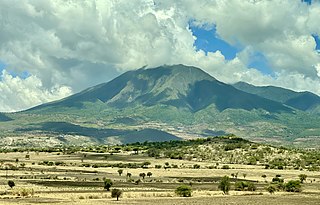
Manyara Region is one of Tanzania's 31 administrative regions. The regional capital is the town of Babati. According to the 2012 national census, the region had a population of 1,425,131, which was lower than the pre-census projection of 1,497,555. For 2002–2012, the region's 3.2 percent average annual population growth rate was tied for the third highest in the country. It was also the 22nd most densely populated region with 32 people per square kilometre.

Serengeti District is one of the seven districts of Mara Region of Tanzania. Its administrative centre is the town of Mugumu. It is home to part of the world-famous Serengeti National Park a UNESCO World Heritage Site and contains one of the western gates to the park.

Arusha City Council is one of seven administrative districts of Arusha Region in Tanzania. It is surrounded to the south, west and north by Arusha Rural District and to east by Meru District. The district covers an area of 267.0 km2 (103.1 sq mi). The district is comparable in size to the land area of Cayman Islands. The district capital is the city of Arusha. As of 1994, Arusha District was the wealthiest district in Tanzania. According to the 2022 Tanzania National Census, the population of Arusha Urban District was 617,631.
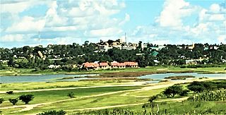
Singida is a city in central Tanzania. The city is the location of the regional headquarters of Singida Region as well as the district headquarters of Singida Urban District. The region and district are named after the city.

Arusha District or Arusha District Council is one of the seven districts of the Arusha Region of Tanzania. The district is bordered to the north by Longido District, to the east by Meru District, to the south by Kilimanjaro Region, and to the west by Monduli District. the district surrounds Arusha City on all three sides. The district covers an area of 1,547.6 km2 (597.5 sq mi). The district is comparable in size to the land area of Guadeloupe. The district capital is located in Sokon II. According to the 2022 Tanzania National Census, the population of Arusha District was 449,518.

Babati Urban District is one of the six districts of the Manyara Region of Tanzania. Babati Urban District is surrounded by Babati Rural District. The administrative capital of the district is Babati town.
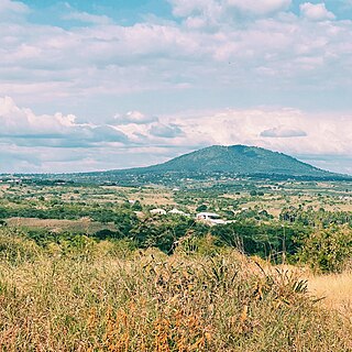
Handeni Town Council also known as Handeni Urban District is one of the 11 districts of the Tanga Region of Tanzania. The district covers an area of 837.4 km2 (323.3 sq mi). The administrative capital of the district is Mdoe. Handeni Town District is bordered to the east by Handeni District and the west by Kilindi District.

The T1 is a Trunk road in Tanzania. The road runs from the intersection of Morogoro Road/Bibi Titi Mohamed St in Dar es Salaam all the way to Zambian border at Tunduma. The route is approximately 924 km (574 mi). The T1 in its entirety forms the Tanzanian part of the Tanzam Highway. The road is a major road artery between Dar es Salaam and the cities in the Southern Highlands of Tanzania. The road is entirely paved.

The T2 is a Trunk road in Tanzania. The road runs from the major highway junction in Chalinze where the Trunk Road T1 and T2 intersect all the way to Kenyan border at Namanga. The route is approximately 644 km (400 mi). The road is a major road artery between Dar es Salaam and the cities in the North of Tanzania. The road is entirely paved. The road is a busy road link between the two largest economies in the East African Community & is part of the Cape to Cairo Road.

The T4 is a Trunk road in Tanzania. The road runs along Lake Victoria in the regions of the Lake Zone in Tanzania. The T4 runs from Tarime at the Kenyan border all the way through Mwanza and Bukoba to the Ugandan border. The T4 is the only highway in the country that both starts and ends at an International border. The roads as it is approximately 765 km (475 mi). The road is entirely paved.

The T6 is a Trunk road in Tanzania. The road runs from the city center of Mtwara along the southern border of Tanzania to Songea and then connecting to the T1 road at Makambako. The roads as it is approximately 931 km (578 mi). The road is entirely paved. This is the only Trunk Road that connects to Mtwara city and Mtwara Port. The T6 provides an important road link as part of the Mtwara Development Corridor.

The T7 is a Trunk road in Tanzania. The road runs from the city center of Dar es Salaam at the Kamata Intersection, south along the Indian Ocean to Lindi. The road then extends an additional 27 km (17 mi) to Mingoyo, where the road connects to the T6 road. The roads as it is approximately 447 km (278 mi). The road is entirely paved.

The T8 is a Trunk road in Tanzania. The road runs from Mbeya through Tabora, ending just outside the city of Mwanza in Kisesa. The roads as it is approximately 881 km (547 mi). The road is partially paved, with the biggest unpaved section being from Chunya to Tabora.
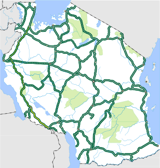
The T9 is a Trunk road in Tanzania. The road runs from Biharamulo in Kagera along the western zones of the country through to Tunduma forming a junction at the Tanzam Highway. The roads as it is approximately 881 km (547 mi). The road is partially paved, with the biggest unpaved section being from Mpanda to Biharamulo. As of November 2021, the route is the longest unpaved section of the National Trunk road system.

The T10 is a Trunk road in Tanzania. The road runs from Uyole in Mbeya in the southern highlands and heds south to connect to the Malawin border. THis is the only trunk road that connects to Malawi from Tanzania. The roads as it is approximately 104 km (65 mi). The road is entirely paved. The road connects to a One Stop Border post in Malawi with the Songwe M1 Bridge that crosses the river between Malawi and Tanzania.

The T11 is a Trunk road in Tanzania. The road runs from Kasulo in Kagera and heads west towards Burundi. This is one of two trunk roads that connect Tanzania to Burundi. The roads as it is approximately 98 km (61 mi). The road is entirely paved. The Kabanga Nickel Project exploration activities are being conducted alongside this trunk road.

The T13 is a Trunk road in Tanzania. The road runs from the T2 major trunk road junction in Segera and heads west towards Tanga. The road then connects the Tanga to the Kenyan border at Horohoro. The A7 road from the Kenyan border connects to Mombasa. The roads as it is approximately 137 km (85 mi). The road is entirely paved.
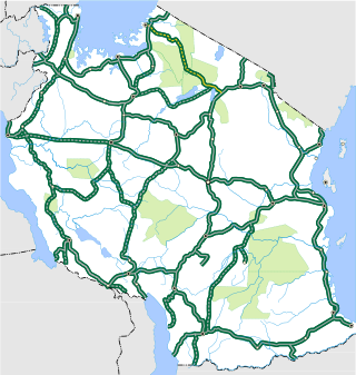
The T17 is a Trunk road in Tanzania. The road runs from the T5 major trunk road junction at Makuyuni and heads north towards Musoma. The roads as it is approximately 431 km (268 mi). The road is mostly not paved. The route goes through the Ngorongoro Conservation Area as well as the Serengeti National Park. The highway was in much controversy as the Government of Tanzania aimed to pave the road, with many campaigns mostly in Europe against the move to protect the ecosystem of the national parks. After much pressure, the government agreed to improve the regional roads instead and provide an alternative route around the park. The T37 trunk road was drawn up as the alternative to connect the communities in the northern regions.

The T26 is a Trunk road in Tanzania. The road runs north from Dar es Salaam at the T1 Trunk Road junction towards Bagamoyo ending at the city center where it connects to the T35 Trunk Road. The roads as it is approximately 64 km (40 mi). The road is paved.


