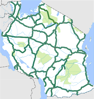
Transport in Tanzania includes road, rail, air and maritime networks. The road network is 86,472 kilometres (53,731 mi) long, of which 12,786 kilometres (7,945 mi) is classified as trunk road and 21,105 kilometres (13,114 mi) as regional road. The rail network consists of 3,682 kilometres (2,288 mi) of track. Commuter rail service is in Dar es Salaam only. There are 28 airports, with Julius Nyerere International being the largest and the busiest. Ferries connect Mainland Tanzania with the islands of Zanzibar. Several other ferries are active on the countries' rivers and lakes.
The New Zealand state highway network is the major national highway network in New Zealand. Nearly 100 roads in the North and South Islands are state highways. All state highways are administered by the NZ Transport Agency.

The island of Ireland, comprising Northern Ireland and the Republic of Ireland, has an extensive network of tens of thousands of kilometres of public roads, usually surfaced. These roads have been developed and modernised over centuries, from trackways suitable only for walkers and horses, to surfaced roads including modern motorways. Driving is on the left-hand side of the road. The major routes were established before Irish independence and consequently take little cognisance of the border other than a change of identification number and street furniture. Northern Ireland has had motorways since 1962, and has a well-developed network of primary, secondary and local routes. The Republic started work on its motorway network in the early 1980s; and historically, the road network there was once somewhat less well developed. However, the Celtic Tiger economic boom and an influx of European Union structural funding, saw national roads and regional roads in the Republic come up to international standard quite quickly. In the mid-1990s, for example, the Republic went from having only a few short sections of motorway to a network of motorways, dual carriageways and other improvements on most major routes as part of a National Development Plan. Road construction in Northern Ireland now tends to proceed at a slower pace than in the Republic, although a number of important bypasses and upgrades to dual carriageway have recently been completed or are about to begin.

Highways in Australia are generally high capacity roads managed by state and territory government agencies, though Australia's federal government contributes funding for important links between capital cities and major regional centres. Prior to European settlement, the earliest needs for trade and travel were met by narrow bush tracks, used by tribes of Indigenous Australians. The formal construction of roads began in 1788, after the founding of the colony of New South Wales, and a network of three major roads across the colony emerged by the 1820s. Similar road networks were established in the other colonies of Australia. Road construction programs in the early 19th century were generally underfunded, as they were dependent on government budgets, loans, and tolls; while there was a huge increase in road usage, due to the Australian gold rushes. Local government authorities, often known as Road Boards, were therefore established to be primarily responsible for funding and undertaking road construction and maintenance. The early 1900s saw both the increasingly widespread use of motorised transportation, and the creation of state road authorities in each state, between 1913 and 1926. These authorities managed each state's road network, with the main arterial roads controlled and maintained by the state, and other roads remaining the responsibility of local governments. The federal government became involved in road funding in the 1920s, distributing funding to the states. The depression of the 1930s slowed the funding and development of the major road network until the onset on World War II. Supply roads leading to the north of the country were considered vital, resulting in the construction of Barkly, Stuart, and Eyre Highways.

A trunk road, trunk highway, or strategic road is a major road, usually connecting two or more cities, ports, airports and other places, which is the recommended route for long-distance and freight traffic. Many trunk roads have segregated lanes in a dual carriageway, or are of motorway standard.

Dodoma Region is one of Tanzania's 31 administrative regions. The regional capital is the city of Dodoma. Dodoma is located in central Tanzania, bordered by Singida region to the west, Manyara region to the north, Iringa region to the south, and Morogoro region to the east. Dodoma region hosts the nation's capital city, where the legislative assembly of Bunge is based. Dodoma region also hosts one of the largest universities in Tanzania: University of Dodoma. The region is the home of the Tanzanian wine industry, which is the second largest wine industry on the continent after South Africa. According to the 2022 national census, the region had a population of 3,085,625; in the 2012 national census, the population was 2,083,588.
The government of Zimbabwe is the main provider of air, rail and road services; historically, there has been little participation of private investors in transport infrastructure.

Roads in Portugal are defined by the Plano Rodoviário Nacional, which describes the existing and planned network of Portuguese roads. The present plan in force is the 2000 National Road Plan (PRN 2000), approved in 1998. It replaced PRN 1985, which itself had replaced PRN 1945.
This article describes the highway systems available in selected countries.
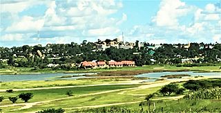
Singida is a city in central Tanzania. The city is the location of the regional headquarters of Singida Region as well as the district headquarters of Singida Urban District. The region and district are named after the city.
The Zimbabwe National Roads Administration (ZINARA) is a Zimbabwean parastatal responsible for the management, maintenance and development of Zimbabwe's national road network.
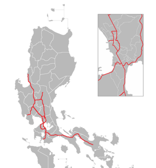
The Philippine expressway network, also known as the High Standard Highway Network, is a controlled-access highway network managed by the Department of Public Works and Highways (DPWH) which consists of all expressways and regional high standard highways in the Philippines.
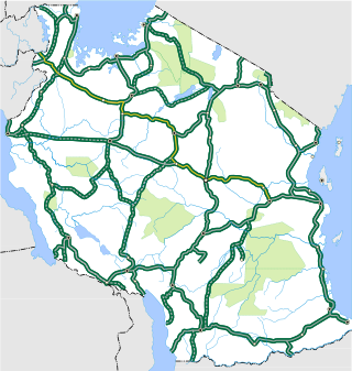
The T3 is a Trunk road in Tanzania. The road runs from the center of Morogoro where the Trunk Road T1 and T3 intersect all the way to Rwandan border at Rusumo. The road is the longest trunk road in the Tanzanian road system and it is approximately 1,097 km (682 mi). The road is a major road connecting the coast to the Tanzanian Capital Dodoma along with Rwanda. The road is entirely paved. The trunk road forms the only major land link to East African Community member Rwanda.
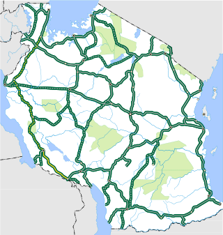
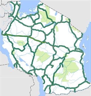
The T9 is a Trunk road in Tanzania. The road runs from Biharamulo in Kagera along the western zones of the country through to Tunduma forming a junction at the Tanzam Highway. The roads as it is approximately 881 km (547 mi). The road is partially paved, with the biggest unpaved section being from Mpanda to Biharamulo. As of November 2021, the route is the longest unpaved section of the National Trunk road system.

The T16 is a Trunk road in Tanzania. The road runs from the T2 major trunk road junction at Himo and heads east towards Holili at the Kenyan Border. The roads as it is approximately 15 km (9.3 mi). The road is entirely paved.
The T17 is a Trunk road in Tanzania. The road runs from the T5 major trunk road junction at Makuyuni and heads north towards Musoma. The roads as it is approximately 431 km (268 mi). The road is mostly not paved. The route goes through the Ngorongoro Conservation Area as well as the Serengeti National Park. The highway was in much controversy as the Government of Tanzania aimed to pave the road, with many campaigns mostly in Europe against the move to protect the ecosystem of the national parks. After much pressure, the government agreed to improve the regional roads instead and provide an alternative route around the park. The T37 trunk road was drawn up as the alternative to connect the communities in the northern regions.
The T18 is a Trunk road in Tanzania. The road runs from the T3 major trunk road junction at Manyoni and heads east towards Kigoma through Tabora The roads as it is approximately 645 km (401 mi). The road is not entirely paved and is paved in patches.
The T19 is a Trunk road in Tanzania. The road runs from Kasulu and heads west towards Kigoma and then North to the Burundian border. The roads as it is approximately 131 km (81 mi). The road is entirely paved.

The T20 is a Trunk road in Tanzania. The road runs south from Sumbawanga towards the Zambian border in Kasesya. The roads as it is approximately 94 km (58 mi). The road is not entirely paved. In October 2023, the president of Tanzania, Samia Suluhu Hassan on a state visit to Zambia expressed desire from the government to upgrade this route and the border post with Zambia.


