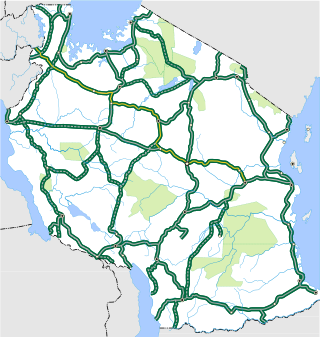
Transport in Tanzania includes road, rail, air and maritime networks. The road network is 86,472 kilometres (53,731 mi) long, of which 12,786 kilometres (7,945 mi) is classified as trunk road and 21,105 kilometres (13,114 mi) as regional road. The rail network consists of 3,682 kilometres (2,288 mi) of track. Commuter rail service is in Dar es Salaam only. There are 28 airports, with Julius Nyerere International being the largest and the busiest. Ferries connect Mainland Tanzania with the islands of Zanzibar. Several other ferries are active on the countries' rivers and lakes.

Bunda is one of the seven districts of Mara Region in the United Republic of Tanzania, East Africa. It is bordered to the north by the Musoma Rural District and Butiama District, to the east by Serengeti District, to the south by Bariadi District and Busega District, and to the west by Lake Victoria. The district administration town is also called Bunda, located on the north-south trans-national all tarmac highway from Kenya to Zambia via Tarime and the lakeside municipalities of Musoma, Mwanza, and thereon to Mbeya in southern Tanzania. The district has four divisions: Kenkombyo, Nansimo, Serengeti and Chamuriho.

Mwanza Region is one of Tanzania's 31 administrative regions, covering a total land area of 25,233 km2 (9,743 sq mi). The region is comparable in size to the combined land area of the nation state of North Macedonia. Mwanza Region is bordered to the north through Lake Victoria by the Kagera Region and Mara Region, to the east by Simiyu Region, to the south by the Shinyanga Region and to the west by Geita Region. The regional capital is the city of Mwanza. According to the 2022 national census, the region had a population of 3,699,872 and national census of 2012 had 2,772,509. Mwanza Region is the second region with high population in Tanzania after Dar es Salaam Region.

Biharamulo District is one of the eight districts of the Kagera Region of Tanzania. It is bordered to the north by Karagwe District and Muleba District, to the east and south by Geita Region, to the west by Ngara District, and to the southwest by the Kigoma Region. Its administrative seat is Biharamulo town. Biharamulo Game Reserve is located within the borders of the district.

Tarime District is one of the seven districts of the Mara Region of Tanzania, East Africa. It was previously known as the "North Mara District". Its district capital is Tarime town. It is bordered from the north to east by the Kenyan districts of Migori, Trans Mara and Kuria East and West Districts, and to the east by the Maasai Mara game reserve. To the south, it is bordered across the Mara River by the Serengeti and Butiama districts, and to the west by Rorya District.

Geita District is located in the Geita Region of Tanzania. According to the 2022 census, the population of the district was 1,035,214. The district is bordered to the east by Mwanza Region and Nyang'hwale District, to the south by Shinyanga Region and Mbogwe District, and to the west by Chato District.

Geita Region is one of Tanzania's 31 administrative regions. The region covers an area of 20,054 km2 (7,743 sq mi)."Geita Region Size". The region is comparable in size to the combined land area of the nation state of Slovenia. Geita Region is bordered to the east by Lake Victoria, Mwanza Region and Shinyanga Region. The region is bordered by Tabora Region and Kigoma Region to the south and south west respectively. Lastly, Gieta is borders Kagera Region to the west.

Butiama District is one of the seven districts of Mara Region of Tanzania. It is bordered to the north by Roya District across the Kirumi Bridge on the Mara river. Its administrative centre is the town of Butiama. Julius Nyerere was born in Butiama; the Mwalimu Nyerere Museum is located in his town of birth.
Magu is a town in Mwanza Region of Tanzania, East Africa. It is the administrative seat of Magu District, one of the seven districts of Mwanza Region. The distance from Magu to Mwanza town is around 60 kilometres. According to the national census of 2012, the population of Magu – Magu Mjini in Swahili – was 23,822.

Busega District is one of the five districts of Simiyu Region of Tanzania, East Africa. Its administrative centre is the town of Nyashimo. It is bordered to the north by Lake Victoria and Bunda District, to the east by Bariadi District, and to the south by Magu District.
Lamadi is a town and a ward in Busega District of Simiyu Region, Tanzania. It is located on the shore of Lake Victoria. On 'dala dala' mini-busses in the area, the town's name is sometimes misspelled as 'Ramadi' the town have street (mitaa) that are Itongo, Makanisani, Majengo, Msekula Road, Mwalukonge and three village that are Lukungu, Mwabayanda and Kalago The main tribes in Lamadi Town are Sukuma, Jita,Kurya,Zanaki,Luo and Waha from Kigoma. The people like to visit Lamadi Town because is fevered by many attraction.

Bukoba Urban District is one of the eight districts of the Kagera Region of Tanzania. It is bordered to east by Lake Victoria and to the west by Bukoba Rural District. Its administrative seat is the town of Bukoba.

Missenyi District is one of the eight districts of the Kagera Region of Tanzania. The district was created in 2007 out of Bukoba District. It is bordered to the north by Uganda, to the east by Bukoba Rural District, to the south by Karagwe District and to the west by Kyerwa District.
Nyashimo is a town in Tanzania on the shores of Lake Victoria. It is the district capital of Busega District, Simiyu Region.
MV Mwanza is a Lake Victoria ferry operating on Lake Victoria in Tanzania. The ferry is a Ro-Pax ferry that operates between the villages of Kigongo and Busisi south of Mwanza town across the Mwanza Gulf in east-west direction. MV Mwanza is not the only ferry along the route which highlights the relevance of the ferry service.

The Kigongo–Busisi Bridge, also referred to as the Mwanza Gulf Bridge, is a bridge under construction in Tanzania. When completed as expected in 2024, it will span 3.2 kilometres (2.0 mi) across the Gulf of Mwanza, linking the areas of Kigongo in the Mwanza Region and Busisi in the Geita Region, cutting crossing time from thirty-five minutes by ferry to four minutes by automobile. It is reported to be the longest bridge in East Africa and the sixth-longest on the African continent. The bridge forms a part of the Tanzanian Trunk Road T4. As part of this road infrastructure project, a 35 kilometres (22 mi) tarmacked road will be constructed to link the eastern end of the bridge to the city of Mwanza.
The T3 is a Trunk road in Tanzania. The road runs from the center of Morogoro where the Trunk Road T1 and T3 intersect all the way to Rwandan border at Rusumo. The road is the longest trunk road in the Tanzanian road system and it is approximately 1,097 km (682 mi). The road is a major road connecting the coast to the Tanzanian Capital Dodoma along with Rwanda. The road is entirely paved. The trunk road forms the only major land link to East African Community member Rwanda.

The T8 is a Trunk road in Tanzania. The road runs from Mbeya through Tabora, ending just outside the city of Mwanza in Kisesa. The roads as it is approximately 881 km (547 mi). The road is partially paved, with the biggest unpaved section being from Chunya to Tabora.

The T10 is a Trunk road in Tanzania. The road runs from Uyole in Mbeya in the southern highlands and heds south to connect to the Malawin border. THis is the only trunk road that connects to Malawi from Tanzania. The roads as it is approximately 104 km (65 mi). The road is entirely paved. The road connects to a One Stop Border post in Malawi with the Songwe M1 Bridge that crosses the river between Malawi and Tanzania.
The T28 is a Trunk Road in Tanzania. The road serves as a brief but crucial link between Kasumulu and Kyela, located in the border region with Malawi, providing access to a ferry terminal on the shores of Lake Malawi. Spanning a total distance of 25 kilometers, theroad plays a role in connecting the surrounding areas to the lake's transportation network.

