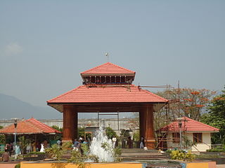
Kottayi-II is a village in the Palakkad district, state of Kerala, India. Kottayi-II and Kottayi-I come under the Kottayi gram panchayat.

Pottassery-II is a village in the Palakkad district, state of Kerala, India. It is administered by the Tachampara gram panchayat and the Kanjirampuzha gram panchayat.
it is a beautiful village with following places
- mundakkunnu
- kanjiram
- pottassery

Kuvettu is a census town in the southern state of Karnataka, India. Administratively it is under Beltangadi taluk of Dakshina Kannada district in Karnataka.

Hattikuni is a panchayat village in the southern state of Karnataka, India. It is located in the Yadgir taluk of Yadgir district in Karnataka.

Narayanapur Rural is a panchayat village in the southern state of Karnataka, India. It is located in the Shorapur Taluka of Yadgir district in Karnataka. It is adjacent to and gives its name to the Narayanpur Dam on the Krishna River.

Damergidda is a panchayat village in Ranga Reddy district, Telangana, India. It falls under Chevella mandal, and is the only village in the gram panchayat.

Agni is a panchayat village in the southern state of Karnataka, India. Administratively, Agni is under Shorapur Taluka of Yadgir District in Karnataka. The village of Agni is 1.5 km by road west of the village of Agthirth and 14 km by road north of the village of Hunasagi. The nearest railhead is in Yadgir.

Azalapur is a panchayat village in the southern state of Karnataka, India. Administratively, Azalapur is under Yadgir Taluka of Yadgir District in Karnataka. The village of Azalapur is 3.5 km by road northwest of the village of Ujjelli in Andhra Pradesh, and 20 km by road east of the census town of Saidapur in Yadgir Taluka. The nearest railhead is in Yadgir.

Saidapur is a census town and panchayat village in the southern state of Karnataka, India. Administratively, Saidapur is under Yadgir Taluka of Yadgir District in Karnataka. The village of Saidapur is 14 km by road west of the village of Badepalli, and 33 km by road south of the town of Yadgir. Saidapur has its own railway station which comes on Bangalore-Mumbai and Mumbai-Chennai main corridor.

Kolhar is a panchayat village in the southern state of Karnataka, India. It is located in the Kolhar taluk of Bijapur district in Karnataka.

Thangunda is a panchayat village in the southern state of Karnataka, India. Administratively, Thangunda is under Yadgir Taluka of Yadgir District in Karnataka. The village of Thangunda is 12 km by road northwest of the town of Yadgir. The nearest rail station is Thangunda Railway Station two kilometres to the east, while the nearest railhead is in Yadgir.

Wadgera is a panchayat village in the southern state of Karnataka, India. Administratively, Wadgera is under the Jevargi Taluka, Gulbarga district, Karnataka. Wadgera is 5 km by road north of the village of Hadnoor and 64 km by road southwest of the taluka headquarters village of Jevargi.

Sugur is a panchayat village in the southern state of Karnataka, India. Administratively, Sugur is under Shorapur Taluqa of Yadgir District in Karnataka. Sugur lies on the left (north) bank of the Krishna River. The village of Sugur is 3 km by road southwest of the village of Adwadgi and 15 km by road east of the village of Devapur. The nearest railhead is in Yadgir.

Devapur is a panchayat village in the southern state of Karnataka, India. Administratively, Devapur is under Shorapur Taluka of Yadgir District in Karnataka. The village of Devapur is 15 km by road west of the village of Sugur and 26 km by road east of the village of Hunasagi. The nearest railhead is in Yadgir.

Malchapur is a panchayat village in Bidar District, Karnataka, India. Administratively, it is under Bhalki Taluka of Bidar District. The village of Malchapur is 18 km by road west of the city of Bidar.

Kur is a panchayat village in Rajasthan in western India. Administratively, it is under Bhopalgarh tehsil, Jodhpur District of the state of Rajasthan.

Fulay is a panchayat village in Gujarat, India. Administratively it is under Nakhatrana Taluka, Kutch District, Gujarat.

Bhanada is a panchayat village in Gujarat, India. Administratively it is under Abdasa Taluka, Kutch District, Gujarat. The village of Bhanada is the only village in Bhanada gram panchayat. It is 12 km by road southeast of the town of Naliya along National Highway 8A, and 11 km along the same road northwest of the village of Kothara.

Karimba is a gram panchayat in the Palakkad district, state of Kerala, India, near the National Highway 213. The largest town in Karimba panchayath is Kalladikode. It borders with Thachampara, Kongad and Mundur. Recently, it was awarded the Nirmal Gram Title (sanitation). It is the local government organisation that serves the villages of Karimba-I and Karimba-II.

Teggi is a panchayat village in the southern state of Karnataka, India. Administratively, Teggi is under Bilagi Taluka of Bagalkot District in Karnataka. The village of Teggi is 18.1 km by road east of Galagali and 12.5 km by road northwest of the town of Bilagi. Teggi is on the south shore of the Krishna River. Teggi has Higher Primary School (HPS) and Government High School and medium of teaching is in Kannada. The people of this village worship Shri Somalingeshwar god and has temple of it built it in stone. Population is dominated by the Valmiki/Nayak/Bedar community. The Teggi village has Vijaya Bank and customers from nearby villages Bisanal, Shivapur, Hanchinal, and Ballur along with local people use this.


