Tarapoa Airport

Last updated
Tarapoa Airport
Summary
Airport type Public
Operator Government
Serves Tarapoa, Ecuador
Elevation  AMSL 814 ft / 248 m
Coordinates 00°07′22″S76°20′15″W / 0.12278°S 76.33750°W / -0.12278; -76.33750
Map
Ecuador location map.svg
Airplane silhouette.svg
TPC
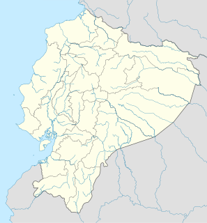
Location of the airport in Ecuador
Runways
Direction Length Surface
m ft
12/30 1,570 5,151 Asphalt
Source: WAD [1] GCM [2] Google Maps [3]

Tarapoa Airport (Spanish : Aeropuerto Tarapoa) ( IATA : TPC, ICAO : SETR) is an airport serving Tarapoa, a town in the Sucumbíos Province of Ecuador.

Spanish language Romance language

Spanish or Castilian, is a Western Romance language that originated in the Castile region of Spain and today has hundreds of millions of native speakers in the Americas and Spain. It is a global language and the world's second-most spoken native language, after Mandarin Chinese.

An IATA airport code, also known as an IATA location identifier, IATA station code or simply a location identifier, is a three-letter code designating many airports around the world, defined by the International Air Transport Association (IATA). The characters prominently displayed on baggage tags attached at airport check-in desks are an example of a way these codes are used.

ICAO airport code four-letter code designating many airports around the world

The ICAOairport code or location indicator is a four-letter code designating aerodromes around the world. These codes, as defined by the International Civil Aviation Organization and published in ICAO Document 7910: Location Indicators, are used by air traffic control and airline operations such as flight planning.

Contents

The runway length does not include 88 metres (289 ft) overruns at each end of the runway. The Tarapoa non-directional beacon (Ident: TRP) is located 0.5 nautical miles (0.93 km) off the approach threshold of Runway 30. [4]

Non-directional beacon radio transmitter which emits radio waves in all directions

A non-directional (radio) beacon (NDB) is a radio transmitter at a known location, used as an aviation or marine navigational aid. As the name implies, the signal transmitted does not include inherent directional information, in contrast to other navigational aids such as low frequency radio range, VHF omnidirectional range (VOR) and TACAN. NDB signals follow the curvature of the Earth, so they can be received at much greater distances at lower altitudes, a major advantage over VOR. However, NDB signals are also affected more by atmospheric conditions, mountainous terrain, coastal refraction and electrical storms, particularly at long range.

See also

Transportation in Ecuador uses six transportation methods to transport passengers and freight. They are aviation, highways, pipelines, ports and harbors, railways, and waterways

Related Research Articles

José Joaquín de Olmedo International Airport airport

José Joaquín de Olmedo International Airport is an airport serving Guayaquil, the capital of the Guayas Province and the most populous city in Ecuador. It is the second busiest airport in Ecuador.

Puerto Bolívar Airport

Puerto Bolívar Airport is a private airport in the Guajira Department of Colombia. The closest city is Uribia. It is located next to the Cerrejón coal terminal and only serves the workers of the area. Only private sector aircraft and Colombia's Aerocivil land at Puerto Bolivar. No commercial airlines serve the airport and it is mostly empty.

Edmundo Carvajal Airport

Edmundo Carvajal Airport (Spanish: Aeropuerto "Coronel Edmundo Carvajal", also known as Macas Airport, is an airport serving Macas, the capital of Morona-Santiago Province in Ecuador. The airport is named for Edmundo Carvajal Flores, a former commander of the Ecuadorian Air Force.

Welwitschia Mirabilis Airport

Welwitschia Mirabilis International Airport is an airport serving the Atlantic port city of Moçâmedes, the capital of Namibe Province in Angola. The runway is 6.8 kilometres (4.2 mi) south of the city.

Mbandaka Airport airport

Mbandaka Airport is an airport serving the Congo River port of Mbandaka, capital city of the Équateur District in the Democratic Republic of the Congo. The runway is on the southeast side of the city.

Muanda Airport

Muanda Airport or Moanda Airport is an airport serving Muanda, an Atlantic coastal city in the Democratic Republic of the Congo.

Pittsburgh–Monroeville Airport is a public-use airport located one nautical mile (1.8 km) north of the central business district of Monroeville, in Allegheny County, Pennsylvania, United States. The airport is privately owned by the estate of Helen M. Brown and is also known as the Harold W. Brown Memorial Field.

Río Amazonas Airport

Río Amazonas Airport is an airport serving Shell Mera, a town in the Pastaza Province of Ecuador. The airport was established in 1937 by Royal Dutch Shell and abandoned in 1948. In 1949 the Mission Aviation Fellowship, a Christian missionary group, established themselves in the area and used the airport as their main base.

NDolo Airport airport

N'Dolo Airport, also known as Ndolo Airport, is a secondary airport in the city of Kinshasa, Democratic Republic of the Congo, located in the commune of Barumbu near the city center.

Cotopaxi International Airport

Cotopaxi International Airport is a high elevation airport in Latacunga, the capital of the Cotopaxi Province in Ecuador. The airport is within a broad valley of the Ecuadoran Andes, with rising terrain east and west, and mountainous terrain distant in all quadrants.

Chacalluta International Airport airport

Chacalluta International Airport is an airport serving the city of Arica, capital of the Arica Province in the northern Arica y Parinacota Region of Chile. It is 18.5 kilometres (11.5 mi) northwest of the city and 1 kilometre (0.62 mi) south of the border with Peru.

Francisco de Orellana Airport

Francisco de Orellana Airport is an airport serving Puerto Francisco de Orellana, the capital of Orellana Province in Ecuador.

Mariscal Lamar International Airport airport

Mariscal Lamar International Airport is a high elevation airport serving Cuenca, the capital of the Azuay Province in Ecuador. It is named after the Peruvian military leader and politician José de la Mar, a native of Cuenca.

Seymour Airport airport

Seymour Airport is an airport serving the island of Baltra, one of the Galápagos Islands in Ecuador.

San Cristóbal Airport

San Cristóbal Airport is an airport on the island of San Cristóbal, in the Galápagos Islands of Ecuador. The airport is on the southwestern end of the island, with rising terrain to the northeast. Approaches to both runways are over the ocean.

Teniente Coronel Luis A. Mantilla International Airport

Teniente Coronel Luis A. Mantilla International Airport is a high elevation airport serving Tulcán, capital of the Carchi Province of Ecuador.

General José Antonio Anzoátegui International Airport

General José Antonio Anzoátegui International Airport is an airport serving Barcelona, Venezuela. General Anzoátegui (1789–1819) was a Venezuelan Brigadier General during the Venezuelan War of Independence.

Reales Tamarindos Airport

Reales Tamarindos Airport is a closed airport formerly serving Portoviejo, the capital of Manabí Province in Ecuador.

Atahualpa Airport

Atahualpa Airport was an airport formerly serving the town of Ibarra in Imbabura Province, Ecuador.

El Carmen Airport

El Carmen Airport is an airport serving the river village of Montalvo in Pastaza Province, Ecuador.

References

The Aviation Safety Network (ASN) is a website that keeps track of aviation accidents, incidents, and hijackings. Their database contains details of over 10,700 reports. The ASN includes an aviation database with aviation investigations, news, photos, and statistics.

National Oceanic and Atmospheric Administration An American scientific agency within the US Department of Commerce that focuses on the oceans and the atmosphere

The National Oceanic and Atmospheric Administration is an American scientific agency within the United States Department of Commerce that focuses on the conditions of the oceans, major waterways, and the atmosphere.

National Weather Service United States weather agency

The National Weather Service (NWS) is an agency of the United States federal government that is tasked with providing weather forecasts, warnings of hazardous weather, and other weather-related products to organizations and the public for the purposes of protection, safety, and general information. It is a part of the National Oceanic and Atmospheric Administration (NOAA) branch of the Department of Commerce, and is headquartered in Silver Spring, Maryland, within the Washington metropolitan area. The agency was known as the United States Weather Bureau from 1890 until it adopted its current name in 1970.