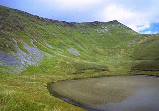
Càrn Eige, sometimes spelt Càrn Eighe, is a mountain in the north of Scotland. At an elevation of 1,183 metres (3,881 ft) above sea level, it is the highest mountain in Scotland north of the Great Glen, the twelfth-highest summit above sea level in the British Isles, and, in terms of relative height, it is the second-tallest mountain in the British Isles after Ben Nevis. The highpoint of the historic county of Ross and Cromarty, it is the twin summit of the massif, being mirrored by the 1,181-metre (3,875 ft) Mam Sodhail, to the south on the same ridge.

Cadair Berwyn or Cader Berwyn is a mountain summit in north-east Wales with a height of 832 metres (2,730 ft) above sea level. It is the highest point in the Berwyn range, the highest in North East Wales and the highest significant summit in Wales outside the National Parks. Cadair Berwyn and Foel Cedig to the west are the two Marilyns that form the Berwyn range. The undulating plateau of the range also includes a large number of other summits above 2,000 feet (610 m), including satellite summits of Cadair Berwyn and many which are classed as Nuttalls.

The Southern Uplands are the southernmost and least populous of mainland Scotland's three major geographic areas. The term is used both to describe the geographical region and to collectively denote the various ranges of hills and mountains within this region. An overwhelmingly rural and agricultural region, the Southern Uplands are partly forested and contain many areas of open moorland - the hill names in the area are congruent with these characteristics.

The Lugar Water, or River Lugar, is created by the confluence of the Bellow Water and the Glenmuir Water, just north of Lugar, both of which flow from the hills of the Southern Uplands in East Ayrshire, Scotland.

Ochiltree is a conservation village in East Ayrshire, Scotland, near Auchinleck and Cumnock. It is one of the oldest villages in East Ayrshire, with archaeological remains indicating Stone Age and Bronze Age settlers. A cinerary urn was found in 1955 during excavation for a new housing estate.

Windy Gyle is a mountain in the Cheviot Hills range, on the border between England and Scotland. Like the other hills in the area, it is rounded and grass-covered. It is the highest summit on the border, although not the highest point as the border is higher where it runs along the western shoulder of The Cheviot, at a point called Cairn Hill West Top, or Hangingstone Hill. The cairn at the summit of this hill is named Russell's Cairn and has a small depression suitable for shielding about 15 people from the wind; the border runs directly through the cairn although this can only be seen on the map, the fence which follows it in many places is absent here. The Pennine Way crosses the summit, thus providing one possible route of ascent. Windy Gyle may also be climbed from the Coquet valley to the south (England), or from Cocklawfoot to the north (Scotland). There are good views from the summit north towards the Scottish Borders, Eildon Hills and Edinburgh and south across the southern Cheviot Hills to the North Pennines.

Scotland is the most mountainous country in the United Kingdom. Scotland's mountain ranges can be divided in a roughly north to south direction into: the Scottish Highlands, the Central Belt and the Southern Uplands, the latter two primarily belonging to the Scottish Lowlands. The highlands eponymously contains the country's main mountain ranges, but many hills and mountains are to be found south of these as well. The below lists are not exhaustive; there are countless subranges throughout the country.

The Galloway Hills are part of the Southern Uplands of Scotland, and form the northern boundary of western Galloway. They lie within the bounds of the Galloway Forest Park, an area of some 300 square miles (800 km2) of largely uninhabited wild land, managed by Forestry and Land Scotland. The unusual place names reflect a mixture of the Old Norse and Scottish Gaelic languages and hint at the range of influences which have acted on society within the area over the centuries.

Lyle Hill at the West End of Greenock, Inverclyde, Scotland, has scenic viewpoints accessible from Lyle Road which was constructed in 1879–1880 and named after Provost Abram Lyle, well known as a sugar refiner. The hill's highest point is Craigs Top at 426 feet above sea level, and before the road was constructed the hill was known as the Craigs, or as the Bingens.

Gateside is a small village in North Ayrshire, Scotland about 1⁄2 mile east of Beith on the B777.

Carlin Stone or Carline Stane is the name given to a number of prehistoric standing stones and natural stone or landscape features in Scotland. The significance of the name is unclear, other than its association with old hags, witches, and the legends of the Cailleach.

The Range of the Awful Hand is a range of hills in the Galloway Hills range, part of the Southern Uplands of Scotland. The most westerly of three parallel ridges, the range is neighboured to the east by the Dungeon Hills and the Rhinns of Kells. The Minnigaff Hills also lie southeast. In total, these four ranges are part of the Galloway Forest Park. The ridge is split between South Ayrshire and Dumfries and Galloway.

Ordnance Survey (OS) is the national mapping agency for Great Britain. The agency's name indicates its original military purpose, which was to map Scotland in the wake of the Jacobite rising of 1745. There was also a more general and nationwide need in light of the potential threat of invasion during the Napoleonic Wars. Since 1 April 2015 Ordnance Survey has operated as Ordnance Survey Ltd, a government-owned company, 100% in public ownership. The Ordnance Survey Board remains accountable to the Secretary of State for Business, Energy and Industrial Strategy. It was also a member of the Public Data Group.

Kirriereoch Hill is a hill in the Range of the Awful Hand, a sub-range of the Galloway Hills range, part of the Southern Uplands of Scotland. It lies on the border of the old counties of Ayrshire and Kirkcudbrightshire, or the modern regions of Dumfries and Galloway and South Ayrshire. A boundary wall near the summit is the highest point in South Ayrshire and Ayrshire as a whole. Kirriereoch Hill was classified as a Corbett and Marilyn but then deleted from these lists in 1984 due to not being thought to achieve the respective prominence criteria. In August 2015 the hill was relisted as a Marilyn after having been surveyed to have a 150.2 m prominence. However, since this is less than the 152.4 m required, the hill will not be re-listed as a Corbett.

Lendalfoot is a small village located on Carleton Bay, parish of Colmonell in the old district of Carrick, now South Ayrshire, about six miles south of Girvan, Scotland. This is mainly a farming district, lacking in woodland, with a low population density. The village sits astride the A77 that runs north to Girvan and south to Cairnryan and Stranraer. Carleton Hill rises to 520 feet or 158 metres from the road and is the site near its summit of earth banks, an ancient fort.

The ruins of the five storey high 15th century Carleton Castle lie in a prominent position above the village of Lendalfoot located on Carleton Bay, parish of Colmonell in the old district of Carrick, now South Ayrshire, about 6 miles south of Girvan, Scotland.

Meigle or Meagle is a hamlet on the Meigle Burn in North Ayrshire, Parish of Largs, Scotland. The settlement lies close to the road to Greenock and is named after the bay where the Skelmorlie Burn flows into the Firth of Clyde. Meigle once stood on the old toll road from Largs to Greenock. It lies 41 m (135 ft) above sea level. Skelmorlie Castle and glen lie nearby. The Meigle Burn has its confluence with the Skelmorlie Burns to the east of Skelmorlie Bridge. The modern spelling 'Meigle' will be used for consistency. There is also a village called Meigle in Perth & Kinross.

Lawthorn is a hamlet near Perceton in Strathannick, Irvine, North Ayrshire, Scotland. The settlement lies on the old Irvine to Stewarton toll road.


