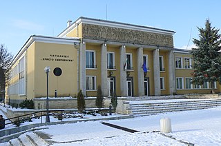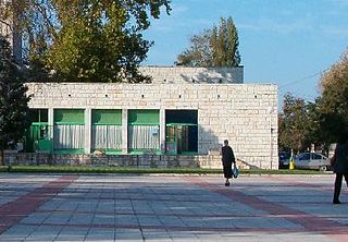
Opaka is a town in Targovishte Province in northeast Bulgaria. As of December 2009, the town had a population of 2,873 and covers an area of 57 square kilometres (22 sq mi). It is 70 kilometres (43 mi) south of the city of Rousse on the border with Romania and 250 kilometres (160 mi) northeast of the Bulgarian capital, Sofia. Archeologists have found evidence of Thracian, Roman and Slavonic settlements in the area. Near the village of Krepcha, a stone monastery is the site of the oldest known Old Bulgarian Cyrillic inscription, dated from around 920 CE. A 2nd century Thracian tumulus containing various artifacts, including six leaves of a golden wreath and bronze figurines, was excavated in 2011.

Kubrat is a town in Razgrad Province, Northeastern Bulgaria, part of the Ludogorie region. Named after the Bulgar ruler Kubrat, it is the administrative centre of the homonymous Kubrat Municipality. As of December 2009, the town has a population of 8,118 inhabitants.

Zlatitsa is a town and the seat of the Zlatitsa Municipality in southern Bulgaria located in the Zlatitsa-Pirdop valley. It lies between Stara Planina to the north and Sredna Gora to the south at 680 metres (2,230 ft) above sea level. It is situated immediately south in the lap of the Zlatitsa -Teteven Mountain. Zlatitsa is situated 75 kilometres (47 mi) east of Sofia, 27 kilometres (17 mi) south of Etropole, 32 kilometres (20 mi) north of Panagiurishte, 2 kilometres (1.2 mi) west of Pirdop and 32 kilometres (20 mi) northwest of Koprivshtitsa. The population is 5,286.

King's Highway 118, commonly referred to as Highway 118, is a provincially maintained highway in the Canadian province of Ontario. The route travels across South-Central Ontario between Highway 11 near Bracebridge and Highway 28 near Bancroft

Kula is a town in northwestern Bulgaria. It is the administrative centre of Kula Municipality part of Vidin Province. Located just east of the Serbian-Bulgarian border, it is the third largest town in the province after Vidin and Belogradchik. Kula lies 30 kilometres west of Vidin and 13 kilometres east of the border checkpoint at Vrashka Chuka. As of December 2009, the town has a population of 3,287 inhabitants.

Gulyantsi is a town in central northern Bulgaria, part of Pleven Province. It is the administrative centre of Gulyantsi municipality and lies in the central north of the province, near the town of Nikopol, very close to the Danube River. As of December 2009, the town has a population of 3,432 inhabitants.

Sungurlare is a town in southeastern Bulgaria, part of Burgas Province. It is the administrative centre of Sungurlare municipality, which lies in the northwestern part of Burgas Province.

Kocherinovo is a town in southwestern Bulgaria, part of Kyustendil Province. It is the administrative centre of Kocherinovo Municipality, which lies in the southern part of Kyustendil Province. As of 2013 it has 2,255 inhabitants.

Vetovo is a town in northeastern Bulgaria, part of Ruse Province. It is the administrative centre of Vetovo Municipality, which lies in the eastern part of the area, and ranks third in population in the province after Ruse and Byala. The town is located 40 kilometres away from the provincial capital - Ruse. As of December 2009, Vetovo has a population of 4,777 inhabitants.

Smyadovo is a town in eastern Bulgaria, part of Shumen Province. It is the administrative centre of the homonymous Smyadovo Municipality, which lies in the southeastern part of the province. As of December 2009, the town has a population of 4,036 inhabitants.

Dalgopol is a town in northeastern Bulgaria, part of Varna Province. It is the administrative centre of Dalgopol Municipality, which lies in the southwestern part of the Province. As of December 2009, the town has a population of 4,829 inhabitants.

Suvorovo is a town in northeastern Bulgaria, part of Varna Province. It is the administrative centre of the homonymous Suvorovo Municipality, which lies in the northwestern part of the Province. The town is located in the southwestern part of the Dobruja plateau, 34 kilometres (21 mi) northwest of the provincial capital of Varna, 56 kilometres (35 mi) southwest of Dobrich and 59 kilometres (37 mi) east of Shumen. As of December 2009, it has a population of 4,723 inhabitants.

Dimovo is a town in northwestern Bulgaria, part of Vidin Province. It is the administrative centre of the homonymous Dimovo Municipality, which lies in the eastern part of Vidin Province, 30 kilometres from Vidin at the Danube and 50 kilometres from Bregovo at the Timok River and the Serbian border. As of December 2009, Dimovo has a population of 1,211 inhabitants.

Gramada is a town in northwestern Bulgaria, part of Vidin Province. It is the administrative centre of the homonymous Gramada Municipality, which lies in the central part of Vidin Province. It is located in the western Danubian Plain, 30 kilometres from the provincial capital Vidin and 200 kilometres from Sofia. As of December 2009, the town has a population of 1,647 inhabitants.

Landry Heights is a hamlet in northern Alberta, Canada within the Municipal District of Greenview No. 16. It is located approximately 11 kilometres (6.8 mi) west of Highway 40 and 16 kilometres (9.9 mi) southwest of Grande Prairie.

Altimir Glacier is a 4.8-kilometre (3.0 mi) long and 5.5-kilometre (3.4 mi) wide glacier draining the north slopes of the Osterrieth Range on Anvers Island in the Palmer Archipelago, Antarctica. It flows northwards to enter Dalchev Cove in Fournier Bay east of Studena Point.

The Vardar Offensive was a World War I military operation, fought between 15 and 29 September 1918. The operation took place during the final stage of the Balkans Campaign. On September 15, a combined force of Serbian, French and Greek troops attacked the Bulgarian-held trenches in Dobro Pole, at the time part of the Kingdom of Serbia. The assault and the preceding artillery preparation had devastating effects on Bulgarian morale, eventually leading to mass desertions.

Ahryansko is a village in Ardino Municipality, Kardzhali Province, southern-central Bulgaria. It is located 191.083 kilometres (118.733 mi) from Sofia. It covers an area of 6.839 square kilometres and as of 2007 had a population of 51 people.

Sedlartsi is a village in Ardino Municipality, Kardzhali Province, southern-central Bulgaria. It is located 190.742 kilometres (118.522 mi) southeast of Sofia. It covers an area of 1.837 square kilometres and as of 2007 it had a population of 118 people.

Daskalovo is a village in Chernoochene Municipality, in Kardzhali Province, in southern-central Bulgaria. It is located 190.284 kilometres (118.237 mi) southeast of Sofia. It covers an area of 4.986 square kilometres and as of 2007 it had a population of 382 people.


