Mawana is a city in Meerut district in the Uttar Pradesh state of India. It is 26 km from the district headquarters Meerut. Its name comes from the word "Muhana" which means gateway. It is supposed to be the Muhana of Hastinapur kingdom. Hastinapur is a Mahabharata period town situated 9 km from the city center.

Kausani is a hill station and Village situated in Bageshwar district in the state of Uttarakhand, India. It is famous for its scenic splendour and its spectacular 300 km-wide panoramic view of Himalayan peaks like Trisul, Nanda Devi and Panchchuli. Mahatma Gandhi called this place the 'Switzerland of India', due to similarity in landscapes.
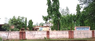
Baireddipalle is a Mandal in Palamaner Revenue Division and Chittoor district of the Indian state of Andhra Pradesh. It is the mandal headquarters of Baireddipalle mandal.

Kannavam is a Village in Thalassery Taluk in Kannur District of Kerala State, India. It comes under Chittaripparamba Panchayat. It is located 37 km (23 mi) south east of District headquarters Kannur, 13 km (8.1 mi) east of Kuthuparamba and 466 km (290 mi) from State capital Thiruvananthapuram

Tashiding Monastery is a Buddhist monastery of the Nyingma sect of Tibetan Buddhism in Western Sikkim, northeastern India, which is the most sacred and holiest monasteries in Sikkim. It is described as the "Heart of Sikkim/Denzong", citing to its importance of religious sacredness. It is located on top of the hill rising between the Rathong chu and the Rangeet River, 40 kilometres (25 mi) from Gyalshing and 19 kilometres (12 mi) to the south east of Yuksam. The annual festival of Bumchu, meaning ~Holy water~ takes place on the 14th and 15th of the 1st month of Tibetan lunar calendar, often around the months of February and March. The festival is believed to predict the upcoming forecasts and events for Sikkim in the coming year. Undoubtedly, one of the most important and holiest festivals for all the Buddhists in Sikkim and around, it also provides for a perfect platform for all those Non-Buddhists who seek a deeper insight into Buddhism and its religious customs, beliefs and rituals. History of the Festival- Somewhere between 755 and 804 CE in Tibet under the reign of King Trisong Deutsonin. It was under his rule that Guru Padmasambhava when invited to Tibet performed a holy sadhana and consecrated the land with water from his SACRED VASE, which was then later concealed as a hidden treasure in his most blessed place, the Tashiding Monastery in Sikkim. Somewhere around 17th century, the vase was again discovered by one of the reincarnations of Padmasambhava and it is since that time, this festival again resumed with all its glory and splendour in the hidden and blessed land of Sikkim/Beyul Demazong. Tashiding is the nearest town to the Tashiding Monastery (Gompa)
Deh is a Tehsil in Nagaur district of Rajasthan India
Madlur is a village in the Belgaum district of Karnataka State, India. The village is famous for its history and its also called Siddhabhoomi. The place was once ruled by the Chalukyas. The ancient village is rich with the architecture of the Chalukyas. The Historical name of the place is Shreerangapur. Shree Shiddeshwar temple and Koranar Bhavi are the major attractions. Other major attractions are Marakumb Kola and lake Maagani.
Tareythang is a small village located in Pakyong sub division at the Pakyong District of Sikkim state in India. This village is about 1250 m above sea level with a sub-tropical climate. It is 12 kilometers away from Pakyong. In electoral roll of 2011, Tareythang comes under the Assembly Constituency of Chujachen.
Bering or Biring is a small village at Pakyong sub-division in the Pakyong District of Sikkim. It is 13 km away towards east from Pakyong Market. This small village is inhabited by Sharma, Chettri, Limboo, Rai communities. In the lower belt Sharma are in majority - Ghimire, Bastola, Bhattarai, Thapa, Kharka, Budathoki, Gotamey, Bogoti Khatiwara etc. are among the subcaste living in this area. Agriculture is the main occupation of the people of this area. Ginger, Amliso, are the main cash crop of this area. Paddy, maize, Millet, wheat are the cereal crop. Nearest town from this village is Pakyong in west and Rongli in east. This village falls under Pakyong Block development Office.
Kheri Shilla is a village in Makrana tehsil in Nagaur district, Rajasthan state of India. It is 7 km from Gachhipura. Other names for Kheri Shella are Mundelo Ki kheri and Guda Kheri, and the latest name of is Devnagari Kheri Sheela.
Manakawad is a village in Dharwad district of Karnataka, India.
Boraj Tawaran is a village in the Udaipur district of Rajasthan, India. It comes under the Malpur gram panchayat, in Salumber block. The village is located 8 km east of Salumber. It is also known as Boraj Tanwaran or Boraj Tavraan. Salumbar is nearest town to Boraj Tawaran village. Around 1700 CE, a Thakur of the Tanwar clan moved to Salumber during the rule of Rawat Kesari Singh Chundawat. In 1876, his descendant Thakur Tej Singh Tanwar was granted the jagir of the present-day village site to Rawat Jodh Singh Chundawat.
Mujagada is a large village located near Bhanjanagar of Ganjam district in Orissa. It is located 89 kilometres (55 mi) north of district headquarters, Chhatrapur, and 159 kilometres (99 mi) from the state capital Bhubaneswar. Asika, Hinjilicut, Phulabani, and Berhampur are nearby. Oriya is the local language here. The main occupation of this village is agriculture.
Nanagwas is a small village located in Behror Tehsil of Alwar District, Rajasthan, India.
Jatike is a village in Kapurthala district of Punjab State, India. It is located 14.98 kilometres (9.31 mi) from Kapurthala, which is both district and sub-district headquarters of Jatike.
Birdang is a small village located in between Legship and Jorethang, under Soreng sub division at the West district of Sikkim state in India. This village is about 50 m above sea level with a tropical climate. It is just 10 kilometer far away from Jorethang. In electoral roll of 2011, Birdang comes under the Assembly Constituency of Rinchenpong.
Salun is a village in Bhatar CD block in Bardhaman Sadar North subdivision of Purba Bardhaman district in the state of West Bengal, India.
Salkuni is a village in Bhatar CD block in Bardhaman Sadar North subdivision of Purba Bardhaman district in the state of West Bengal, India.
Ramchandrapur is a village in Bhatar CD block in Bardhaman Sadar North subdivision of Purba Bardhaman district in the state of West Bengal, India.
Dooniwari or Dooniwara is a village in Budgam district of the Indian union territory of Jammu and Kashmir, situated 13 km (8.1 mi) away from Srinagar city and 18 km (11 mi) away from Budgam town. The total geographical area of village is 168 ha. Dooniwari has a total population of 1,839 citizens. There are about 278 houses in Dooniwari village as per 2011 census. Areas in its locality include Wathoora, Gopalpora, Chattergam, Kralapora and Bagati Kani Pora.

