Tashigang | |
|---|---|
Village and Monastery | |
 Tashigang Location in Himachal Pradesh, India | |
| Coordinates: 31°50′24″N78°41′48″E / 31.84010°N 78.69669°E | |
| Country | |
| State | Himachal Pradesh |
| District | Kinnaur |
| Languages | |
| • Official | Hindi |
| • Local | Spiti |
| Time zone | UTC+5:30 (IST) |
| Vehicle registration | HP-27 |
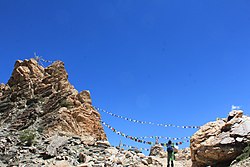
Tashigang is a village near an ancient monastery in the state of Himachal Pradesh, India, at a staggering altitude of 15,256 feet above msl. It is a settlement in Kinnaur and is located in the Sutlej river valley near the India-Tibet border. National Highway 5 connects Khab with state capital Shimla. Below Tashigangis flows the Sutlej river, which originates from Mansarovar Lake in Tibet. The villages of Nako and Khab are nearby. Current Tashigang is controlled by India but claimed by Zanda County, Ngari Prefecture, Tibet, China. You can go to the mountain Gang Chua via here through a pass.