
Cache Creek is a historic transportation junction and incorporated village 354 kilometres (220 mi) northeast of Vancouver in British Columbia, Canada. It is on the Trans-Canada Highway in the province of British Columbia at a junction with Highway 97. The same intersection and the town that grew around it was at the point on the Cariboo Wagon Road where a branch road, and previously only a trail, led east to Savona's Ferry on Kamloops Lake. This community is also the point at which a small stream, once known as Riviere de la Cache, joins the Bonaparte River.

The Tla-o-qui-aht First Nations are a Nuu-chah-nulth First Nation in Canada. They live on ten reserves along the Pacific Rim National Park Reserve on Vancouver Island, British Columbia. The band is part of the Nuu-chah-nulth Tribal Council. There were 618 people living in the Tla-o-qui-aht reserves in 1995. Their primary economic activities are fishing and tourism.

The Thompson River is the largest tributary of the Fraser River, flowing through the south-central portion of British Columbia, Canada. The Thompson River has two main branches, the South Thompson River and the North Thompson River. The river is home to several varieties of Pacific salmon and trout. The area's geological history was heavily influenced by glaciation, and the several large glacial lakes have filled the river valley over the last 12,000 years. Archaeological evidence shows human habitation in the watershed dating back at least 8,300 years. The Thompson was named by Fraser River explorer, Simon Fraser, in honour of his friend, Columbia Basin explorer David Thompson. Recreational use of the river includes whitewater rafting and angling.

The Liard River of the North American boreal forest flows through Yukon, British Columbia and the Northwest Territories, Canada. Rising in the Saint Cyr Range of the Pelly Mountains in southeastern Yukon, it flows 1,115 km (693 mi) southeast through British Columbia, marking the northern end of the Rocky Mountains and then curving northeast back into Yukon and Northwest Territories, draining into the Mackenzie River at Fort Simpson, Northwest Territories. The river drains approximately 277,100 km2 (107,000 sq mi) of boreal forest and muskeg.

Stewart is a district municipality at the head of the Portland Canal in northwestern British Columbia, Canada, near the Alaskan panhandle. In 2021, it had a population of 517.

The Restigouche River is a river that flows across the northwestern part of the province of New Brunswick and the southeastern part of Quebec.
Black Creek is a community on the eastern side of Vancouver Island, British Columbia, Canada. It is approximately 16 kilometres (9.9 mi) north of Courtenay. It is primarily an agricultural hamlet and bedroom community to Courtenay and Campbell River - approximately 20 kilometres (12 mi) to the north. It is part of Electoral Area C in the Comox Valley Regional District.
The Stave River is a tributary of the Fraser, joining it at the boundary between the municipalities of Maple Ridge and Mission, about 35 kilometres (22 mi) east of Vancouver, British Columbia, Canada, in the Central Fraser Valley region.

Salmo is a village in the West Kootenay region of southeastern British Columbia. It is mostly on the north side of Erie Creek at the confluence with the Salmo River. The place lies largely east of the junction of BC Highway 3, and BC Highway 6.

Houston is a forestry, mining and tourism town in the Bulkley Valley of the Northern Interior of British Columbia, Canada. Its population as of 2021 was 3,052, with approximately 2,000 in the surrounding rural area. It is known as the "steelhead capital" and it has the world's largest fly fishing rod. Houston's tourism industry is largely based on ecotourism and Steelhead Park, situated along Highway 16. Houston is named in honour of the pioneer newspaperman John Houston.
François Lake Provincial Park is a provincial park in British Columbia, Canada, located at the east end of Francois Lake. The total park area is 7,214 hectares. It is about 12 kilometres (7.5 mi) off BC Highway 16, southwest of the town of Fraser Lake. There is no potable water at the site so campers should bring their own.

Babine Lake borders the Skeena and Omineca regions of central British Columbia, Canada. Vehicle access to the lake, via BC Highway 16 and Nilkitkwa forestry service road, is by road about 105 kilometres (65 mi) northeast of Smithers; via BC Highway 16 and Central Babine Lake Highway, is about 132 kilometres (82 mi) east of Smithers; or via Babine Lake Road, is about 20 kilometres (12 mi) northeast of Burns Lake.
Taylor Arm Provincial Park is a provincial park in British Columbia, Canada, located on the north side of Sproat Lake 23 km northwest of Port Alberni on Vancouver Island. Situated along Highway 4, the 71-hectare park has few services but provides group camping sites, undeveloped beaches, and day-use areas. The group camping site has pit toilets and a hand pump water supply, and is connected to the lake shore via a trail that passes under the highway.

Ymir is a village in the Selkirk Mountains in the West Kootenay region of southeastern British Columbia. Ymir is located where the Salmo River meets Quartz Creek, and Ymir Creek. The locality, on BC Highway 6, is by road about 10 kilometres (6 mi) northeast of Salmo and 34 kilometres (21 mi) south of Nelson.

The Village of Slocan is in the West Kootenay region of southeastern British Columbia. The former steamboat landing and ferry terminal is at the mouth of Springer Creek, at the foot of Slocan Lake. The locality, on BC Highway 6 is about 69 kilometres (43 mi) by road north of Castlegar and 183 kilometres (114 mi) by road and ferry south of Revelstoke.

Coquihalla Summit is a highway summit along the Coquihalla Highway in British Columbia, Canada. It is the highest point on the highway between the cities of Hope and Merritt. It is located just south of the former toll booth plaza on the Coquihalla Highway, about 50 km (31 mi) north of Hope, and 65 km (40 mi) south of Merritt and is the divide between the Coquihalla River and the Coldwater River.
Somass River is a river on Vancouver Island, in the Canadian province of British Columbia. Its drainage basin is 1,412 square kilometres (545 sq mi) in size.
The Clowhom River is a short, 19.8-kilometre (12.3 mi) river in British Columbia. It flows into the head of the Salmon Inlet about 26.2 km west of Squamish.

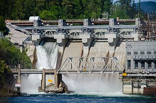
Salmon Inlet, formerly Salmon Arm, is a fjord branching east from Sechelt Inlet in the British Columbia, Canada. Its companion, Narrows Inlet, another side-inlet of Sechelt Inlet, lies roughly 10 km (6.2 mi) north. Misery and Sechelt Creeks flow freely into the inlet, while the Clowhom River flows in from the artificial Clowhom Lake, formed by a small hydroelectric power development. The fjord is 23 km (14 mi) long; Clowhom Lake, covering a waterfall on the Clowhom River, stretches a further 12 km (7.5 mi) to the western base of Mount Tantalus, which is best known from the direction of Squamish and the Cheakamus Canyon stretch of British Columbia Highway 99. Heavily affected by logging and milling operations, the inlet is split almost into two portions by an alluvial fan spreading from the mouth of Sechelt Creek.
There are four current and two former suffixed routes of Highway 97 in British Columbia, Canada. The majority of the routes serve the Okanagan area of the British Columbia Interior.