Related Research Articles

Dannevirke, is a rural service town in the Manawatū-Whanganui region of the North Island, New Zealand. It is the major town of the administrative of the Tararua District, the easternmost of the districts of which the Horizons Regional Council has responsibilities.
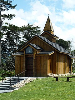
Norsewood is a small rural settlement in the Tararua District and Manawatū-Whanganui region of New Zealand's North Island. The town is situated east of the Ruahine Mountain range and is located 20 kilometres northeast of Dannevirke.
Tūrangi is a small town on the west bank of the Tongariro River, 50 kilometres south-west of Taupō on the North Island Volcanic Plateau of New Zealand. It was built to accommodate the workers associated with the Tongariro hydro-electric power development project and their families. The town was designed to remain as a small servicing centre for the exotic forest plantations south of Lake Taupō and for tourists. It is well known for its trout fishing and calls itself "The trout fishing capital of the world". The major Māori hapū (tribe) of the Tūrangi area is Ngāti Tūrangitukua.

The Tararua District is an area near the south-east corner of New Zealand's North Island that is administered by the Tararua District Council. It has a population of 19,050, and an area of 4,364.65 km². The Tararua District Council was created by the amalgamation of the Dannevirke Borough, Eketahuna County Council, Pahiatua Borough Council, Pahiatua County Council and Woodville District Council in the 1989 local government reforms.

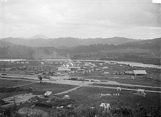
Murupara is a town located in the Whakatāne District and Bay of Plenty Region of New Zealand's North Island. The town is situated in an isolated part of the region between the Kaingaroa Forest and Te Urewera protected area, on the banks of the Rangitaiki River, 65 kilometres southeast of Rotorua.
Woodville, previously known as The Junction is a small town in the southern North Island of New Zealand, 75 km north of Masterton and 25 km east of Palmerston North. The 2013 census showed that 1401 people reside in Woodville.

Ōtaki is a town in the Kapiti Coast District of the North Island of New Zealand, situated half way between the capital city Wellington, 70 km (43 mi) to the southwest, and Palmerston North, 70 km (43 mi) to the northeast.

Kakahi ) is a small King Country settlement about 10 kilometres (6.2 mi) up the Whanganui River from Taumarunui, New Zealand. Founded as a sawmill town, it takes its name from the Māori word for the New Zealand freshwater mussel.

Maketu is a small town on the Bay of Plenty Coast in New Zealand.
Bridge Pā is a rural Māori settlement and surrounding area in Hawke's Bay, New Zealand, located approximately 10 kilometres inland from Hastings. The pā itself comprises approximately 70 households, a school, a meetinghouse of the LDS Church, two marae, a cemetery, a disused quarry, and the 140-year-old historical Homestead of the Puriri Family. The population was 184 in 1996, increasing to 213 in 2001.
Te Teko is a small inland town along the banks of the Rangitaiki River in the Bay of Plenty region of New Zealand's North Island.
Manunui is a small Whanganui River settlement, about 6 kilometres (3.7 mi) east of Taumarunui on State Highway 4, in New Zealand's King Country. It was once known as Waimarino, but John Burnand of the Ellis and Burnand sawmilling firm renamed it Manunui around 1905.
Kaeo is a township in the Far North District of New Zealand, located some 22 km (14 mi) northwest of Kerikeri. The town takes its name from the kāeo or New Zealand freshwater mussel, which is found in the nearby rivers.

Horeke is a settlement in the upper reaches of the Hokianga Harbour in Northland, New Zealand. Kohukohu is just across the harbour. The Horeke basalts are located near the town, and can be viewed on an easy stroll through the Wairere Boulders, a commercial park.

Rangitāne is a Māori iwi (tribe). Their rohe (territory) is in the Manawatū, Horowhenua, Wairarapa and Marlborough areas of New Zealand.
Waitōtara is a town in South Taranaki, New Zealand. Waverley is 10 km to the north-west, and Whanganui is 34 km to the south-east. State Highway 3 passes through it. The Waitōtara River flows past the east side of the town.
Hairini is a suburb of Tauranga in the Bay of Plenty region of New Zealand's North Island.
Ohinewai or Ōhinewai is a small settlement in the Waikato Region, in New Zealand. It is located on the east bank of the Waikato River on SH1, 9 km north of Huntly
Rotoiti is a settlement on the shore of Lake Rotoiti, in Rotorua Lakes within the Bay of Plenty Region of New Zealand's North Island.
Hāwai is a coastal settlement in the Ōpōtiki District and Bay of Plenty Region of New Zealand's North Island.
References
- ↑ Ruahine School: About Us Archived 2010-05-23 at the Wayback Machine
- ↑ Makirikiri Marae Archived 2010-06-02 at the Wayback Machine
- ↑ McLintock, A.H., ed. (1966). "Dannevirke". An Encyclopaedia of New Zealand. Te Ara: The Encyclopedia of New Zealand. Last updated: 18 September 2007.
- ↑ NZPA (13 May 2008). "Emotional scenes as PPC announces closure". The New Zealand Herald .
- ↑ Ruahine Forest Park Archived 2008-10-15 at the Wayback Machine