The Maro River also known as Sungai Merauke and Merauke-rivier, Merauki River flows in Merauke Regency, Papua, Indonesia. It is located just to the west of the Bensbach River of Western Province, Papua New Guinea.

The Brantas is the longest river in East Java, Indonesia. It has a length of 320 km, and drains an area of over 11,000 km2 from the southern slope of Mount Kawi-Kelud-Butak, Mount Wilis, and the northern slopes of Mount Liman-Limas, Mount Welirang, and Mount Anjasmoro. Its course is semi-circular or spiral in shape: at its source, the river heads southeast, but gradually curves south, then southwest, west, then north, and finally it flows generally eastward at the point where it branches off to become the Kalimas and Porong River.

The Asahan River is one of the principal rivers in North Sumatra, Indonesia, that begins in Porsea, Toba Regency near the southeast corner of Lake Toba.

The Indragiri River is a river in Sumatra, in the Indonesian province of Riau, about 800 km northwest of the capital Jakarta. Formed by the union of the Ombilin River and the Sinamar River, the Indragiri empties into the Strait of Malacca. The middle part that flows in the Kuantan Singingi Regency is called Batang Kuantan.
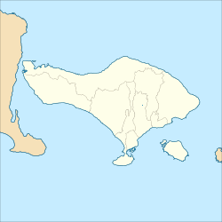
The Sungi River is a river in Bali, Indonesia. Its source is located in the mountainous area in the central-northern part of Bali. It flows through the ancient site of Mengwi and enters the sea to the west of Kerobokan Kelod on the southern coast.

Pembuang River or Seruyan River is a river of Borneo, Indonesia. The river has its source near Bikit Tikung in the Schwaner Mountain Range. The eastern side of the river contains dense forest down to Sembulu (Belajau) lakes and is said to be a major habitat of the orangutan. Pembuang means "place of rejection".
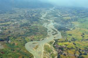
The Sissa River is a river of Flores, East Nusa Tenggara, Indonesia. The 87-km river flows from a southwest to northeast direction, with the upstream at Mount Inielika north of Bajawa, Ngada Regency and discharges into the Flores Sea near Mbay, Nagekeo Regency.
Pemali River is a river in northern Central Java, Indonesia, about 250 km east of the capital Jakarta.
The Porong River is a river flowing through Sidoarjo, East Java, Indonesia, about 700 km east of the capital Jakarta. It is one of the main distributaries of the Brantas River that discharges into the Bali Sea, close to the Madura Strait, and is the main outlet for the Lusi mudflow.
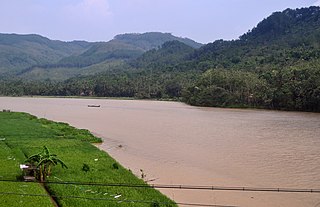
Buni River is a river in southern West Java, Indonesia. The 109-km-long river flows in the Bandung and Cianjur regencies, with the upstream at the west slope of Mount Patuha and discharge into the Indian Ocean.
The Serayu River is a river in Central Java, Indonesia, about 300 km southeast of the capital Jakarta.
The Progo River is a river in southern central Java, Indonesia. The river passes through two provinces; Central Java and Yogyakarta Special Region. The source of the river is on the slopes of Mount Sindoro, Central Java.
The Kamundan River is a river in southern West Papua province, Indonesia. Kamundan is mostly still natural with the upstream in Manokwari Regency and river mouth at the border of Bintuni Bay and Sorong Selatan Regency. It is also known as the "Sungai Kamundan".
Mamasa River is a river in Sulawesi, Indonesia. It is a tributary of the Sadang River.

The Jamboaye River is a river in the province of Aceh in northern Sumatra, Indonesia, about 1,600 km northwest of the capital Jakarta.
Barumun River is a Sumatran river that begins in Siraisan, Padang Lawas Regency in the southeastern North Sumatra, Indonesia, about 1,200 km northwest of the capital Jakarta.
Rokan River is a river in Riau province, central-eastern Sumatra, Indonesia, about 1,100 km northwest of the capital Jakarta.
Alas River is a river in Aceh in northeastern Sumatra, Indonesia, about 1400 km northwest of the capital Jakarta. It is known for its white water rafting. The banks of the rivers are inhabited by the Alas people.

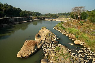
The Tabalong River is a river traversing Tabalong Regency, in the province of South Kalimantan, Indonesia. The river flows into the Negara River. It is a confluence of two tributaries: the Left Tabalong and Right Tabalong rivers.
The Simpang-kanan River is a river in southern Sumatra, Indonesia, about 600 km northwest of the capital Jakarta. It is a tributary of the Rawas River.