
Tamanrasset, also known as Tamanghasset or Tamenghest, is an oasis city and capital of Tamanrasset Province in southern Algeria, in the Ahaggar Mountains. It is the chief city of the Algerian Tuareg. It is located an altitude of 1,320 metres (4,330 ft). As of the 2008 census, it has a population of 92,635, up from 72,741 in 1998, with an annual growth rate of 2.5%.

Acıpayam is a town and a rural district of Denizli Province in high country between the Aegean and Mediterranean regions of Turkey. A plain, watered by two reservoirs, known for growing melons and watermelons, on the road between the city of Denizli and Antalya. It covers an area of 1700 km², and the altitude is 895 m. The district has a population of 57,533 of which 13,700 live in the city of Acipayam.

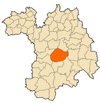
Khamissa, ancient Thubursicum Numidarum or Thubursicum, is an Ancient Roman and Byzantine archeological site, in Souk Ahras Province of northeastern Algeria.

Mila is a city in the northeast of Algeria and the capital of Mila Province. In antiquity, it was known as Milevum or Miraeon, Μιραίον and was situated in the Roman province of Numidia.

Tazoult is commune town in north-eastern Algeria.

Tigzirt, the classical Iomnium, is a small town on the coast of northeast Algeria in Tizi Ouzou Province. It has a sleepy demeanor and attracts many tourists especially in summer from all over the country.
Loznitsa is a small town in northeastern Bulgaria, part of Razgrad Province, located in the geographic region of Ludogorie. It is the administrative centre of the homonymous Loznitsa Municipality, which lies in the southernmost part of the Province. As of December 2009, the town has a population of 2,409 inhabitants.

Aïn Oussera or Aïn Oussara is a city in Djelfa Province, Algeria, with an estimated (2005) population of 134,174. It is the district seat of the Aïn Oussera District. This city, located 200 km south of the capital Algiers, is crossed by the Trans-Saharan Highway main road number 1. The road that runs through the whole of Algeria from north to south over 2000 km, connects Algiers on its southern border with Mali near Tamanrasset. Ain Oussera, has experienced, since 1990, rapid population growth due to its proximity to the 15 MW Es Salam nuclear reactor. Aïn Oussera is on the crossroads of the N1 (Trans-Saharan) and N40B highways. The nearest airport is the Algerian Air Force's Aïn Oussera airfield (DAAQ).
Tazoult District is a district of Batna Province, Algeria. The capital is Tazoult, a small city of 5,000 inhabitants.
Ouled Dahmane is a town and commune in Bordj Bou Arréridj Province, Algeria. According to the 1998 census it has a population of 14,777.

Ouled Sidi Brahim is a town and commune in M'Sila Province, Algeria. According to the 2021 census it has a population of 14,499.
M'Chedallah is a town and commune in Bouïra Province, Algeria. According to the 1998 census it has a population of 21,593.

El Karimia is a town and commune in Chlef Province, Algeria. According to the 1998 census it has a population of 25,060.

Oued Fodda is a town and commune in Chlef Province, Algeria. According to the 1998 census it has a population of 36,187.

Cheffia is a town and commune in El Taref Province, Algeria. According to the 1998 census it has a population of 7,450.

Drea is a town and commune in Souk Ahras Province in north-eastern Algeria.

Aïn Oulmene, the classical Zaraï, is a town and commune in Sétif Province in north-eastern Algeria.
Guidjel is a town and commune in Sétif Province in north-eastern Algeria.
Mezloug is a town and commune in Sétif Province in north-eastern Algeria.
Taya is a town and commune in Sétif Province in north-eastern Algeria.
