
Kheda, also known as Kaira, is a city and a municipality in the Indian state of Gujarat. It was former administrative capital of Kheda district. Kheda city is famous for tobacco farming. Nearest railway station is "Mahemadavad Kheda Road". Nearest Airport is Ahmedabad airport. Nearest Bus Station is "Kheda Bus Station". Sardar Patel was born in Kheda District of Gujarat State.

Ugar Khurd is a town municipal council in the district of Belagavi, in the state of Karnataka, in India. Khurd and Kalan Persian language word which means small and Big respectively when two villages have same name then it is distinguished as Kalan means Big and Khurd means Small with Village Name.
Ambaji (Ambājī) is a census town in Banaskantha district in the state of Gujarat, India. It is known for its historical connections with sites of cultural heritage.

Aravakurichi is a panchayat town and a Taluk headquarters in Karur district in the state of Tamil Nadu, India. Aravakurichi is also a taluk. Aravakurichi is well known in Tamil Nadu as a major market for Moringa oleifera vegetable. People belongs to Hinduism, Islam and Christianity lives here in Good intentions and Friendly. Aravakurichy is one of the biggest taluk consists of More than 40 revenue Villages.

Kherwara Chhaoni is a census town in the Udaipur district in the Indian state of Rajasthan. It is part of the Vagad region, which includes the districts of Dungarpur, Banswara and parts of Udaipur district. It is in close proximity to two major highways, National Highway 8 and Rajasthan State Highway 76 and National Highway 927A passes through it. Its name derives from the large number of Kher (Khair) trees in the region in the past.
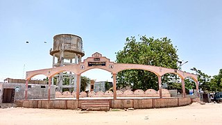
Mahemdavad is a town with municipality in the Kheda district in the Indian state of Gujarat. Mahemdavad is situated on the Vatrak River bank. The nearest city is Kheda.
Unjha is a town and a municipality in Mehsana district in the Indian state of Gujarat. Unjha is 29 km north of Mehsana and 102 km north of Ahmedabad.
Vijapur is a city and a municipality in the Mehsana district in the Indian state of Gujarat.

Kodanad is a rural riverside village of Ernakulam district in Kerala, South India. Kodanad is situated on the south bank of Periyar river, about 42 kilometers east of Kochi. The nearest airport is Cochin International Airport which is about 20 km (12 mi) by road. The village is a major tourist destination because it houses an Elephant training center.

Shirpur is a city and taluka in Dhule district of Nashik Division, Maharashtra. It is located on National Highway 3, which runs from Agra in Uttar Pradesh to Mumbai, Maharashtra. The Arunavati River and Tapi river flows through the city. Shirpur is 50 km from the city of Dhule. It houses Asia's largest and India's first gold refinery. Narsee Monjee Institute of Management Studies has a campus in Shirpur. Ahead of Shirpur there is a small defense airport at Village Tande.

Gozaria is a town and a gram panchayat in Mehsana district in the Indian state of Gujarat.
Kherva is a village in the Mehsana District, Gujarat, India, situated on State Highway 73 between Gandhinagar and Mehsana. It borders the following villages: Devarasan, Kadavasan, Mulsan, Jagudan, Sanganpur, Punasan, Hebuva, Udalpur, Gunjala, Dharusan, and Dhamnava.
Isnav is a little village from one of the 22 Gam Patidar Samaj, situated at coordinates: 22°31'59"N | 72°45'51"E just nearby small town called Sojitra. Isnav is surrounded by natural countryside. The village has an entrance from the State Highway 83 in Gujarat. From the Gateway, off the highway just after 0.80 km drive is the village Isnav.
Sarsavani is a village located in the Mahemdavad Taluka of Kheda district, Gujarat, India.
Ambala is the village of Bechraji taluka in Gujarat and it is far from 15 km from Bechraji. Shree Shaktimata temple is well known in village. There is majority of 72 Kadva Patidar and Panchal. There is also public like thakor, chamar, vaghri.

Kumbhariya is a village of historical, archaeological and religious importance with cultural heritage in Danta Taluka of Banaskantha district, Gujarat, India.
Chamardi is a village and former petty Rajput princely state located within the Vallabhipur Taluka township of the Bhavnagar district (Gujarat), in west India.
Jagana is a village in the Palanpur taluka of Banaskantha district in northern Gujarat, India. The villages Vasna, Bhagal, Sedrasana are located near to Jagana and it is just 6 km away from the district headquarters, Palanpur.

Mahemadavad Kheda Road railway station is a railway station on the Western Railway network in the state of Gujarat, India. Mahemadavad Kheda Road railway station is 18 km far away from Nadiad railway station. Passenger, MEMU and few Express/Superfast trains halt at Mahemadavad Kheda Road railway station. This railway station's nearest city is Kheda.
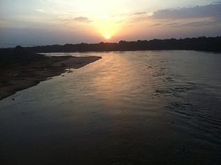
The Vatrak is a tributary of the Sabarmati River which flows for 243 kilometers in Gujarat, India. It originates in the hills of Dungarpur, Rajasthan and enters in Gujarat near village Moydi of Meghraj taluka.


