Related Research Articles

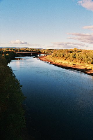
The Kootenay River or Kootenai River is a major river of the Northwest Plateau in southeastern British Columbia, Canada, and northern Montana and Idaho in the United States. It is one of the uppermost major tributaries of the Columbia River, the largest North American river that empties into the Pacific Ocean. The Kootenay River runs 781 kilometres (485 mi) from its headwaters in the Kootenay Ranges of the Canadian Rockies, flowing from British Columbia's East Kootenay region into northwestern Montana, then west into the northernmost Idaho Panhandle and returning to British Columbia in the West Kootenay region, where it joins the Columbia at Castlegar.

The Thompson River is the largest tributary of the Fraser River, flowing through the south-central portion of British Columbia, Canada. The Thompson River has two main branches, the South Thompson River and the North Thompson River. The river is home to several varieties of Pacific salmon and trout. The area's geological history was heavily influenced by glaciation, and the several large glacial lakes have filled the river valley over the last 12,000 years. Archaeological evidence shows human habitation in the watershed dating back at least 8,300 years. The Thompson was named by Fraser River explorer, Simon Fraser, in honour of his friend, Columbia Basin explorer David Thompson. Recreational use of the river includes whitewater rafting and angling.
The Nechako River arises on the Nechako Plateau east of the Kitimat Ranges of the Coast Mountains of British Columbia, Canada, and flows north toward Fort Fraser, then east to Prince George where it enters the Fraser River. "Nechako" is an anglicization of netʃa koh, its name in the indigenous Carrier language which means "big river".
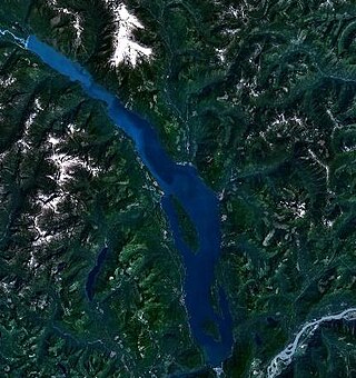
Harrison Lake is the largest lake in the southern Coast Mountains of Canada, being about 250 square kilometres (95 mi²) in area. It is about 60 km (37 mi) in length and at its widest almost 9 km (5.6 mi) across. Its southern end, at the resort community of Harrison Hot Springs, is c. 95 km east of downtown Vancouver. East of the lake are the Lillooet Ranges while to the west are the Douglas Ranges. The lake is the last of a series of large north-south glacial valleys tributary to the Fraser along its north bank east of Vancouver, British Columbia. The others to the west are the Chehalis, Stave, Alouette, Pitt, and Coquitlam Rivers.

The Kechika River is a tributary of the Liard River, about 300 kilometres (190 mi) long, in northern British Columbia, Canada. The Kechika flows generally northwest through the northernmost section of the Rocky Mountain Trench before turning east to join the Liard, a major branch of the Mackenzie River system. The river's 22,700 km2 (8,800 sq mi) drainage basin is characterized by high glaciated peaks, boreal forest, and open tundra. With no settlements, roads or dams along its course, the Kechika is considered "one of British Columbia's finest examples of wilderness and undisturbed wildlife habitat."
The Taseko River or Dasiqox in the original Chilcotin, is a tributary of British Columbia's Chilko River, a tributary of the Chilcotin River which joins the Fraser near the city of Williams Lake.

The Nicola River, originally French Rivière de Nicholas or Rivière de Nicolas, adapted to Nicolas River, Nicola's River in English, is one of the major tributaries of the Thompson River in the Canadian province of British Columbia, entering the latter at the town of Spences Bridge. It is named for Nicola (Hwistesmexteqen) the most famous chief of the joint community of Nlaka'pamux and Okanagan bands, founded by his father and today known as the Nicolas,, as well as its basin, which is known as the Nicola Country. It drains most of the northern Thompson Plateau, beginning near the very eastern edge of the plateau only 30 kilometres (19 mi) northwest of Kelowna, and flows from there more or less westward to feed Douglas Lake and Nicola Lake, with about 15 kilometres (9 mi) of the river's length between those two lakes. Nicola Lake at 20 kilometres (12 mi) long is the largest in the basin; the Nicola River enters at 3/4 way of its length up from its outlet, 10 kilometres (6 mi) downstream from which is Nicola Valley centre and Coquihalla Highway city of Merritt. From there the river flows 60 kilometres (37 mi) northwest to the Thompson, and is followed on that route by British Columbia Highway 8 and a spur line of the Canadian Pacific Railway.

The Kettle River is a 281-kilometre (175 mi) tributary of the Columbia River, encompassing a 10,877-square-kilometre (4,200 sq mi) drainage basin, of which 8,228 square kilometres (3,177 sq mi) are in southern British Columbia, Canada and 2,649 square kilometres (1,023 sq mi) in northeastern Washington, US.
The Wood River, which flows in a southwesterly direction, is in the East Kootenay region of southeastern British Columbia. The former confluence was near the top of the Big Bend of the Columbia River. After the enlarged Kinbasket Lake formed the Mica Dam reservoir, the flow entered Wood Arm.

The Iskut River, located in the northwest part of the province of British Columbia is the largest tributary of the Stikine River, entering it about 11 km (6.8 mi) above its entry into Alaska.
The Stawamus River is a small, creek-like river in British Columbia. It enters the Howe Sound east of the mouth of the Squamish River.
Clendinning Creek is a river in British Columbia. It is the largest tributary of the Elaho River. It is located entirely within Clendinning Provincial Park.
The Clowhom River is a short, 19.8-kilometre (12.3 mi) river in British Columbia. It flows into the head of the Salmon Inlet about 26.2 km west of Squamish.

The Emerald River is a short river in British Columbia. It is about 6.5 kilometres (4.0 mi) long and drains the waters of Emerald Lake to the Kicking Horse River. The river exits the lake's south end and flows in a southern direction for about 6.5 kilometres (4.0 mi) to its mouth, which is at almost exactly the same place as the mouth of the Amiskwi River. It picks up three named tributaries; Hamilton Creek, Russell Creek and Kendel Creek.
The Kiwetinok River is a short river in British Columbia. It is the largest tributary of the Amiskwi River.
The Marron River is a very small & very short river in southern British Columbia. It is located just west of Skaha Lake, and is about 7.8 km long.
The Moose River is a river in Mount Robson Provincial Park of British Columbia. It is the first "river" tributary of the Fraser, entering the Fraser just above the inlet to Moose Lake, which is along the course of the Fraser and not the Moose.

The Robson River is a short but swift, rapid and waterfall-infested river in Mount Robson Provincial Park of British Columbia. It is a tributary of the Upper Fraser River and it originates near Robson Pass, which divides the Robson River and the headwaters of the Smoky River drainage. There are three lakes along the river's course as well as four waterfalls.
Swiftcurrent Creek is a river in Mount Robson Provincial Park of British Columbia. It is a tributary of the Fraser River, entering the Fraser about 1.7 kilometres (1.1 mi) below the mouth of the Robson River.
The Cheslatta River is a tributary of the Nechako River, one of the main tributaries of the Fraser River, in the Canadian province of British Columbia. It flows through the Nechako Plateau. Before the construction of Kenney Dam in the early 1950s the Cheslatta was a minor tributary of the Nechako. Today the Nechako River is dry above the Cheslatta, which provides all its source water.
References
- ↑ Source elevation derived from Google Earth search using GNIS source coordinates.
- ↑ "Templeton River". BC Geographical Names .
- ↑ "Rocky Mountain Ramblers Trip Report Shangri-la (Dunbar Lakes) via Templeton Lake: BP on 2006-06-30 by Trip id".
- ↑ "Lang Lake". BC Geographical Names .