The Ismailia Stadium is located in Ismailia, Egypt, and has a total capacity of 18,525 after the remodelation in 2009. It is used by Ismaily SC, and was one of six stadiums to be used in the 2006 African Cup of Nations, held in Egypt.

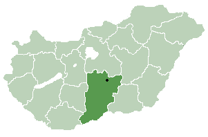
Jakabszállás is a village in Bács-Kiskun county, in the Southern Great Plain region of Hungary.

Basti Fauja is a town and union council of Dera Ghazi Khan District in the Punjab province of Pakistan. It is located at 29°46'49N 70°36'4E and has an altitude of 111 metres.

Verin Ptghni, is a village in the Kotayk Province of Armenia.

Nad Bladówkiem is a village in the administrative district of Gmina Tuchola, within Tuchola County, Kuyavian-Pomeranian Voivodeship, in north-central Poland. It lies approximately 4 kilometres (2 mi) west of Tuchola and 56 km (35 mi) north of Bydgoszcz.

Mołczany is a village in the administrative district of Gmina Dołhobyczów, within Hrubieszów County, Lublin Voivodeship, in eastern Poland, close to the border with Ukraine. It lies approximately 2 kilometres (1 mi) north of Dołhobyczów, 26 km (16 mi) south-east of Hrubieszów, and 125 km (78 mi) south-east of the regional capital Lublin.
Kalinówka is a settlement in the administrative district of Gmina Sidra, within Sokółka County, Podlaskie Voivodeship, in north-eastern Poland.

Malenia is a village in the administrative district of Gmina Buczek, within Łask County, Łódź Voivodeship, in central Poland. It lies approximately 5 kilometres (3 mi) east of Buczek, 12 km (7 mi) south-east of Łask, and 36 km (22 mi) south-west of the regional capital Łódź.

Katarzynów is a village in the administrative district of Gmina Kobiele Wielkie, within Radomsko County, Łódź Voivodeship, in central Poland. It lies approximately 4 kilometres (2 mi) south-west of Kobiele Wielkie, 13 km (8 mi) south-east of Radomsko, and 87 km (54 mi) south of the regional capital Łódź.

Zrecze Chałupczańskie is a village in the administrative district of Gmina Chmielnik, within Kielce County, Świętokrzyskie Voivodeship, in south-central Poland. It lies approximately 4 kilometres (2 mi) east of Chmielnik and 34 km (21 mi) south of the regional capital Kielce.

Samsonów-Dudków is a village in the administrative district of Gmina Zagnańsk, within Kielce County, Świętokrzyskie Voivodeship, in south-central Poland. It lies approximately 5 kilometres (3 mi) west of Zagnańsk and 12 km (7 mi) north of the regional capital Kielce.

Pętkowice is a village in the administrative district of Gmina Bałtów, within Ostrowiec County, Świętokrzyskie Voivodeship, in south-central Poland. It lies approximately 4 kilometres (2 mi) east of Bałtów, 17 km (11 mi) north-east of Ostrowiec Świętokrzyski, and 71 km (44 mi) east of the regional capital Kielce.

Poylu is a village in the Agstafa Rayon of Azerbaijan. The village forms part of the municipality of Poylu.

Sośniczany is a village in the administrative district of Gmina Koprzywnica, within Sandomierz County, Świętokrzyskie Voivodeship, in south-central Poland. It lies approximately 3 kilometres (2 mi) north-east of Koprzywnica, 13 km (8 mi) south-west of Sandomierz, and 76 km (47 mi) south-east of the regional capital Kielce.

Świetlino is a village in the administrative district of Gmina Łęczyce, within Wejherowo County, Pomeranian Voivodeship, in northern Poland. It lies approximately 5 kilometres (3 mi) east of Łęczyce, 22 km (14 mi) west of Wejherowo, and 53 km (33 mi) north-west of the regional capital Gdańsk.

Czarna Buda is a settlement in the administrative district of Gmina Postomino, within Sławno County, West Pomeranian Voivodeship, in north-western Poland. It lies approximately 10 kilometres (6 mi) south-west of Postomino, 11 km (7 mi) north-west of Sławno, and 175 km (109 mi) north-east of the regional capital Szczecin.

Mosina is a village in the administrative district of Gmina Szczecinek, within Szczecinek County, West Pomeranian Voivodeship, in north-western Poland. It lies approximately 7 kilometres (4 mi) south-west of Szczecinek and 137 km (85 mi) east of the regional capital Szczecin.

Ogawa Station is a railway station of Kyushu Railway Company located in Uki, Kumamoto, Japan.
Shahrak-e Gharbi is a village in Qeshlaq-e Shomali Rural District, in the Central District of Parsabad County, Ardabil Province, Iran. At the 2006 census, its population was 1,425, in 384 families.
Adatepe Olive Oil Museum is a museum in Çanakkale Province, Turkey The museum is at 39°32′51″N26°36′04″E in Adatepe village of Ayvacık ilçe (district) and on Turkish state highway connecting İzmir to Çanakkale. It is located in an abandoned soap plant. It was opened in 2001 by a private olive company.


