
The geography of France consists of a terrain that is mostly flat plains or gently rolling hills in the north and west and mountainous in the south and the east. Metropolitan France has a total size of 551,695 km2 (213,011 sq mi). It is the third largest country in Europe after Russia and Ukraine.

Sehore District is a district of Madhya Pradesh state in central India. The town of Sehore is the district headquarters. The district is part of Bhopal Division.
Angah, is a village and one of the 51 Union Councils of Khushab District in the Punjab Province of Pakistan. It is located at 32° 36' 0N 72° 4' 60E.

Bougara is a district in Blida Province, Algeria. It was named after its capital, Bougara.

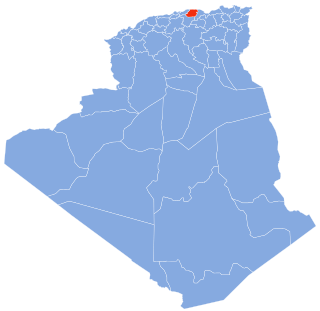
Djelida is a town in northern Algeria.

The Shaksgam River is a left tributary of the Yarkand River. The river is also known as the Kelechin River and Muztagh River. It rises in the Gasherbrum, Urdok, Staghar, Singhi and Kyagar Glaciers in the Karakoram. It then flows in a general northwestern direction parallel to the Karakoram ridge line in the Shaksgam Valley. It receives the waters of the Shimshal Braldu river and the Oprang river from the Pakistan-administered Hunza District before turning east and joining the Yarkand River. The stretch of the river's course between Shimshal Braldu and Oprang is used as the Pakistan–China border.

Bielewicze is a village in the administrative district of Gmina Gródek, within Białystok County, Podlaskie Voivodeship, in north-eastern Poland, close to the border with Belarus. It lies approximately 4 kilometres (2 mi) south-east of Gródek and 36 km (22 mi) east of the regional capital Białystok.

Topola Królewska is a village in the administrative district of Gmina Łęczyca, within Łęczyca County, Łódź Voivodeship, in central Poland. It lies approximately 4 kilometres (2 mi) north of Łęczyca and 38 km (24 mi) north-west of the regional capital Łódź.
Topola Szlachecka is a village in the administrative district of Gmina Łęczyca, within Łęczyca County, Łódź Voivodeship, in central Poland. It lies approximately 4 kilometres (2 mi) north of Łęczyca and 38 km (24 mi) north-west of the regional capital Łódź.
Marszewo is a village in the administrative district of Gmina Śrem, within Śrem County, Greater Poland Voivodeship, in west-central Poland. It lies approximately 3 kilometres (2 mi) west of Śrem and 36 km (22 mi) south of the regional capital Poznań.
Sarkajmy is a village in the administrative district of Gmina Korsze, within Kętrzyn County, Warmian-Masurian Voivodeship, in northern Poland. It lies approximately 4 kilometres (2 mi) west of Korsze, 22 km (14 mi) north-west of Kętrzyn, and 58 km (36 mi) north-east of the regional capital Olsztyn.

Sidi Moussa is a commune in the Baraki District of the Algiers Province and a suburb of the city of Algiers in northern Algeria. It is situated 15 kilometers south of central Algiers.
Long'an District is a district of the city of Anyang, Henan province, China.
Ouadhia District is a district of Tizi Ouzou Province, Algeria.
Machali is a village in Belgaum district in Karnataka, India.

Mustafabeyli is a town in Ceyhan district of Adana Province, Turkey. It is on the highway D.400 near the intersection D.817 at 37°05′N36°04′E. The distance to Ceyhan is 27 kilometres (17 mi). The population of the town is 1856 as of 2015.

Kilis is an electoral district of the Grand National Assembly of Turkey. It elects two members of parliament (deputies) to represent the province of the same name for a four-year term by the D'Hondt method, a party-list proportional representation system.
Obukhov or Obukhova is the name of several rural localities in Russia.
Kafr Hind is a Syrian village located in Salqin Nahiyah in Harem District, Idlib. According to the Syria Central Bureau of Statistics (CBS), Kafr Hind had a population of 1073 in the 2004 census.
This page is based on this
Wikipedia article Text is available under the
CC BY-SA 4.0 license; additional terms may apply.
Images, videos and audio are available under their respective licenses.
