Băneasa is a commune located in Giurgiu County, Romania. It is composed of four villages: Băneasa, Frasinu, Pietrele and Sfântu Gheorghe.

Paliwodzizna is a village in the administrative district of Gmina Golub-Dobrzyń, within Golub-Dobrzyń County, Kuyavian-Pomeranian Voivodeship, in north-central Poland. It lies 2 kilometres (1 mi) south of Golub-Dobrzyń and 30 km (19 mi) east of Toruń.
Sierzputy Zagajne is a village in the administrative district of Gmina Śniadowo, within Łomża County, Podlaskie Voivodeship, in north-eastern Poland. It lies approximately 8 kilometres (5 mi) north-east of Śniadowo, 10 km (6 mi) south of Łomża, and 75 km (47 mi) west of the regional capital Białystok.
Haykavan is a town in the Armavir Province of Armenia.
Bronno is a village in the administrative district of Gmina Łęczyca, within Łęczyca County, Łódź Voivodeship, in central Poland. It lies approximately 8 kilometres (5 mi) west of Łęczyca and 40 km (25 mi) north-west of the regional capital Łódź.

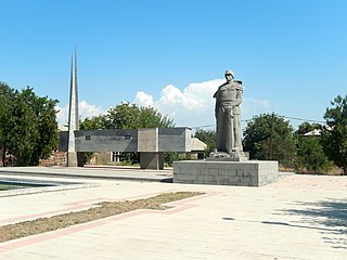
Şükürbəyli is a village in the Agdam Rayon of Azerbaijan.
Wola Rzędzińska is a village in the administrative district of Gmina Tarnów, within Tarnów County, Lesser Poland Voivodeship, in southern Poland. It lies approximately 7 kilometres (4 mi) east of Tarnów and 82 km (51 mi) east of the regional capital Kraków.
Trzebownisko is a village in Rzeszów County, Subcarpathian Voivodeship, in south-eastern Poland. It is the seat of the gmina called Gmina Trzebownisko. It lies approximately 7 km (4 mi) north-east of the regional capital Rzeszów.
Şükürağalı is a village in the municipality of Çəmənli in the Agdam Rayon of Azerbaijan.
The Findlay Group is a group of islands in the Canadian Arctic Archipelago in Qikiqtaaluk Region, Nunavut. This Arctic Ocean group consists of Lougheed Island, Stupart Island, Edmund Walker Island, Grosvenor Island and Patterson Island.
Kawcze is a village in the administrative district of Gmina Śrem, within Śrem County, Greater Poland Voivodeship, in west-central Poland. It lies approximately 3 kilometres (2 mi) east of Śrem and 37 km (23 mi) south of the regional capital Poznań.
Sosnowiec is a village in the administrative district of Gmina Śrem, within Śrem County, Greater Poland Voivodeship, in west-central Poland. It lies approximately 3 kilometres (2 mi) east of Śrem and 37 km (23 mi) south of the regional capital Poznań.
Obra is a village in the administrative district of Gmina Wolsztyn, within Wolsztyn County, Greater Poland Voivodeship, in west-central Poland. It lies approximately 6 kilometres (4 mi) south-west of Wolsztyn and 69 km (43 mi) south-west of the regional capital Poznań.
Ślazowo is a village in the administrative district of Gmina Przelewice, within Pyrzyce County, West Pomeranian Voivodeship, in north-western Poland. It lies approximately 3 kilometres (2 mi) south-west of Przelewice, 13 km (8 mi) south-east of Pyrzyce, and 49 km (30 mi) south-east of the regional capital Szczecin.
Long'an District is a district of the city of Anyang, Henan province, China.
Pikevere is a village in Väike-Maarja Parish, Lääne-Viru County, in northeastern Estonia.

Mount Hochlin is a large ice-topped mountain, 2,760 metres (9,060 ft) high, standing east of Festninga Mountain in the Mühlig-Hofmann Mountains of Queen Maud Land, Antarctica. It was mapped by Norwegian cartographers from surveys and air photos by the Sixth Norwegian Antarctic Expedition (1956–60) and named for L. Hochlin, a radio operator and dog driver with the expedition (1956–58).
Baltalimanı is a neighborhood at a bay of the European coast of Bosporus, in the Sarıyer district of Istanbul, Turkey. The name means "axe port" in Turkish.
Atyashevo is the name of several inhabited localities in Russia.


