Tennessee State Route 39

Last updated

Tennessee 39.svg Secondary Tennessee 39.svg

State Route 39

Route information
Maintained by TDOT
Length31.8 mi (51.2 km)
ExistedOctober 1, 1923 [1] –present
Major junctions
West endI-75.svg I-75 in Riceville
Major intersectionsUS 11.svg US 11 in Riceville
Tennessee 30.svg SR 30 in Athens
US 411.svg US 411 in Englewood
East endTennessee 68.svg SR 68 in Tellico Plains
Location
Country United States
State Tennessee
Counties McMinn, Monroe
Highway system
Secondary Tennessee 38.svg SR 38 I-40.svg I-40

State Route 39 (SR 39) is a state highway in McMinn and Monroe counties in the eastern portion of the U.S. state of Tennessee. [2]

Contents

Route description

SR 39 begins as a secondary highway in McMinn County in Riceville at Exit 42 on I-75. It then goes east as a 2-lane country road to the center of town and has a short concurrency with US 11/SR 2. It then turns northeast, now concurrent with US 11 BUS, to parallel US 11/SR 2 and leave Riceville to go through some countryside before entering Athens. SR 39/US 11 BUS then goes through some suburbs and passes by Starr Regional Medical Center before entering downtown, where US 11 BUS turns northwest to join back up with US 11/SR 2, while SR 39 continues through downtown to an intersection with SR 30/SR 305/SR 307, where SR 39 turns south to become concurrent with SR 30 as a 4-lane divided highway. SR 39/SR 30 then cross over a ridge, where they leave Athens, just before the intersection where SR 39 separates from SR 30 and goes east as a rural 2-lane highway through the countryside of McMinn County before entering Englewood. It travels along various city streets through downtown before coming to an intersection with US 411/SR 33, which it turns north to become concurrent with as a 4-lane undivided highway and they go through a business district before SR 39 separates and turns east, becoming a primary highway and leaving Englewood as a curvy 2-lane highway as it enters some mountains and ridges. It winds its way through the mountains to an intersection with SR 310, where it becomes a primary highway, just before crossing into Monroe County.

SR 39 crossing of Conasauga Creek in Monroe County, September 2019 Tennessee State Route 39 in Monroe County, Sept 2019.jpg
SR 39 crossing of Conasauga Creek in Monroe County, September 2019

The curves then straighten out as SR 39 leaves the mountains, crosses the Conasauga Creek, and starts going through some farmland. SR 39 passes through Jalapa and has a Y-intersection with SR 315 before going through some more farmland before ending at an intersection with SR 68, just north of Tellico Plains. [2]

Major intersections

CountyLocationmikmDestinationsNotes
McMinn Riceville 0.000.00I-75.svg I-75  Chattanooga, Knoxville I-75 exit 42; western terminus; SR 39 begins as a secondary highway
North plate.svg
US 11.svg
US 11 north (Lee Highway/SR 2) Athens
Begin with concurrency with US 11/SR 2
South plate.svg
US 11.svg
North plate.svg
Business plate.svg
US 11.svg
US 11 south (Lee Highway/SR 2) / US 11 Bus. north Calhoun, Charleston, Cleveland
End concurrency with US 11/SR 2; Begin concurrency with US 11 Business; Southern terminus of US 11 Business
Athens North plate.svg
Business plate.svg
US 11.svg
West plate.svg
Tennessee 30.svg
North plate.svg
Secondary Tennessee 305.svg
North plate.svg
Secondary Tennessee 307.svg
US 11 Bus. north (N Jackson Street/N White Street) / SR 30 west (Green Street) / SR 305 north (Ingleside Avenue) / SR 307 north (E Madison Avenue)
End concurrency with US 11 Business; Begin concurrency with SR 30; Southern terminus for both SR 305 & SR 307
East plate.svg
Tennessee 30.svg
SR 30 east (S White Street) Etowah
End concurrency with SR 30
Englewood South plate.svg
US 411.svg
US 411 south (SR 33) Etowah
Begin concurrency with US 411/SR 33
North plate.svg
US 411.svg
US 411 north (SR 33) Madisonville
End concurrency with US 411/SR 33
Mecca Tennessee 310.svg SR 310 (Mecca Pike) Etowah Eastern terminus of SR 310; SR 39 turns primary
Monroe Jalapa South plate.svg
Secondary Tennessee 315.svg
SR 315 south (Reliance Road) Reliance
Northern terminus of SR 315
Tellico Plains 31.851.2Tennessee 68.svgTo plate.svg
Secondary Tennessee 165.svg
SR 68 (New Highway 68) to SR 165 (Cherohala Skyway) Coker Creek, Madisonville, Ducktown, Robbinsville, North Carolina
Eastern terminus; SR 39 ends as a primary highway
1.000 mi = 1.609 km; 1.000 km = 0.621 mi

See also

Related Research Articles

<span class="mw-page-title-main">U.S. Route 411</span> Numbered U.S. Highway in Alabama, Georgia, and Tennessee in the United States

U.S. Route 411 (US 411) is an alternate parallel-highway associated with US 11. It extends for about 309.7 miles (498.4 km) from US 78 in Leeds, Alabama, to US 25W/US 70 in Newport, Tennessee. US 411 travels through northeastern Alabama, northwestern Georgia, and southeastern Tennessee. It is signed north-south, as with most highways that have odd numbers, but the route runs primarily in a northeast-southwest direction, and covers a more east-west mileage than it does north-south. Notable towns and cities along its route include Gadsden, Alabama; Rome, Georgia; Cartersville, Georgia; Maryville, Tennessee; Sevierville, Tennessee, and Newport, Tennessee.

<span class="mw-page-title-main">Tennessee State Route 56</span> Highway in Tennessee

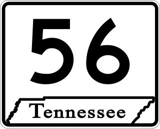
State Route 56 is a 160.6-mile-long (258.5 km) state highway that runs south to north in Middle Tennessee, from the Alabama state line near Sherwood to the Kentucky state line near Red Boiling Springs.

<span class="mw-page-title-main">Tennessee State Route 24</span> State highway in Tennessee, United States

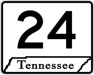
State Route 24 is an unsigned west–east state highway in Tennessee, as it coincides with U.S. Route 70 and U.S. Route 70N for its entire duration from Nashville to Crossville. The road begins in western Nashville and ends in Crossville. It runs alongside Interstate 40 for its entire length.

<span class="mw-page-title-main">Tennessee State Route 2</span> State highway in Tennessee, United States

State Route 2 is a 197-mile-long (317 km) west–to–east state highway in the U.S. state of Tennessee. It begins in Murfreesboro, in Rutherford County, and ends near Farragut in Loudon County. The route is both a primary and secondary route. Most of the route is unsigned.

<span class="mw-page-title-main">Tennessee State Route 22</span> State Highway in Tennessee

State Route 22 is a 172.8-mile long (278.1 km) south-to-north state highway in the western part of Tennessee, United States. It begins at the Mississippi state line in McNairy County, where the roadway continues as Mississippi Highway 2. It ends at the Kentucky state line in Lake County, when it crosses into the Kentucky Bend, a detached portion of Fulton County, Kentucky. The monument for the 1862 Battle of Island Number Ten in the American Civil War is located on SR 22, about 3 mi (4.8 km) north of Tiptonville.

<span class="mw-page-title-main">Tennessee State Route 66</span>

State Route 66 is a state-maintained highway in eastern Tennessee, including a six-lane divided highway known as Winfield Dunn Parkway in Sevier County, a four-lane expressway in Hamblen and Jefferson counties and a two-lane rural collector through mountainous terrain continuing to the northeast terminus in Hancock County.

<span class="mw-page-title-main">Tennessee State Route 99</span>

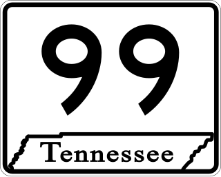
State Route 99 is a long east–west highway in Middle Tennessee. The route travels through large sections of rural areas and for most of the length is a secondary highway. The route begins near Waynesboro and ends in Bradyville after logging 126.7 mi (203.9 km) and passing through six counties.

<span class="mw-page-title-main">Tennessee State Route 20</span> State highway in Tennessee, United States

State Route 20 (SR 20) is a 143.04-mile (230.20 km) long east–west primary state highway that begins in Dyersburg and ending near Summertown. SR 20 is unsigned and concurrent with U.S. Route 412 (US 412) for its entire length, except for a short section between Hohenwald and Summertown. Along its route, SR 20 traverses parts of both Middle Tennessee and West Tennessee.

<span class="mw-page-title-main">Tennessee State Route 10</span> Highway in Tennessee

State Route 10 is a south–north route from the Alabama state line in Lincoln County to the Kentucky state line in Macon County.

<span class="mw-page-title-main">Tennessee State Route 15</span> Highway in Tennessee

State Route 15 is a west–east route from Memphis to Monteagle. For much of its route it has an unsigned concurrency with U.S. Route 64. SR 15 does travel through the southern part of all 3 Grand Divisions of the state: West Tennessee, Middle Tennessee, and East Tennessee.

<span class="mw-page-title-main">Tennessee State Route 76</span> Highway in Tennessee

State Route 76 (SR 76) is a state highway in Tennessee, traversing the state in a northeast-southwest axis from east of Memphis to north of Nashville. SR 76 is unique in that it actually changes its cardinal directions in Clarksville at the junction with US 41A and US 41A Bypass.

<span class="mw-page-title-main">U.S. Route 412 in Tennessee</span> U.S. Highway in Tennessee

In Tennessee, U.S. Route 412 stretches for 181.93 miles (292.79 km) through the farmland of West Tennessee and the hills of Middle Tennessee, starting at the Missouri state line near Dyersburg and running to an interchange between I-65 and SR 99 in Columbia.

<span class="mw-page-title-main">Tennessee State Route 70</span>

State Route 70 is a state-maintained highway in East Tennessee, beginning at the border with North Carolina in the midst of the Cherokee National Forest and the Great Smoky Mountains and ending at the Virginia border in the extremely rural and mountainous terrain of Hancock County.

<span class="mw-page-title-main">U.S. Route 421 in Tennessee</span>

U.S. Route 421 is a north–south United States highway that runs for 43.4 miles (69.8 km) in East Tennessee, connecting the cities of Mountain City and Bristol.

<span class="mw-page-title-main">Tennessee State Route 16</span> State highway in Tennessee, United States

State Route 16 is a state highway in the U.S. state of Tennessee. Its southern terminus is at the Alabama state line, where it continues as State Route 79 in Alabama. From there, it continues to Winchester, where it becomes unsigned in a concurrency with U.S. Route 41A. This concurrency lasts until its northern terminus in Williamson County, at a junction with U.S. Route 31A.

<span class="mw-page-title-main">Tennessee State Route 32</span> State unsigned highway in Tennessee

State Route 32 is a state highway in East Tennessee. For most of its route, it is an unsigned companion route concurrent with U.S. Route 25E. The highway stretches 89 miles from the North Carolina state line to the Tennessee-Kentucky state line near the town of Cumberland Gap.

<span class="mw-page-title-main">Tennessee State Route 72</span>

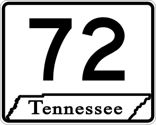
State Route 72 is a 43.3-mile-long (69.7 km) state highway in the eastern portion of U.S. state of Tennessee. It travels through the towns of Vonore and Loudon.

<span class="mw-page-title-main">Tennessee State Route 50</span>

State Route 50 (SR 50) is a west–to–east highway in Middle Tennessee. The road begins near Only and ends in Altamont. The current length is 161.3 miles (259.6 km).

<span class="mw-page-title-main">U.S. Route 231 in Tennessee</span>

U.S. Route 231 in Tennessee runs north–south for 121.15 miles (194.97 km), entirely in Middle Tennessee, that starts south of Fayetteville at the Alabama state line, and ends north of Westmoreland at the Kentucky state line. For the majority of its length, between the Alabama state line and Trousdale County, it is concurrent with unsigned State Route 10.

<span class="mw-page-title-main">Tennessee State Route 35</span> Highway in Tennessee

State Route 35 is a north–south state highway in East Tennessee. The 81.35 miles (130.92 km) long state highway traverses Blount, Sevier, a small portion of Jefferson, Cocke, and Greene Counties. Most of the route is a secret, or hidden designation, as it runs concurrently with U.S. Highways in the area.

References

  1. Highway Planning Survey Division (1925). Biennial Report of the Commissioner of the Department of Highways and Public Works State of Tennessee for the Years 1923 and 1924 (PDF) (Report). Nashville: Tennessee Department of Highways and Public Works. pp. 39–44. Retrieved May 19, 2023.
  2. 1 2 "TN-39 · Tennessee".