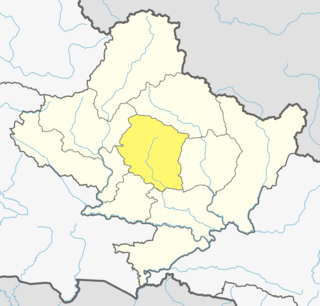
Kaski District, a part of Gandaki Province, is one of the seventy-seven districts of Nepal. The name is disambiguated from Kaskikot, the ancient Kaski Kingdom.
Mount Afadja, known as Afadjato to the Ewe people of Ghana and Togo, is the highest mountain in Ghana. The summit is located in the Volta Region, near the border with Togo, close to the villages of Liati Wote and Gbledi Gbogame in the Afadjato South District and Hohoe Municipality, respectively. It is about 178 kilometers (111 mi) northeast of Accra, and 178 kilometers (111 mi) northwest of Lomé. Part of the Agumatsa sub-range of the West Africa Mountains, its summit is 885 metres (2,904 ft) above sea level. The summit of Mount Aduadu lies 3.5 kilometers (2 mi) to the east.

Nkawkaw is a town in southern Ghana and is the capital of Kwahu East District, an area in the Eastern Region of south Ghana. Nkawkaw has a 2013 settlement population of 61,785 people. Nkawkaw is also described as a city in a valley as it the gateway to ascend the Kwahu mountains

Jasikan District is one of the eight districts in Oti Region, Ghana. Originally created as an ordinary district assembly on 10 March 1989, which was created from the former Jasikan District Council, which it was established by Legislative Instrument (L.I.) 1464, until the western part of the district was split off to create Biakoye District on 29 February 2008, which was established by Legislative Instrument (L.I.) 1901; thus the remaining part has been retained as Jasikan District. The district assembly is located in the southern part of Oti Region and has Jasikan as its capital town.

Kadjebi District is one of the eight districts in Oti Region, Ghana. Originally created as an ordinary district assembly on 10 March 1989, which was created from the former Jasikan District Council, which it was established by Legislative Instrument (L.I.) 1465. The district assembly is located in the southern part of Oti Region and has Kadjebi as its capital town.

Krachi East Municipal District is one of the eight districts in Oti Region, Ghana. Originally it was formerly part of the then-larger Krachi District on 1988, until the eastern part of the district was split off to create Krachi East District on 19 August 2004, which was established by Legislative Instrument (L.I.) 1755; thus the remaining part has been renamed to become Krachi West District. However, on 14 November 2017, it was later elevated to municipal district assembly status to become Krachi East Municipal District; which was established by Legislative Instrument (L.I.) 2281. The municipality is located in the northern part of Oti Region and has Dambai as its capital town.

Vardenis is a town and urban municipal community in the southeastern part of the Gegharkunik Province of Armenia. It is located in the valley of the Masrik River, on the territory of the Masrik artesian basin at 2,006 metres above sea level, near the southeastern shores of Lake Sevan. It is 170 kilometres by road east of the capital Yerevan, and 75 kilometres southeast of the provincial centre Gavar. The administrative territory of Vardenis comprises 3,006 hectares, of which 736 hectares is occupied by the town itself. Vardenis obtained its status as an urban settlement in 1995. As of the 2011 census, the population of the town was 12,685. However, as per the 2016 official estimate, the population of Vardenis is 12,600.
The Roman Catholic Diocese of Jasikan is a diocese located in the city of Jasikan in the Ecclesiastical province of Accra in Ghana.

North Dayi is one of the constituencies represented in the Parliament of Ghana. It elects one Member of Parliament (MP) by the first past the post system of election. North Dayi is located in the Anfoega district of the Volta Region of Ghana.

Akpafu-Todzi is a village in the Akpafu traditional area of the Jasikan Municipality District in the Oti Region of Ghana. The inhabitants of Todzi call themselves the Mawu and speak Siwu, a Kwa language that is quite distinct from the dominant regional languages Ewe and Twi. The Siwu name for the village is kaa i kato, or "home up high". The oldest of the five Akpafu villages, Todzi functions as the capital of the traditional area and its chief is the paramount chief of Akpafu.

The Akan constituency is one of the constituencies represented in the Parliament of Ghana. It elects one Member of Parliament (MP) by the first past the post system of election. It is located in the Kadjebi district of the Oti Region of Ghana.

The Buem constituency is one of the constituencies represented in the Parliament of Ghana. It elects one Member of Parliament (MP) by the first past the post system of election. It is located in the Jasikan district of the Oti Region of Ghana.

Biakoye District is one of the eight districts in Oti Region, Ghana. Originally it was formerly part of the then-larger Jasikan District on 10 March 1989, which was created from the former Jasikan District Council, until the western part of the district was split off to create Biakoye District on 29 February 2008, which was established by Legislative Instrument (L.I.) 1910; thus the remaining part has been retained as Jasikan District. The district assembly is located in the southern part of Oti Region and has Nkonya Ahenkro as its capital town.
Akim Swedru is a town and the capital of Birim South District, a district in the Eastern Region of south Ghana. Akim Swedru has a 2013 settlement population of 10,379 people.
Jasikan is a small town and is the capital of Jasikan district, a district in the Oti Region of Ghana. It is home to Bueman Secondary School and Jasikan College of Education. It is the local business hub for Buem enclave and the seat of government for the district. The main language in the area is Leleme, and cocoa is the cash crop.
Okadjakrom is a small town located in the Jasikan District of the newly created Oti Region of Ghana. The resident are predominantly farmers. The main cash crop for the area is Coaoa Beans the main ingredient for chocolate and the main language spoken there is Leleme. The town is known for the Okadjakrom Secondary Technical School. The school is a second cycle institution.

Thalisain is a town and tehsil of Pauri Garhwal district in the North Indian state of Uttarakhand. At an elevation of 1690 metres from sea level, it is situated on a gentle slope above the right bank of Nayaar (East) river. It is in the southwestern foothills of Dudhatoli Range and at a distance of 83 kilometers from Pauri town and 95 kilometers from Gairsain, the future capital of Uttarakhand.
Jasikan College of Education is a teacher education college in Jasikan-Buem. The college is located in Volta Zone zone. It is one of the about 40 public colleges of education in Ghana. The college participated in the DFID-funded T-TEL programme.
The Adele people are an ethnic group and tribe of the Ghanaian-Togo border area indigenous to the Jasikan, Nkwanta South and Nkwanta North Districts of the Volta Region centered around the towns of Dadiasi and Dutukpene in Ghana and the Sotouboua Prefecture of the Centrale Region centered around the towns of Assouma Kedeme and Tiefouma in Togo. The Adele people are agricultural, primarily farming yams, cassava, plantain, beans, and rice.
Shiare is a village mountain settlement in the Breast Mountains in the Oti region of Ghana. The Oti Region is in the northern part of the Volta Region. Shiare is a part of Nkwanta South Municipal District. It is noted that the village settlement is nine centuries old. It is north of the Oti Region in Ghana. The village is known as 'The Hanging Village'.


