
Interstate 37 (I-37) is a 143-mile (230 km) Interstate Highway located within the southern portion of the US state of Texas. The highway was first designated in 1959 as a route between Corpus Christi and San Antonio. Construction in the urban areas of Corpus Christi and San Antonio began in the 1960s, and the segments of the Interstate Highway in rural areas were completed by the 1980s. Prior to I-37, the route between Corpus Christi and San Antonio was served by a combination of State Highway 9 (SH 9) from Corpus Christi to Three Rivers and US Highway 281 (US 281) from Three Rivers to San Antonio. As a result of the construction of I-37, SH 9 was removed from the State Highway System.

Interstate 820 (I-820) is an auxiliary route of I-20 in Fort Worth, Texas, of approximately 35.173 miles (56.605 km) around the city and some of its suburbs. Exit numbers begin at its interchange with I-20 in southwest Fort Worth and continue in a clockwise direction around the city until it ends at its interchange with I-20 in southeast Fort Worth. A portion of I-820 in the northeast quadrant is cosigned with State Highway 121 (SH 121) as well as SH 183.

U.S. Route 290 is an east–west U.S. Highway located entirely within the state of Texas. Its western terminus is at Interstate 10 southeast of Segovia, and its eastern terminus is at Interstate 610 in northwest Houston. It is the main highway between Houston and Austin and is a cutoff for travelers wanting to bypass San Antonio on Interstate 10. Throughout its length west of Austin, US 290 cuts across mountainous hills comprising the Texas Hill Country and the Edwards Plateau; between Austin and Houston, the highway then travels through gradually hilly grasslands and pine forests comprising the Gulf Coastal Plains.

Interstate 410 (I-410), colloquially Loop 410, is an auxiliary route of I-10 around San Antonio, Texas. It is identified as the Connally Loop in honor of former Texas Governor John Connally.

State Highway 46 is a 71.4-mile (114.9 km) state highway in the U.S. state of Texas that runs from SH 16 east of Bandera to the intersection of SH 123 and SH 123 Business just south of Seguin.
The President George Bush Turnpike (PGBT) is a 52-mile (84 km) controlled-access toll road running through the northern, northeastern and western suburbs, forming a partial loop around Dallas, Texas, United States. It is named for the late George H. W. Bush, the 41st president of the United States. At its west end near Belt Line Road in Irving, State Highway 161 continues southwest to Interstate 20 (I-20) in Grand Prairie. The discontinuous free frontage roads along the turnpike from I-35E in Carrollton east to its end at I-30 in Garland are assigned the State Highway 190 designation. SH 190 signage appears only along the Rowlett, Garland, Richardson, Plano, and Carrollton sections of the frontage road with the undersign "frontage road only". At intersections with city streets, only the Bush Turnpike signs are displayed, not the SH 190 signage. Prior to the construction of the main lanes as a tollway, SH 190 was used as the name of the planned main lanes too. Similarly, the part west of I-35E was planned as part of SH 161. Bush Turnpike is signed as a north–south road from I-20 to I-35E, an east–west road from I-35E to the Merritt Main Lane Gantry and as a north–south road from the Merritt Main Lane Gantry to I-30, as Bush Turnpike makes a nearly 90-degree curve in both places.

Loop 337 is a 8.3-mile-long (13.4 km) partial loop route around the city of New Braunfels in the U.S. state of Texas. The loop was designated in 1960. Loop 337 begins and ends at I-35 and shares a concurrency with SH 46 from the interchange at SH 46 eastward to I-35.

Loop 1604 is the outer highway loop encircling San Antonio, Texas, spanning approximately 95.6 miles (153.9 km). Originally constructed as a two-lane highway, the northern segment of the route, from US 90 in western San Antonio to Kitty Hawk Road in northeastern Bexar County, has been upgraded to a four-lane freeway. Loop 1604 is designated the Charles W. Anderson Loop in honor of former Bexar County Judge Charles W. Anderson, who died from cancer in 1964 after serving for 25 years.
The Loop is a 21.4-mile-long (34.4 km) beltway around Texarkana, TX and Texarkana, AR, which are twin cities in the U.S. states of Arkansas and Texas. Consisting of a section of Interstate 49 (I-49) in Arkansas, and Loop 151 and a section of I-369 and U.S. Route 59 (US 59) in Texas, it forms a three-quarter loop around the east, south and west sides of the city. The Loop is built to Interstate Highway standards.

State Highway 151, also known as the Raymond E. Stotzer Jr. Freeway, is a 10.7-mile (17.2 km) state highway in the U.S. state of Texas that runs from Loop 1604 to U.S. Highway 90 (US 90) in San Antonio. SH 151 is a limited-access freeway for its entire length with the exception of its junction with Loop 1604 at its western terminus where a traffic light controls the junction. The routing of the freeway was first conceived in 1983 and construction was conducted in phases through the 1980s and 1990s until completion in 2004. The freeway provides access to the western part of San Antonio, the SeaWorld San Antonio theme park, Chase, Northwest Vista College, and the future site of a Microsoft data center.

Interstate 10 (I-10) is the major east–west Interstate Highway in the Southern United States. In the U.S. state of Texas, it runs east from Anthony, at the border with New Mexico, through El Paso, San Antonio, and Houston to the border with Louisiana in Orange. At just under 880 mi (1,420 km), the Texas segment of I-10, maintained by the Texas Department of Transportation, is the longest continuous untolled freeway in North America that is operated by a single authority. It is also the longest stretch of Interstate Highway with a single designation within a single state. Mile marker 880 and its corresponding exit number in Orange, Texas, are the highest numbered mile marker and exit on any freeway in North America. After widening was completed in 2008, a portion of the highway west of Houston is now also believed to be the widest in the world, at 26 lanes when including feeders.

Interstate 44 (I-44) in the U.S. state of Texas is an Interstate Highway that has a short, but regionally important, 15.398-mile (24.781 km) stretch connecting Wichita Falls with Oklahoma. Its entire length runs concurrently with U.S. Highway 277 (US 277) and US 281. I-44 provides access to downtown Wichita Falls and Sheppard Air Force Base. I-44 is known as the Central Freeway in Wichita Falls and the Red River Expressway in Burkburnett.

State Highway 358 is a Texas state highway that runs along the southern edge of Corpus Christi. The access road for Highway 358 is known as South Padre Island Drive (SPID). The official division is FM 665.
Wurzbach Parkway is a part freeway and part major arterial road in San Antonio, Texas, built to provide relief on Interstate 410 (I-410) and Loop 1604 on the city's north side. The highway is named for Harry M. Wurzbach, who represented the San Antonio area in Congress as a Republican in the 1920s and 1930s. The congressman's name was first applied to the connecting Wurzbach Road. The highway's western third was built as an expressway with at-grade intersections and the remainder as a freeway. The opening in September 2015 of an interchange with U.S. Highway 281 completed primary construction of the parkway. The highway, along with part of Wurzbach Road near the Ingram Park Mall, is maintained by the Texas Department of Transportation despite not carrying a state highway designation. Rather, it is being developed and maintained under the Principal Arterial State System (PASS) program, under which it is designated as PASS Project 1502. The parkway includes an interchange with US 281, and drivers can access I-10 and I-35 via local roads that extend the parkway.

Loop 13 is a 21.684-mile (34.897 km) partial loop route around the city of San Antonio in the U.S. state of Texas. Prior to I-410, Loop 13 served as the primary loop for the city. Part of the road was eventually turned into part of I-410. It follows Military Drive from US 90 through the south side of the city. It then follows W.W. White Road after it turns to the north through the east side of San Antonio before ending at I-410. The road is still a major arterial for the city, providing access to Lackland Air Force Base, Kelly USA, and Brooks City-Base.

Loop 353 is a 7.875-mile-long (12.674 km) loop route in the U.S. state of Texas that follows a former route of U.S. Highway 81 (US 81) in San Antonio. Loop 353 follows New Laredo Highway from Interstate 35 (I-35) on the southwest side of San Antonio towards the northeast and follows Nogalitos Street before ending at another point on I-35 just southwest of Downtown San Antonio. The road is still a major arterial for the city, providing access to Kelly USA.
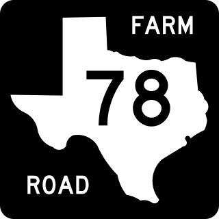
Farm to Market Road 78 is a 30.205 mi (48.610 km) farm-to-market road connecting San Antonio and Seguin, Texas.

