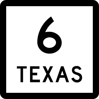
State Highway 6 (SH 6) runs from the Red River, the Texas–Oklahoma state line, to northwest of Galveston, where it is known as the Old Galveston Highway. In Sugar Land and Missouri City, it is known as Alvin-Sugarland Road and runs perpendicular to Interstate 69/U.S. Highway 59 (I-69/US 59). In the Houston area, it runs north to Farm to Market Road 1960 (FM 1960), then northwest along US 290 to Hempstead, and south to Westheimer Road and Addicks, and is known as Addicks Satsuma Road. In the Bryan–College Station area, it is known as the Earl Rudder Freeway. In Hearne, it is known as Market Street. In Calvert, it is known as Main Street. For most of its length, SH 6 is not a limited-access road. In 1997, the Texas Legislature designated SH 6 as the Texas Korean War Veterans Memorial Highway.

State Highway 7 (SH 7) is an east–west state highway in the U.S. state of Texas that runs from Interstate 35 at Eddy to U.S. Highway 84 about 3 miles (4.8 km) west of the Louisiana state line. Between Crockett and Nacogdoches, SH 7 passes through the Davy Crockett National Forest. Commissioned on April 4, 1917, SH 7 is one of the original state highways established in Texas, and has been re-routed several times since its original conception. In earlier years, SH 7 mostly followed present day U.S. Highway 84, U.S. Highway 67, U.S. Highway 70 among other highways between northwest Texas and the Louisiana state line. By 1939, most of the mileage belonging to SH 7 was transferred to the U.S. Highway System, leaving the highway extant only within eastern Texas. SH 7 subsequently went through several other major reroutings, truncations and extensions between 1939 and 1990, before becoming the highway it is today.

State Highway 46 is a 71.4-mile (114.9 km) state highway in the U.S. state of Texas that runs from SH 16 east of Bandera to the intersection of SH 123 and SH 123 Business just south of Seguin.

State Highway 17 runs from Marfa to Pecos in west Texas. The road is maintained by the Texas Department of Transportation (TxDOT).
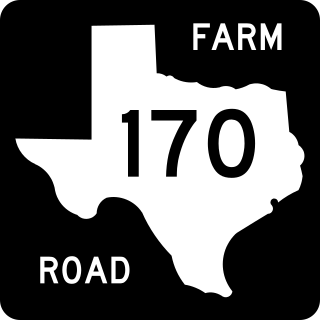
Farm to Market Road 170 is a 114.6-mile (184.4 km) highway maintained by the Texas Department of Transportation (TxDOT) in Presidio and Brewster counties in Texas. The route, known locally as the River Road, runs along the United States side of the Rio Grande which in Texas forms the international boundary between the U.S. and Mexico. The road runs from Candelaria through the city of Presidio as well as several smaller communities and former settlements to State Highway 118 in Study Butte near Big Bend National Park. The road also passes through the southern portion of Big Bend Ranch State Park.

U.S. Highway 59 (US 59) in the U.S. state of Texas is named the Lloyd Bentsen Highway, after Lloyd Bentsen, former U.S. senator from Texas. In northern Houston, US 59, co-signed with Interstate 69 (I-69), is the Eastex Freeway. To the south, which is also co-signed with I-69, it is the Southwest Freeway. The stretch of the Southwest Freeway just west of The Loop was formerly one of the busiest freeways in North America, with a peak AADT of 371,000 in 1998.
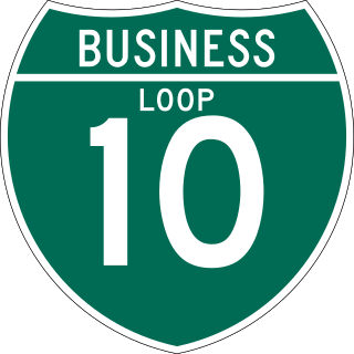
Interstate business routes are roads connecting a central or commercial district of a city or town with an Interstate bypass. These roads typically follow along local streets often along a former US route or state highway that had been replaced by an Interstate. Interstate business route reassurance markers are signed as either loops or spurs using a green shield shaped and numbered like the shield of the parent Interstate highway.

Numerous special routes of U.S. Route 67, all business routes, exist. One other route, formerly an alternate route in western Illinois, has since been downgraded to state Route 267.
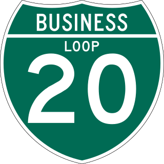
All of the business loops within Texas are maintained by the Texas Department of Transportation (TxDOT). Interstate 20 (I-20) has 15 business loops in the state, all located in western Texas. Along I-20, TxDOT identifies each business route as Business Interstate 20 followed by an alphabetic suffix. Along Texas Interstates, the alphabetic suffixes on business route names ascend eastward and northward. There are gaps in the alphabetic values to allow for future system expansion. The alphabetic naming suffixes are included as small letters on the bottom of route shields.

There are currently nine business routes of U.S. Highway 287 in Texas that are designated and maintained by the Texas Department of Transportation (TxDOT). The business routes in the US state of Texas are traditionally short spurs or loops that connect the main route, in this case, U.S. Highway 287 (US 287), to the center or commercial district of a city. The routes commonly follow the course of a decommissioned state highway, or the old course of the main route. Business routes are signed with the traditional US 287 highway shield, and with a small "business plate" placed above the marker. TxDOT regards business routes as official highways, and is responsible for the maintenance of the route.

