Texas State Highway Spur 536

Last updated

Texas Spur 536.svg

State Highway Spur 536

Texas State Highway Spur 536
Route information
Maintained by TxDOT
Length7.035 mi [1]  (11.322 km)
Existed1978–present
Major junctions
South endI-410.svgUS 281.svg I-410  / US 281
Major intersections
North endI-10.svgI-35.svgUS 87.svg I-10  / I-35  / US 87
Location
Country United States
State Texas
Counties Bexar
Highway system
Texas Spur 535.svg Spur 535 Texas Spur 537.svg Spur 537

State Highway Spur 536 (Spur 536) is a state highway spur in San Antonio, Texas. [1]

Contents

Route description

Spur 536 begins at the intersection of US 281 and Loop 410; northbound US 281 follows Loop 410 to the east, while Spur 536 continues north along Roosevelt Avenue through the mission district of San Antonio. [2] The route passes the west side of Stinson Municipal Airport before crossing Loop 13 (Military Drive). Spur 536 turns northwest onto Steves Avenue (crossing under I-10), then north onto Probandt Avenue through Southtown. It then turns west along Alamo Street before ending at I-10/35. [1] [3]

History

Spur 536 was designated on February 23, 1978, along with Spur 537, due to the rerouting of US 281 along the Interstate 37 freeway through central and south San Antonio. [1] Spur 536 was proposed for decommissioning in 2014 as part of TxDOT's San Antonio turnback proposal, which would have turned back over 129 miles of roads to the city of San Antonio, but the city of San Antonio rejected that proposal. [4]

Major intersections

The entire route is in San Antonio, Bexar County.

mi [5] kmDestinationsNotes
0.00.0I-410.svgNorth plate.svg
US 281.svg
I-410 (Connally Loop) / US 281 north
Southern terminus, continues as South plate.svg
US 281.svg
US 281 south Pleasanton
0.91.4S. Flores St.
2.33.7Texas Loop 13.svg Loop 13Lackland AFB, Brooks City-Base
2.84.5Mission Rd.
3.55.6Southcross Blvd.
3.76.0Bridge over San Antonio River
4.97.9Steves Ave. eastRoute continues along Steves Ave. west
5.28.4Mission Rd.
5.38.5Bridge over San Antonio River
5.69.0Probandt St. south / to I-10.svgUS 87.svgUS 90.svg I-10  / US 87  / US 90  Houston Route continues along Probandt St. north
6.310.1S. Alamo St. eastRoute continues along S. Alamo St. west
7.011.3I-10.svgI-35.svgUS 87.svg I-10  / I-35  / US 87  El Paso, Austin Northern terminus, continues as Frio St.
1.000 mi = 1.609 km; 1.000 km = 0.621 mi

See also

Related Research Articles

<span class="mw-page-title-main">U.S. Route 181</span> Highway in Texas, United States

U.S. Highway 181 is a south–north U.S. Highway located entirely in the state of Texas. Both termini are at Interstate 37, the road that it mainly parallels to the east. US 181 begins in Corpus Christi, Texas at mile marker 0 to the south, through south-central Texas to just south of San Antonio to the north, for a total length of 137 miles (220 km).

<span class="mw-page-title-main">U.S. Route 290</span> Highway in Texas

U.S. Route 290 is an east–west U.S. Highway located entirely within the state of Texas. Its western terminus is at Interstate 10 southeast of Segovia, and its eastern terminus is at Interstate 610 in northwest Houston. It is the main highway between Houston and Austin and is a cutoff for travelers wanting to bypass San Antonio on Interstate 10. Throughout its length west of Austin, US 290 cuts across mountainous hills comprising the Texas Hill Country and the Edwards Plateau; between Austin and Houston, the highway then travels through gradually hilly grasslands and pine forests comprising the Gulf Coastal Plains.

<span class="mw-page-title-main">Texas State Highway 35</span> State highway in Texas

State Highway 35 is a state highway in the U.S. state of Texas, maintained by the Texas Department of Transportation (TxDOT). It runs primarily south–north, paralleling the Gulf of Mexico for much of its length, from a junction with Interstate 37 in Corpus Christi to Interstate 45 in southeastern Houston.

<span class="mw-page-title-main">U.S. Route 281 in Texas</span> Section of U.S. Highway in Texas, United States

U.S. Route 281 (US 281) is a United States Numbered Highway that runs from the Mexican border in the Rio Grande Valley to the Canadian border near Dunseith, North Dakota. In the state of Texas, the highway is a major south–north corridor, connecting Brownsville to the Oklahoma state line at the Red River in Burkburnett. Several segments of U.S. 281 are concurrent with Interstate routes, including I-69C in the Rio Grande Valley, I-37 in San Antonio, and I-44 north of Wichita Falls.

<span class="mw-page-title-main">U.S. Route 87 in Texas</span> Section of U.S. highway in Texas

In the U.S. state of Texas, U.S. Highway 87 is a north–south U.S. Highway that begins near the Gulf Coast in Port Lavaca, Texas and heads north through San Antonio, Lubbock, Amarillo, and Dalhart to the New Mexico state line near Texline.

<span class="mw-page-title-main">Special routes of U.S. Route 87 in Texas</span>

The following special routes exist or existed parallel to U.S. Route 87 (US 87) in Texas, primarily along former alignments. They are varyingly designated by the Texas Department of Transportation (TxDOT) as business routes of US 87, state highway loops and spurs, and business loops of Interstate 27 (I-27).

<span class="mw-page-title-main">Texas State Highway Loop 13</span> State highway in Texas

Loop 13 is a 21.684-mile (34.897 km) partial loop route around the city of San Antonio in the U.S. state of Texas. Prior to I-410, Loop 13 served as the primary loop for the city. Part of the road was eventually turned into part of I-410. It follows Military Drive from US 90 through the south side of the city. It then follows W.W. White Road after it turns to the north through the east side of San Antonio before ending at I-410. The road is still a major arterial for the city, providing access to Lackland Air Force Base, Kelly USA, and Brooks City-Base.

<span class="mw-page-title-main">Texas State Highway Spur 345</span> State highway in Texas

Spur 345 is a 5.1-mile-long (8.2 km) route in Greater San Antonio in the U.S. state of Texas, maintained by the Texas Department of Transportation (TxDOT). It follows a former route of U.S. Route 87 (US 87) through Balcones Heights and northwest San Antonio. Known locally as Fredericksburg Road, it is a major arterial for the cities of San Antonio and Balcones Heights, providing access to the headquarters of United Services Automobile Association (USAA) and to the South Texas Medical Center.

<span class="mw-page-title-main">Texas State Highway Loop 368</span> State highway in Texas

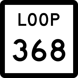
Loop 368 is a state highway loop in the U.S. state of Texas that follows a former route of US 81 in San Antonio. 8.115 miles (13.060 km) in length, the route is a major arterial in the city, providing access to Brackenridge Park, the San Antonio Zoo, and the University of the Incarnate Word.

<span class="mw-page-title-main">Texas State Highway Spur 122</span> State highway in Texas

Spur 122 is a 5.664-mile (9.115 km) spur route in the U.S. state of Texas that follows a former route of U.S. Highway 181 (US 181) in San Antonio. Spur 122 follows Presa Street from US 181 near the city limits on the southeast side of San Antonio towards the northwest ending at Loop 13 just east of the San Antonio River. The spur provides access to Mission San Francisco de la Espada and other parks along the banks of the San Antonio River.

<span class="mw-page-title-main">Business routes of Interstate 35</span>

Interstate business routes are roads connecting a central or commercial district of a city or town with an Interstate bypass. These roads typically follow along local streets often along a former U.S. Route or state highway that had been replaced by an Interstate. Interstate business route reassurance markers are signed as either loops or spurs using a green shield shaped sign and numbered like the shield of the parent Interstate highway.

<span class="mw-page-title-main">Farm to Market Road 2696</span>

Farm to Market Road 2696 is a 16-mile (26 km) farm to market road in Bexar County, Texas. It is known in Greater San Antonio as Blanco Road, a major north–south thoroughfare.

<span class="mw-page-title-main">Texas State Highway Spur 422</span> State highway in Texas

State Highway Spur 422 is a state highway spur in San Antonio, Texas. It is known locally as the Poteet-Jourdanton Freeway.

<span class="mw-page-title-main">Texas State Highway Spur 421</span> State highway in Texas

State Highway Spur 421 is a state highway spur in the San Antonio, Texas, USA metropolitan area.

<span class="mw-page-title-main">Texas State Highway Loop 473</span> State highway in Texas

State Highway Loop 473 (Loop 473) is a loop located in Wichita Falls.

References

  1. 1 2 3 4 Transportation Planning and Programming Division (n.d.). "State Highway Spur No. 536". Highway Designation Files. Texas Department of Transportation . Retrieved January 2, 2011.
  2. Transportation Planning and Programming Division (2018). Texas County Mapbook (PDF) (Map) (2018 ed.). 1:72,224. Texas Department of Transportation. p. 1907. Retrieved June 30, 2023.
  3. Transportation Planning and Programming Division (2018). Texas County Mapbook (PDF) (Map) (2018 ed.). 1:72,224. Texas Department of Transportation. p. 1869. Retrieved June 30, 2023.
  4. Davila, Vianna (November 20, 2013). "City officials say no to TxDOT turnback program". San Antonio Express-News. Retrieved August 10, 2020 via MySA.com.
  5. Google (January 2, 2011). "Overview map of Texas State Highway Spur 536 Distances Between Interchanges" (Map). Google Maps . Google. Retrieved January 2, 2011.