This article needs additional citations for verification .(August 2016) |
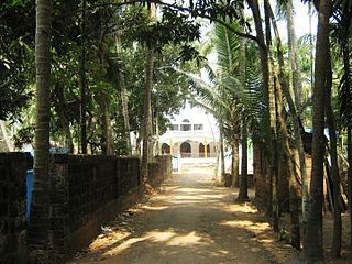
Thalappady is a village in Kasaragod district of the Indian state of Kerala. The Kunjathur Mahalingeshwara temple is located in Thalappady.
Contents

This article needs additional citations for verification .(August 2016) |
Thalappady is a village in Kasaragod district of the Indian state of Kerala. The Kunjathur Mahalingeshwara temple is located in Thalappady.
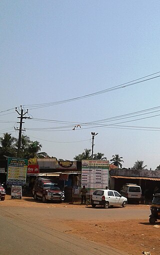
Thalappady is the northernmost village in Kerala in NH 66. While traveling from Kasaragod to Mangalore, Thalappady is the last village in Kerala. It is one kilometre from Kunjathur town. It is located 20 km from Mangalore, 30km from Kasarakod, 600km from Thiruvanathapuram and 700 km from Kanyakumari. There are check posts of Kerala and Karnataka states in this village. After the check posts, there is another village called Talapady in Karnataka state. [1]
Thalappady is located on the Kerala-Karnataka border. It is 30 km from Kasaragod and one km from Manjeshwaram. The village is 586 km from the state capital Thiruvananthapuram. Mangalore is only 24 km from Manjeshwar. [2]
Thalappady has a post office and the pin code is 671323. [3]
Thalappady is part of Manjeshwaram Taluk. It comes under the Manjeshwaram grama panchayath.
The nearest railway station is Manjeshwar at a distance of 2 km. Thokottu railway station is 14 km away.

Kasaragod is a municipal town and administrative headquarters of Kasaragod district in the state of Kerala, India. Established in 1966, Kasaragod was the first municipal town in the district. It is the northernmost district of Kerala and is also known as Sapta Bhasha Sangama Bhumi.

Manjeshwar is a town and a minor port in Kasaragod district at the northern tip of Kerala. It is situated at a distance of 584 kilometres (360 mi) from the state capital Thiruvananthapuram, 695 kilometres (430 mi) from Kanyakumari, 28 kilometres (20 mi) north of district HQ Kasarakod and 30 kilometres (20 mi) south of Mangalore city in neighboring Karnataka. It is a coastal town in Kasaragod district. Thalappady is the northern border of Kerala situated near to Manjeshwaram town.
Bangramanjeshwar (Bangramanjeshwaram) is a census town in Kasaragod district in the state of Kerala, India.

Uppala is a town and Headquarters of Manjeshwaram Taluk in Kasaragod district, Kerala, India. It is geographically located midway from Kasaragod to Mangalore. Easy geographical access and lack of major towns nearby are the key reasons for the town to develop exponentially, especially in the past decade. The population of Manjeshwaram Taluk alone was over 268,642 as of 2011. Uppala is 22 km north of Kasaragod and one of the fastest growing urban settlements in Kasaragod district. It is well known as an important trade hub in the northernmost part of Kerala state.

Kasaragod (Malayalam:[kaːsɐrɡoːɖɨ̆] is one of the 14 districts in the southern Indian state of Kerala. Its northern border Thalappady is located just 9 km south to Ullal, which is the southernmost portion of the major port city Mangalore, on the southwestern Malabar coast of India.
Govt. High School (GHS) is a public school, located in Bangra Manjeshwar, Kasaragod District, Kerala State of India. This high school is affiliated to the Kerala State Education Board. This High School is listed as one of the SSLC examination centres by the Kerala Education Board. This school is one of the very few schools in Kerala that teaches in Kannada Language instead of Malayalam Language.
Badaje is a village in Kasaragod district in the state of Kerala, India. It is a small village in Manjeshwaram Taluk. NH66 which passes through Manjeshwar is 3 kilometres (1.9 mi) away from Badaje.

Badiyadka officially known as "Badiadka" is a town and gram panchayat in the Kasaragod district, state of Kerala, India.

Bandadka is a small town in Kasaragod district in the state of Kerala, India. It is also called Kottakal because of Bandadka Fort. It comes under Kuttikole Grama Panchayat. It is located 38 km (24 mi) towards east from the District headquarters Kasaragod, 568 km (353 mi) away from the State capital Thiruvananthapuram, 5 km (3.1 mi) west of Karnataka border and 20 km (12 mi) away from Sullia. Bandadka's pin code is 671541 and its postal head office is Chengala.
Kodalamogaru is a village in Manjeshwaram Taluk of Kasaragod district in the state of Kerala, India.

Kunjathur is a census town in Kasaragod district in the state of Kerala, India. It is 22 km (14 mi) south of Mangalore.
Mangalpady is a Grama Panchayat in Kasaragod district, Kerala. Uppala is the major town in this panchayat.
Vorkady is a Gram Panchayat in Kasaragod district in the state of Kerala, India.
Meenja is a grama Panchayat in Manjeshwaram Taluk of Kasaragod district in the state of Kerala, India. It consists of 7 revenue villages. Kaliyoor, Koliyoor, Talakala, Meenja, Kadambar, Moodambail and [Kuloor]
Talikala is a village in Kasaragod district in the state of Kerala, India.

Vellarikund is a town and taluk headquarters in the Hill range of Kasaragod District in the state of Kerala. Vellarikundu is located between Odayanchal and Chittarikkal on Odayanchal-Cherupuzha Road.
Attenganam is a town in the Kasaragod District of the Indian state of Kerala. Primary road SH 56 connects Kanhangad and Panathur. The route has a limited bus service. Near by towns are Thattummal and Odayanchal

Manjeshwaram taluk is the northern most taluk of Kerala which borders Karnataka state. It is located in Kasaragod district, Kerala which was carved out from Kasaragod taluk on 2013.
Manjeshwar Railway Station is an NSG–6 category Indian railway station in Palakkad railway division of Southern Railway zone. It is a major railway station serving the town of Manjeshwar in the Kasaragod District of Kerala, India. It lies in the Shoranur–Mangalore section of the Southern Railways.

Mulleria is a small town located in Karadka Panchayath, Kasaragod district in Kerala, India.
| Municipalities | |
|---|---|
| Taluks | |