Thayatheru | |
|---|---|
town | |
 Thayatheru Location in Kerala, India | |
| Coordinates: 11°52′10″N75°22′35″E / 11.86944°N 75.37639°E Coordinates: 11°52′10″N75°22′35″E / 11.86944°N 75.37639°E | |
| Country | |
| State | Kerala |
| District | Kannur |
| Languages | |
| • Official | Malayalam, English |
| Time zone | UTC+5:30 (IST) |
| ISO 3166 code | IN-KL |
| Vehicle registration | KL- |
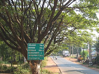
Thayatheru is a small place in Kannur district of Kerala state, South India. Thayatheru means "the street below". It is near Kannur and is easily accessible via National Highway 17 (NH 17).

Kannur is one of the 14 districts along the west coast in the state of Kerala, India. The town of Kannur is the district headquarters and gives the district its name. The old name, Cannanore is the anglicised form of the Malayalam name "Kannur". Kannur district is bounded by Kasaragod District to the north, Kozhikode district to the south, Mahé district to the southwest and Wayanad District to the southeast. To the east the district is bounded by the Western Ghats, which forms the border with the state of Karnataka. The Arabian Sea lies to the west. Paithalmala is the highest point in the Kannur District (1,372m). Enclosed within the southern part of the district is the Mahé district of the Union Territory of Puducherry. The district was established in 1957.

Kerala is a state on the southwestern Malabar Coast of India. It was formed on 1 November 1956, following passage of the States Reorganisation Act, by combining Malayalam-speaking regions. Spread over 38,863 km2 (15,005 sq mi), Kerala is the twenty-third largest Indian state by area. It is bordered by Karnataka to the north and northeast, Tamil Nadu to the east and south, and the Lakshadweep Sea to the west. With 33,387,677 inhabitants as per the 2011 Census, Kerala is the thirteenth-largest Indian state by population. It is divided into 14 districts with the capital being Thiruvananthapuram. Malayalam is the most widely spoken language and is also the official language of the state.

South India is the area including the five southern Indian states of Andhra Pradesh, Karnataka, Kerala, Tamil Nadu and Telangana, as well as the three union territories of Andaman and Nicobar islands, Lakshadweep and Puducherry, occupying 19% of India's area. Covering the southern part of the peninsular Deccan Plateau, South India is bounded by the Bay of Bengal in the east, the Arabian Sea in the west and the Indian Ocean in the south. The geography of the region is diverse with two mountain ranges–the Western and Eastern Ghats, bordering the plateau heartland. Godavari, Krishna, Kaveri, Tungabhadra, Periyar and Vaigai Palar rivers are important non-perennial sources of water. Bengaluru, Chennai, Hyderabad, Coimbatore, Kochi, Trivandrum, Visakhapatnam,Vellore, Tiruchirapalli, Madurai, Mysuru, Mangalore and Kozhikode are the largest urban areas.
Thayatheru is mainly a residential area with a large Muslim population. The major Malayalam newspaper, Malayala Manorama , has its Kannur district office in Thayatheru. The Malabar Chamber of Commerce, Kannur is also near Thayatheru. [1]

Malayalam is a Dravidian language spoken in the Indian state of Kerala and the union territories of Lakshadweep and Puducherry (Mahé) by the Malayali people, and it is one of 22 scheduled languages of India. Malayalam has official language status in the state of Kerala and in the union territories of Lakshadweep and Puducherry (Mahé) and is spoken by 37 million people worldwide. Malayalam is also spoken by linguistic minorities in the neighbouring states; with significant number of speakers in the Nilgiris, Kanyakumari, and Coimbatore districts of Tamil Nadu, and Kodagu and Dakshina Kannada districts of Karnataka. Due to Malayali expatriates in the Persian Gulf, the language is also widely spoken in Gulf countries.

Malayala Manorama is a morning newspaper, in Malayalam language, published from Kottayam, Kerala, India by Malayala Manorama Company Limited, Headed by Mammen Mathew .It was first published as a weekly on 22 March 1890, and currently has a readership of over 20 million. It is also the second oldest Malayalam newspaper in Kerala in circulation, after Deepika, which is also published from Kottayam