Related Research Articles

Waterton Lakes National Park is a national park located in the southwest corner of Alberta, Canada. It borders Glacier National Park in Montana, United States. Waterton was the fourth Canadian national park, formed in 1895 and named after Waterton Lake, in turn after the Victorian naturalist and conservationist Charles Waterton. Its range is between the Rocky Mountains and prairies. This park contains 505 km2 (195 sq mi) of rugged mountains and wilderness.

Camel's Hump is a mountain in the Green Mountains in the U.S. state of Vermont. The north slope of the mountain borders the Winooski River, which has carved through the Green Mountains over eons. At 4,083 ft (1,244 m), it is tied for the third-highest mountain in Vermont. Surrounded by 10 acres (4 ha) of alpine tundra, the mountain is the most significant feature in Camel's Hump State Park. Because of its distinctive profile, it is perhaps the state's most recognized mountain, featured on the state quarter.

Athabasca Pass is a high mountain pass in the Canadian Rockies on the border between Alberta and British Columbia. In fur trade days it connected Jasper House on the Athabasca River with Boat Encampment on the Columbia River.

Bowser is a community on the east coast of Vancouver Island in British Columbia, Canada. It has a population of 1,729. Approximately 66 kilometres (41 mi) north of Nanaimo, Bowser is in a region informally known as Lighthouse Country, spanning a stretch of highway that extends from Qualicum Beach in the south to Horne Lake to the west and Fanny Bay in the north and east to Denman and Hornby Islands. Bowser is in the Regional District of Nanaimo and in its Electoral Area H, one of eight in the District. The community was named after William J. Bowser, premier of British Columbia from 1915 to 1916.

Shuswap Lake Provincial Park is a provincial park in British Columbia, Canada.

Beaver River is a large river in east-central Alberta and central Saskatchewan, Canada. It flows east through Alberta and Saskatchewan and then turns sharply north to flow into Lac Île-à-la-Crosse on the Churchill River which flows into Hudson Bay.
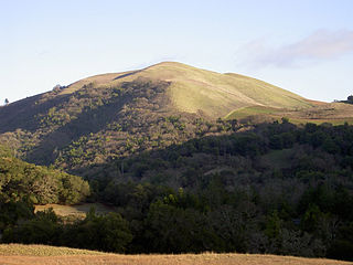
Bald Mountain is a name given to over fifty summits in California.
Kananaskis Village is an unincorporated community in Alberta's Rockies within the Kananaskis Country park system in the Kananaskis Improvement District of Alberta, Canada. It is located approximately 26 km (16 mi) south of the Trans-Canada Highway, 3 km (1.9 mi) west of Highway 40 via Mt. Allan Drive and Centennial Drive. The community is located on the west shore of the Kananaskis River at the base of Mount Kidd.
Signpine is an unincorporated community in Gloucester County, in the U. S. state of Virginia.

Orizari Glacier is the 3 nautical miles long and 0.5 nautical miles wide glacier in Veregava Ridge on the east side of Sentinel Range in Ellsworth Mountains, Antarctica. It is draining the north slopes of Mount Waldron, and flowing north-northwestwards to join Dater Glacier west of Sipey Bluff.
Hump Butte is a summit in South Dakota, in the United States. With an elevation of 2,431 feet (741 m), Hump Butte is the 453rd highest summit in the state of South Dakota.
Hump Mountain is a summit in West Virginia, in the United States. With an elevation of 3,245 feet (989 m), Hump Mountain is the 263rd highest summit in the state of West Virginia.
Pettry is an unincorporated community in Mercer County, in the U.S. state of West Virginia.
Kinfolks Ridge is an unincorporated community in Pemiscot County, in the U.S. state of Missouri.

Briarcliff is a neighborhood in Seattle, Washington. The city's Department of Neighborhoods places Briarcliff on the west side of Magnolia, south of Discovery Park.
Blackface Mountain is a summit in Alberta, Canada.
Casket Mountain is a summit in Alberta, Canada.
Cheviot Mountain is a summit in Alberta, Canada.
Draco Peak is a summit in Alberta, Canada.
References
- ↑ "The Hump". Geographical Names Data Base . Natural Resources Canada.
- ↑ Place-names of Alberta. Ottawa: Geographic Board of Canada. 1928. p. 66.
Coordinates: 54°38′42″N119°26′10″W / 54.64500°N 119.43611°W
| | This Northern Alberta location article is a stub. You can help Wikipedia by expanding it. |