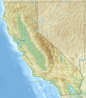
Napa County is a county north of San Pablo Bay in the northern portion of the U.S. state of California. As of the 2010 census, the population was 136,484. The county seat is the City of Napa. Napa County was one of the original counties of California, created in 1850 at the time of statehood. Parts of the county's territory were given to Lake County in 1861.

Napa is the largest city and the county seat of Napa County. It is the principal city of the Napa County Metropolitan Statistical Area, with a population of 78,130 as of the 2019 United States census estimate. It is the second-largest city in California's Wine Country, after Santa Rosa. Napa was incorporated as a city in 1872.

Wine Country is the region of California, in the northern Bay Area, known worldwide as a premier wine-growing region. The region is famed for its wineries, its cuisine, Michelin star restaurants, boutique hotels, luxury resorts, historic architecture, and culture. Viticulture and wine-making have been practiced in the region since the Spanish missionaries from Mission San Francisco Solano established the first vineyards in 1812.

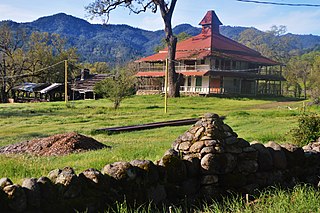
Bale Grist Mill State Historic Park is a California state park located in Napa County between St. Helena and Calistoga. The park is the site of a water-powered grist mill that was built in 1846 is one of only two water-driven mills remaining west of the Mississippi River.

Robert Gerald Mondavi was an American winemaker. His technical and marketing strategies brought worldwide recognition for the wines of the Napa Valley in California. From an early period, Mondavi promoted labeling wines varietally rather than generically, which became the standard for New World wines. The Robert Mondavi Institute (RMI) for Wine and Food Science at the University of California, Davis opened in October 2008 in his honor.

The Napa River is a river approximately 55 miles (89 km) long in the U.S. state of California. It drains a famous wine-growing region called the Napa Valley, in the mountains north of the San Francisco Bay. Milliken Creek and Mt. Veeder watersheds are a few of its many tributaries. The river mouth is at Vallejo, where the intertidal zone of fresh and salt waters flow into the Carquinez Strait and the San Pablo Bay.

The Napa Valley Wine Train is a privately operated excursion train that runs between Napa and St. Helena, California. Much of the rail line parallels State Route 29 after leaving the City of Napa and passes the towns of Yountville, Rutherford and Oakville. The route passes by many the region's vineyards and wineries located in Napa County.

Bothe-Napa Valley State Park is a state park of California in the United States. Located in the Napa Valley, it contains the farthest inland coast redwoods in a California state park. The 1,991-acre (806 ha) park was established in 1960.
The Napa Valley Register is a daily newspaper located in Napa, California. The paper began publication on August 10, 1863. By 1864, the newspaper had dropped “Valley” from its name, becoming simply the Napa Register, until returning to the original name over a century later. Covering a community more known for its wheat crop than wine grapes, the early Register would be unrecognizable to modern readers. A forum for gossip, tall-tales, opinion, moral instruction, aphorisms, propaganda, entertainment and, sporadically, hard news, the Register was one of the top two newspapers of early Napa.
Napa Valley AVA is an American Viticultural Area located in Napa County in California's Wine Country. Napa Valley is considered one of the premier wine regions in the world. Records of commercial wine production in the region date back to the nineteenth century, but premium wine production dates back only to the 1960s.

Pope Valley is an unincorporated community located in the small valley of the same name in the Mayacamas Mountains and northern Napa County, California.

Robert Louis Stevenson State Park is a California state park, located in Sonoma, Lake and Napa counties. The park offers a 5-mile (8 km) hike to the summit of Mount Saint Helena from which much of the Bay Area can be seen. On clear days it is possible to see the peak of Mount Shasta, 192 miles (310 km) distant.

Oakville is a census-designated place (CDP) in the Napa Valley of Napa County, northern California.

Aetna Springs is an unincorporated community in Napa County, California, United States. It lies at an elevation of 771 feet. The ZIP Code is 94567. The community is inside area code 707.
Napa Valley College, formerly known as Napa Junior College and Napa Community College, is a public community college in Napa Valley, California. It is one of California's 116 community colleges. The tree-lined main campus in Napa, California sits on 160 acres overlooking the Napa River and includes a Performing Arts Center, a Child Development Center, a Business Development Center and the Napa Valley Vintners Teaching Winery. An Upper Valley Campus in St. Helena includes the Napa Valley Cooking School, training aspiring chefs. In 2014–2015, the total enrollment was about 8,559.
Napa High School, established in 1897, is a four-year comprehensive high school located in Napa, California. The high school is a comprehensive high school of 1860 students. It is one of three comprehensive high schools in the Napa Valley Unified School District. The other comprehensive high schools are Vintage High School and American Canyon High School. In addition, the district has a small technology high school, New Technology High School; a Catholic high school, Justin-Siena High School; and four comprehensive middle schools fed by 19 elementary schools.

Cuttings Wharf is an unincorporated community in Napa County, California. It lies at an elevation of 7 feet. Cuttings Wharf is located on the Napa River, 4 miles (6.4 km) northwest of Napa Junction.

Rocktram is an unincorporated community in Napa County, California. It lies at an elevation of 13 feet. Rocktram is located on the Southern Pacific Railroad, 3 miles (4.8 km) south of Napa, at the junction with the Napa Valley Railroad and the Basalt Rock Company rock tram. This area got its name from an overhead tramway between the Basalt Rock Company quarry and a plant located on the Napa River. The tram crossed California State Route 221 near what is now Kaiser Road. Metal containers that hung from a steel cable transported rock from Basalt's quarry on the hills east of the highway to the plant on the river. The rocks were loaded on barges and floated down to construction sites from Sacramento to San Francisco. Rocks from Basalt were used in the construction of Treasure Island and most of the Bay Area bridges.

Shipyard Acres was an unincorporated community in Napa County, California. It lies at an elevation of 33 feet. Shipyard Acres is located 2.5 miles (4.0 km) south-southeast of Napa. This was a wartime neighborhood consisting of nearly 400 plywood houses built to house worker families involved in the World War II effort building ships at Basalt Rock Company. It sprang up early in the war and was dismantled sometime in the mid-1950s. It was on the northwest corner of what is now Kaiser Road and Napa-Vallejo Highway. Some of the structures were moved a few miles west to the Cuttings Wharf area, resurrected, and are still in place near the marina.

Napa State Hospital is a psychiatric hospital in Napa, California, founded in 1875. It is located along California State Route 221, also known as the Napa Vallejo Highway. One of California's five state hospitals, Napa State holds civil and forensic patients in a sprawling 138-acre campus. According to a hospital spokesperson, there were 2,338 people employed at the facility during the 2016-2017 fiscal year, making it one of the region's largest employers.


