
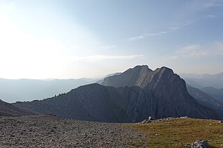
Mount Assiniboine, also known as Assiniboine Mountain, is a pyramidal peak mountain on the Great Divide, on the British Columbia/Alberta border in Canada.

The Winston Churchill Range is a mountain range in the central section of the Park Ranges of the Canadian Rockies located in Jasper National Park. The range was named after Sir Winston Churchill, former British prime minister.

The Slate Range is a mountain range of the Canadian Rockies, located in Banff National Park, Canada. The range is named after slate, the primary composition of the mountains in the area.

The Sawback Range is a mountain range of the Canadian Rockies that stretches from the Bow Valley in Alberta into southeastern Banff National Park.

The Queen Elizabeth Ranges is a group of mountain ranges in the Canadian Rockies on the southeastern side of Jasper National Park, Canada. The northern end of the ranges begins east of Medicine Lake and extends in a southeasterly direction past the southern shore of Maligne Lake. The group was named in 1953 to celebrate the coronation of Elizabeth II as Canada's sovereign.

The Palliser Range is a mountain range of the Canadian Rockies that lies in the extreme southeast corner of Banff National Park, Alberta, Canada.

The Rainbow Range is a small subrange of the Park Ranges subdivisions of the Northern Continental Ranges of the Rocky Mountains on the border between Alberta and British Columbia in Mount Robson Provincial Park.
The Waputik Range lies west of the upper Bow Valley, east of Bath Creek, and south of Balfour Creek in the Canadian Rockies. "Waputik" means "white goat" in Stoney. The range was named in 1884 by George Mercer Dawson of the Geological Survey of Canada. The President Range lies within the Waputik Range.

The Hart Ranges are a major subrange of the Canadian Rockies located in northeastern British Columbia and western Alberta. The mountains constitute the southernmost portion of the Northern Rocky Mountains.
The Fiddle Range is a mountain range of the Canadian Rockies located south of Highway 16 on the east border of Jasper National Park, Canada.

The Jacques Range is a mountain range in the Front Ranges of the Canadian Rockies, located south of Highway 16 and Jasper Lake in Jasper National Park, Alberta, Canada.
The Bosche Range is a mountain range of the Canadian Rockies located northwest of Highway 16 near the eastern border of Jasper National Park, Canada.

The Misty Range is a mountain range of the Canadian Rockies located east of the Bighorn Highway within Kananaskis Country, Canada.

The South Jasper Ranges are mountain ranges of the Rocky Mountains in Alberta and British Columbia, Canada.

The Selwyn Range is a mountain range in the Canadian Rockies in British Columbia. A subrange of the Park Ranges of the Continental Ranges, it is located west of Jasper National Park, east of Valemount and south of Mount Robson Provincial Park.
The Nikanassin Range is a group of mountain ranges in the Canadian Rockies on the eastern edge of Jasper National Park in Alberta, Canada. It is developed south-east of the Fiddle Range, and one of the front ranges. Nikanassin means "first range" in Cree.
The Park Ranges, also known as the Main Ranges, are a group of mountain ranges in the Canadian Rockies of southeastern British Columbia and southwestern Alberta, Canada. It is one of the three main subranges and the most central of the Continental Ranges, extending from southeast of Mount McGregor to the Fernie Basin.

The Terminal Range is the northernmost mountain range of the Canadian Rockies, so-named for its position at the northern terminus of the Rockies. Lying west of Muncho Lake and the Trout River, its northern perimeter is the Liard River. The Sentinel Range lies to its east.

Mount Geikie, pronounced like "geeky", is a 3,298-metre (10,820-foot) mountain summit located in Mount Robson Provincial Park in British Columbia, Canada. Situated 28 km (17 mi) southwest of Jasper near the Tonquin Valley, Mount Geikie is the highest peak of The Ramparts in the Canadian Rockies, one of the most beautiful mountain meccas in the world. Its nearest higher peak is Mount Fraser, 8.0 km (5.0 mi) to the southeast, and the Continental Divide lies 3.0 km (1.9 mi) to the east. Mount Geikie is composed of quartzite of the Cambrian period. This rock was pushed east and over the top of younger rock during the Laramide orogeny. The vertical wall of its north face is over 1,500-metre (4,900-foot) high, and has been compared to the other great north faces of the Canadian Rockies such as North Twin, Alberta, and Kitchener.
Postern Mountain is a 2,944-metre (9,659 ft) mountain located on the SE side of Mount Robson Provincial Park in the Canadian Rockies, British Columbia, Canada. It is a part of the Ramparts range and is adjacent to Geikie Creek, a small stream connected to the Fraser River. It is notable for its steep cliff faces and abundance of quartzite, unusual for the majority-limestone mountains that surround it. These factors make it, along with the rest of the Ramparts, an attractive destination for mountain climbers.


