A moraine is any accumulation of unconsolidated debris, sometimes referred to as glacial till, that occurs in both currently and formerly glaciated regions, and that has been previously carried along by a glacier or ice sheet. It may consist of partly rounded particles ranging in size from boulders down to gravel and sand, in a groundmass of finely-divided clayey material sometimes called glacial flour. Lateral moraines are those formed at the side of the ice flow, and terminal moraines were formed at the foot, marking the maximum advance of the glacier. Other types of moraine include ground moraines and medial moraines.
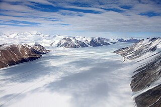
The Beardmore Glacier in Antarctica is one of the largest valley glaciers in the world, being 200 km (125 mi) long and having a width of 40 km (25 mi). It descends about 2,200 m (7,200 ft) from the Antarctic Plateau to the Ross Ice Shelf and is bordered by the Commonwealth Range of the Queen Maud Mountains on the eastern side and the Queen Alexandra Range of the Central Transantarctic Mountains on the western. Its mouth is east of the Lennox-King Glacier. It is northwest of the Ramsey Glacier.
Skelton Glacier is a large glacier flowing from the polar plateau into the Ross Ice Shelf at Skelton Inlet on the Hillary Coast, south of Victoria Land, Antarctica.

Terra Nova Bay is a bay which is often ice free, about 40 nautical miles long, lying between Cape Washington and the Drygalski Ice Tongue along the coast of Victoria Land, Antarctica. It was discovered by the British National Antarctic Expedition under Robert Falcon Scott, 1901–1904, and named by him after Terra Nova, one of the relief ships for the expedition.
Lillie Glacier is a large glacier in Antarctica, about 100 nautical miles long and 10 nautical miles wide. It lies between the Bowers Mountains on the west and the Concord Mountains and Anare Mountains on the east, flowing to Ob' Bay on the coast and forming the Lillie Glacier Tongue.

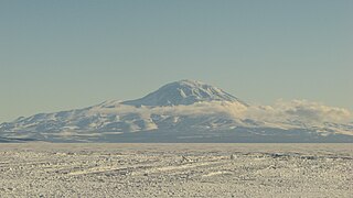
Mount Discovery is a conspicuous, isolated volcanic cone, 2,680 metres (8,790 ft) high, lying at the head of McMurdo Sound and east of Koettlitz Glacier, overlooking the northwest portion of the Ross Ice Shelf. It forms the center of a three-armed mass of which Brown Peninsula is one extension to the north; Minna Bluff is a second to the east; the third is Mount Morning to the west. Mount Discovery was discovered by the British National Antarctic Expedition (1901–04) and named for their expedition ship Discovery.

Koettlitz Glacier is a large Antarctic glacier lying west of Mount Morning and Mount Discovery in the Royal Society Range, flowing from the vicinity of Mount Cocks northeastward between Brown Peninsula and the mainland into the ice shelf of McMurdo Sound.

Ferrar Glacier is a glacier in Antarctica. It is about 35 nautical miles long, flowing from the plateau of Victoria Land west of the Royal Society Range to New Harbour in McMurdo Sound. The glacier makes a right (east) turn northeast of Knobhead, where it where it is apposed, i.e., joined in Siamese-twin fashion, to Taylor Glacier. From there, it continues east along the south side of Kukri Hills to New Harbor.

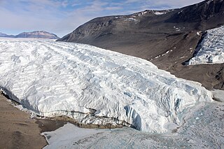
The Taylor Glacier is a glacier in Antarctica about 35 nautical miles long, flowing from the plateau of Victoria Land into the western end of Taylor Valley, north of the Kukri Hills. It flows to the south of the Asgard Range. The middle part of the glacier is bounded on the north by the Inland Forts and on the south by Beacon Valley.

The Wright Valley is a large east–west trending valley, formerly occupied by a glacier but now ice free except for Wright Upper Glacier at its head and Wright Lower Glacier at its mouth, in Victoria Land, Antarctica. It was named by the VUWAE (1958-59) for Sir Charles Wright, for whom the BrAE (1910-13) named the glacier at the mouth of this valley.
Quarles Range is a high and rugged range of the Queen Maud Mountains, extending from the polar plateau between Cooper Glacier and Bowman Glacier and terminating near the edge of Ross Ice Shelf.
Lennox-King Glacier is a large valley glacier, about 40 nautical miles (70 km) long that flows east into the Ross Ice Shelf.
Southern Cross Mountains is the name applied to the group of ranges lying between the Mariner Glacier and Priestley Glacier in Victoria Land, Antarctica.
Bettle Peak is a peak, 1,490 metres (4,890 ft) high, standing west of Bowers Piedmont Glacier and 6 nautical miles north of the Granite Knolls in Victoria Land. It was named by the United States Advisory Committee on Antarctic Names (US-ACAN) for James F. Bettle, a United States Antarctic Research Program meteorologist and scientific leader at McMurdo Station in 1962.
The Chain Moraines are drifting moraines located 5 kilometres (3 mi) northwest of Skew Peak at the confluent flow of ice from Rim Glacier, Sprocket Glacier, and Mackay Glacier, including the moraines at the west side of Rim Glacier, in Victoria Land. Approved by the New Zealand Geographic Board in 1995, the name alludes to the use of a bicycle as a practical means of transportation by a New Zealand glacial mapping party led by Trevor Chinn, summer season 1992–93, and is part of a theme of cycling names in the area.
The Denton Hills are a group of rugged foothills, 24 nautical miles long southwest–northeast and 9 nautical miles wide, to the east of the Royal Society Range on the Scott Coast, Victoria Land, Antarctica.

Kukri Hills is a prominent east-west trending range, about 25 nautical miles (46 km) long and over 2,000 metres (6,600 ft) high, forming the divide between Ferrar Glacier on the south and Taylor Glacier and Taylor Valley on the north, in Victoria Land, Antarctica.
Fry Glacier is a glacier draining the slopes at the northeast corner of the Convoy Range and flowing along the south end of the Kirkwood Range into Tripp Bay, Victoria Land, Antarctica. It was first charted by the British Antarctic Expedition, 1907–09, and named for A.M. Fry, a contributor to the expedition.
The Mawson Glacier is a large glacier on the east coast of Victoria Land, Antarctica, descending eastward from the Antarctic Plateau to the north of Trinity Nunatak and the Kirkwood Range, to enter the Ross Sea, where it forms the Nordenskjöld Ice Tongue. The glacier was first mapped by the British Antarctic Expedition (1907–09) and named for Douglas Mawson, the expedition physicist, who later led two other Antarctic expeditions, 1911–14, and 1929–31.
Blue Glacier is a large glacier which flows into Bowers Piedmont Glacier about 10 nautical miles south of New Harbour, in Victoria Land, Antarctica. It was discovered by the British National Antarctic Expedition (BrNAE) under Robert Falcon Scott, 1901–04, who gave it this name because of its clear blue ice at the time of discovery.


