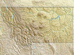
The Madison River is a headwater tributary of the Missouri River, approximately 183 miles (295 km) long, in Wyoming and Montana. Its confluence with the Jefferson and Gallatin rivers near Three Forks, Montana forms the Missouri River.

Founded in 1899, Gallatin National Forest is located in south central Montana, United States. The forest comprises 1,819,515 acres (7,363.32 km2) and has portions of both the Absaroka-Beartooth and Lee Metcalf Wilderness areas within its boundaries. Gallatin National Forest borders Yellowstone National Park on the north and northwest and is part of the Greater Yellowstone Ecosystem, a region which encompasses almost 20,000,000 acres (81,000 km2). The forest is named after Albert Gallatin (1761–1849), U.S. Secretary of the Treasury and scholar of Native American languages and cultures.

The Beaverhead-Deerlodge National Forest is the largest of the National Forests in Montana, United States. Covering 3.36 million acres (13,600 km2), the forest is broken into nine separate sections and stretches across eight counties in the southwestern area of the state. President Theodore Roosevelt named the two forests in 1908 and they were merged in 1996. Forest headquarters are located in Dillon, Montana. In Roosevelt's original legislation, the Deerlodge National Forest was called the Big Hole Forest Reserve. He created this reserve because the Anaconda Copper Mining Company, based in Butte, Montana, had begun to clearcut the upper Big Hole River watershed. The subsequent erosion, exacerbated by smoke pollution from the Anaconda smelter, was devastating the region. Ranchers and conservationists alike complained to Roosevelt, who made several trips to the area.
(Munday 2001)

The Tobacco Root Mountains lie in the northern Rocky Mountains, between the Jefferson and Madison Rivers in southwest Montana. The highest peak is Hollowtop at 10,604 feet (3,232 m). The range contains 43 peaks rising to elevations greater than 10,000 feet.

The Gallatin Range is a mountain range of the Rocky Mountains, located in the U.S. states of Montana and Wyoming. It includes more than 10 mountains over 10,000 feet (3,000 m). The highest peak in the range is Electric Peak at 10,969 feet (3,343 m).

The Madison Limestone is a thick sequence of mostly carbonate rocks of Mississippian age in the Rocky Mountain and Great Plains areas of western United States. The rocks serve as an important aquifer as well as an oil reservoir in places. The Madison and its equivalent strata extend from the Black Hills of western South Dakota to western Montana and eastern Idaho, and from the Canada–United States border to western Colorado and the Grand Canyon of Arizona.

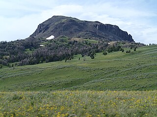
Mount Holmes is a prominent mountain peak in Yellowstone National Park. It is the tallest mountain in the Wyoming portion of the Gallatin Range. Mount Holmes is located in the northwestern part of the park and marks the southern terminus of the Gallatin Range. It is the source of Indian Creek, a tributary of the Gardner River.
The Madison Range is a mountain range located in the Rocky Mountains of Montana and Idaho in the United States. The range was named in honor of future President of the United States, then U.S. Secretary of State James Madison by Meriwether Lewis as the Lewis and Clark Expedition travelled through Montana in 1805. The range extends 80 miles (130 km) from West Yellowstone, Montana to Bozeman, Montana and is flanked by the Madison River on the west and the Gallatin River to the east. The highest point in the range is Hilgard Peak at 11,316 ft (3,449 m), a remote peak that wasn't climbed until 1948.

Mount Jackson el. 8,231 feet (2,509 m) is a mountain peak just north of the Madison River, in the Gallatin Range of Yellowstone National Park. Mount Jackson is named in honor of William Henry Jackson, chief photographer of the Hayden Geological Survey of 1871 and a member of several subsequent geological surveys in the park. Jackson's photographs are some of the earliest ever taken in Yellowstone. The name was suggested by a park naturalist in 1935 but not awarded until 1937 when Jackson, who was still living gave his approval. Jackson visited the park regularly until his death in 1942.
The Gravelly Range, highest peak Black Butte, el. 10,542 feet (3,213 m), is a mountain range southwest of Cameron, Montana in Madison County, Montana.

The Greenhorn Range, el. 8,622 feet (2,628 m), is a small mountain range south of Virginia City, Montana in Madison County, Montana.
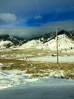
The Henrys Lake Mountains, highest point Sheep Point, el. 10,609 feet (3,234 m), are a small mountain range northwest of West Yellowstone, Montana in Madison County, Montana. These mountains are also referred to as the Lionhead Mountains, and straddle the Continental Divide along the Idaho-Montana border. On the northwest corner of these mountains is Quake Lake, created when the 1959 Hebgen Lake earthquake caused a massive landslide and dammed the Madison River. Nine subalpine lakes sit in high cirques in the higher reaches, with several peaks topping 10,000'. Coffin Lake is the largest and most popular, on the Montana side. About 32,000 acres are roadless in the Montana portion, with an unknown amount in Idaho. Dense forests, pristine streams, rolling tundra, and grassy parks provide year-round habitat for grizzly bears, elk, and bighorn sheep. Rocks and soils are inherently unstable, a factor in the landslide that caused much loss of life in 1959. The instability exists because the range is basically limestone blocks sitting on top of shale and Yellowstone volcanic rocks.
The Highland Mountains, highest point Table Mountain, el. 10,223 feet (3,116 m), are a small mountain range southwest of Whitehall, Montana in Silver Bow and Madison County, Montana.
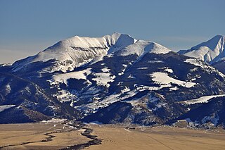
The Spanish Peaks, avg el. 8,441 feet (2,573 m), is a mountain range between Bozeman, Montana and Ennis, Montana in Gallatin and Madison County, Montana. It is a sub-range of the much larger Madison Range, itself a sub-range of the Rocky Mountains. The hydrological divide of the range serves as the border between Gallatin and Madison County, Montana. The Spanish Peaks are made up of 1.6 billion year-old gneiss, making them the oldest peaks in the Madison Range, predating the rest of the range by 50-60 million years. Gallatin Peak, el. 11,015 ft., is the highest peak in the group.
The Ruby Range is a mountain range in Madison and Beaverhead counties Montana. The range lies east of Dillon and southwest of Sheridan. The highest point, Ruby Peak with an elevation of 9,391 feet (2,862 m), lies in the northeast portion of the range. Gordon Peak with an elevation of 8,478 ft (2,584 m) lies in the southwest part of the range to the southeast of Dillon. The range is oriented NE–SW with a length of about 42.7 kilometres (26.5 mi). The Beaverhead River lies to the northwest of the range. Ruby River runs along the southeast and east flanks of the range with Ruby Reservoir on the southeast flank. Blacktail Deer Creek drains the southwest portion of the range and the Blacktail Mountains lie to the southwest. The Tobacco Root Mountains and the Greenhorn Range lie to the northeast and east respectively.
Fan Mountain, 'el. 10,312 feet (3,143 m) is a prominent peak in the Madison Range in Madison County, Montana in the Beaverhead National Forest. The peak is located along the western face of the Madison Range at the northern end of the range. It is due east of Ennis Lake and its prominence and isolation makes it easy to distinguish from Ennis in the Madison River valley.