Soweto is a township of the City of Johannesburg Metropolitan Municipality in Gauteng, South Africa, bordering the city's mining belt in the south. Its name is an English syllabic abbreviation for South Western Townships. Formerly a separate municipality, it is now incorporated in the City of Johannesburg Metropolitan Municipality, and one of the suburbs of Johannesburg.
Sharpeville is a township situated between two large industrial cities, Vanderbijlpark and Vereeniging, in southern Gauteng, South Africa. Sharpeville is one of the oldest of six townships in the Vaal Triangle. It was named after John Lillie Sharpe who came to South Africa from Glasgow, Scotland, as secretary of Stewarts & Lloyds. Sharpe was elected to the Vereeniging City Council in 1932 and held the position of mayor from 1934 to 1937.
Laudium is an Indian township in southwest of central Pretoria, in the City of Tshwane Metropolitan Municipality. Claudius is a residential suburb that is effectively an extension of Laudium.

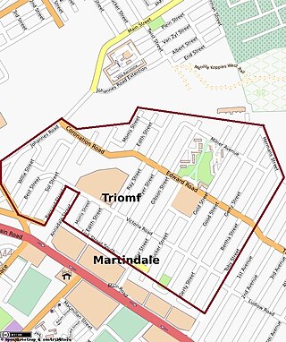
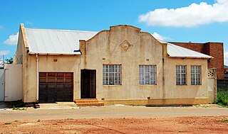
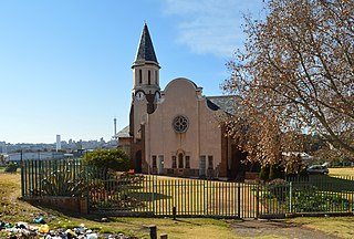
Sophiatown, also known as Sof'town or Kofifi, is a suburb of Johannesburg, South Africa. Sophiatown was a black cultural hub that was destroyed under apartheid, It produced some of South Africa's most famous writers, musicians, politicians and artists. Rebuilt under the name of Triomf, and in 2006 officially returned to its original name. Sophiatown was one of the oldest black areas in Johannesburg and its destruction represents some of the excesses of South Africa under apartheid.
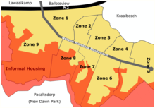
Meadowlands is a suburb of Soweto, Gauteng Province, South Africa. It was founded in the early 1950s during the apartheid era for black residents from Sophiatown.
Sebokeng locally called Zweni by residents, is a middle-class township in the Emfuleni Local Municipality in southern Gauteng, South Africa near the industrial cities of Vanderbijlpark and Vereeniging. Other neighboring townships include Evaton to the north and Sharpville to the south.

District Six is a former inner-city residential area in Cape Town, South Africa. Over 60,000 of its inhabitants were forcibly removed during the 1970s by the apartheid regime.
Inanda or eNanda is a township in KwaZulu-Natal, South Africa that is situated 30 km north-west of the Durban CBD; it forms part of eThekwini, the Greater Durban Metropolitan Municipality. Populated primarily by Zulu-speaking Black Africans, Inanda Township is the home of John Langalibalele Dube, first president of the African National Congress (ANC), as a residence/base of operations of Mahatma Gandhi, and as birthplace of the syncretic Nazareth Baptist Church

George Municipality is a municipality located in the Western Cape Province of South Africa. As of 2011 the population is 193,672. Its municipality code is WC044.

Gqeberha or Port Elizabeth, colloquially often referred to as P.E., is a major seaport and the most populous city in the Eastern Cape province of South Africa. It is the seat of the Nelson Mandela Bay Metropolitan Municipality, South Africa's second-smallest metropolitan district by area size. It is the sixth-most populous city in South Africa and is the cultural, economic and financial centre of the Eastern Cape.

Apartheid was a system of institutionalised racial segregation that existed in South Africa and South West Africa from 1948 to the early 1990s. Apartheid was characterised by an authoritarian political culture based on baasskap, which ensured that South Africa was dominated politically, socially, and economically through minoritarianism by the nation's dominant minority white population. According to this system of social stratification, white citizens had the highest status, followed by Indians and Coloureds, then black Africans. The economic legacy and social effects of apartheid continue to the present day, particularly inequality.

Pageview is a suburb of Johannesburg, South Africa. It is located in Region F of the City of Johannesburg Metropolitan Municipality. Populated by non-whites, predominantly Indians, until the 1970s, it was one of two adjacent suburbs commonly known as Fietas.
Group Areas Act was the title of three acts of the Parliament of South Africa enacted under the apartheid government of South Africa. The acts assigned racial groups to different residential and business sections in urban areas in a system of urban apartheid. An effect of the law was to exclude people of color from living in the most developed areas, which were restricted to Whites. It required many people of color to commute large distances from their homes to be able to work. The law led to people of color being forcibly removed for living in the "wrong" areas. The majority that was people of color, were given much smaller areas to live in than the white minority who owned most of the country. Pass Laws required people of color to carry pass books and later "reference books", similar to passports, to enter the "white" parts of the country.
New Brighton is a township in the Eastern Cape, South Africa. It forms part of the greater township of Ibhayi and the Nelson Mandela Bay Metropolitan Municipality which governs Port Elizabeth and its surroundings.
Cato Manor is a working-class area located 7 kilometres (4.3 mi) from the city centre of Durban, South Africa.

Manenberg is a township of Cape Town, South Africa, that was created by the apartheid government for low-income Coloured families in the Cape Flats in 1966 as a result of the forced removal campaign by the National Party. It has an estimated population of 52,000 residents. The area consists of rows of semi-detached houses and project-like flats, known as "korre". The township is located about 20 km away from the city centre of Cape Town. It is separated from neighbouring Nyanga and Gugulethu townships by a railway line to the east and from Hanover Park by the Sand Industria industrial park to the west and Heideveld to the north. The northern part of Manenberg has wealthy people that are mostly Muslims. The rest of Manenberg has poor people that are mostly associated with Christianity.

Internal resistance to apartheid in South Africa originated from several independent sectors of South African society and took forms ranging from social movements and passive resistance to guerrilla warfare. Mass action against the ruling National Party (NP) government, coupled with South Africa's growing international isolation and economic sanctions, were instrumental in leading to negotiations to end apartheid, which began formally in 1990 and ended with South Africa's first multiracial elections under a universal franchise in 1994.

Vrededorp is a suburb of Johannesburg, South Africa. It is located in Region F of the City of Johannesburg Metropolitan Municipality. Vrededorp is situated on the North-Western side of Johannesburg and is 1,764 m (5,788 ft) above sea level.
Noordgesig is a township in Soweto, situated at the edge of area's northernmost boundary, but within its territory. It is the first township seen on entering Soweto from the frequently used New Canada Road. Noordgesig is a Coloured township. It is colloquially called "Bulte"(meaning Hills) by its residence and neighbors, as depicted by the Mine Dumps surrounding the Township. The name "Bulte" was coined as a form of endearment by the residence for the longest time.
Red Location, Ilali Ebomvu, is one of the oldest townships in South Africa. It is situated in the township of New Brighton in Nelson Mandela Bay, Eastern Cape. It is commonly described as 'the umbilical cord of New Brighton'. It has its characteristic red appearance due to the corrugated deep red structures of the settlement which date back to the early twentieth century. These corrugated iron structures were sourced from a de-constructed concentration camp established in Uitenhage during the South African War. The recycled structures were painted red and consequently the oldest section of New Brighton became known as the Red Location. The township was aimed at housing black people and started development in 1902. Many prominent political and cultural South African leaders were born or spent time in the township.


