Montana is a landlocked state in the Northwestern United States. Montana has several nicknames, although none are official, including "Big Sky Country" and "The Treasure State", and slogans that include "Land of the Shining Mountains" and more recently "The Last Best Place".

Helena is the state capital of the U.S. state of Montana and the county seat of Lewis and Clark County.
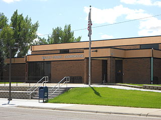
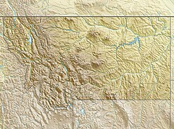
Valley County is a county in the U.S. state of Montana. Valley County was created in 1893 with area partitioned from Dawson County. As of the 2010 United States Census, the population was 7,369. Its county seat is Glasgow. It is located on the Canada–United States border with Saskatchewan.

Havre is the county seat and largest town in Hill County, Montana, in the United States. Havre is nicknamed the crown jewel of the Hi-Line. It is said to be named after the city of Le Havre in France. As of the 2010 census the population was 9,310, and in 2016 the estimated population was 9,846.
TWiki is a Perl-based structured wiki application, typically used to run a collaboration platform, knowledge or document management system, a knowledge base, or team portal. Users can create wiki pages using the TWiki Markup Language, and developers can extend wiki application functionality with plugins.
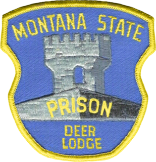
The Montana Department of Corrections is a state agency of Montana that operates state prisons and manages community-corrections programs. The agency has its headquarters in Helena.

Richard Hill is a former Republican member of the United States House of Representatives from Montana. He was the Republican nominee for Governor of Montana in 2012.

John Thoney or John Thoeny [Bullet Jack] was a reserve outfielder / infielder in Major League Baseball who played from 1902 through 1911 for the Cleveland Bronchos (1902–1903), Baltimore Orioles (1902), Washington Senators (1904), New York Highlanders (1904), and Boston Red Sox (1908–1911). Listed at 5 ft 10 in (1.78 m), 175 lb., Thoney batted and threw right-handed. He was born in Fort Thomas, Kentucky.

Stephen Clark Bullock is an American politician and lawyer serving as the 24th Governor of Montana since 2013. A member of the Democratic Party, he has been Chairman of the National Governors Association since 2018, a bipartisan organization created to develop policy to improve state governments.

Lake Great Falls was a prehistoric proglacial lake which existed in what is now central Montana in the United States between 15,000 BCE and 11,000 BCE. Centered on the modern city of Great Falls, Montana, Glacial Lake Great Falls extended as far north as Cut Bank, Montana, and as far south as Holter Lake. At present-day Great Falls, the Glacial Lake Great Falls reached a depth of 600 feet.

In Montana, the South Hills are the small foothills in various Montana communities, most notably those at el. 3,592 feet (1,095 m), south of Missoula, Montana in Missoula County, Montana. Several districts of Missoula, Montana are, also, in the South Hills.

The 2012 Montana gubernatorial election took place on November 6, 2012, to elect the Governor of Montana. Incumbent Democratic Governor Brian Schweitzer was term-limited and could not run for re-election to a third term.
The Regional designations of Montana vary widely within the U.S state of Montana. The state is a large geographical area that is split by the Continental Divide, resulting in watersheds draining into the Pacific Ocean, Gulf of Mexico and Hudson's Bay. The state is approximately 545 miles (877 km) east to west along the Canada–United States border and 320 miles (510 km) north to south. The fourth largest state in land area, it has been divided up in official and unofficial ways into a variety of regions. Additionally, Montana is part of a number of larger federal government administrative regions.

Beavertail Hill State Park is a Montana state park located 26 miles east of Missoula, Montana and just off Interstate 90. The park is 65 acres in size and has an elevation of 3,615 feet. Fishing, rafting, and swimming in the Clark Fork River are possible. The park offers frontage on the Clark Fork River, tipi rentals, a short interpretive trail, an amphitheatre, and campsites and picnic areas. The amphitheatre hosts interpretive programs on Friday evenings in the summer. About 26 camping sites are available for tents or RVs up to 26 feet long.

Thoeny is a ghost town in the northern part of Valley County, Montana, near the Canadian province of Saskatchewan. Thoeny is located north of Hinsdale and west of Opheim. The school house still stands. There is also a cemetery located on the hill.
The basin that held Pleistocene Lake Musselshell is in the lower (north-flowing) reach of the river. It is underlain mostly by highly erodible Cretaceous Colorado shale, Montana group sandstone, siltstone and shale, and Hell Creek sandstone and shale. The bedrock is gently folded and affected by local faults and joints. There is a sequence of nine terraces and more than 100 glacial boulders. The terraces are older than the erratics as the erratics rest on the terraces.