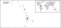
Saint Lucia is an island country in the West Indies in the eastern Caribbean Sea on the boundary with the Atlantic Ocean. The island was previously called Iyonola, the name given to the island by the native Arawaks, and later Hewanorra, the name given by the native Caribs, two separate Amerindian peoples. Part of the Windward Islands of the Lesser Antilles, it is located north/northeast of the island of Saint Vincent, northwest of Barbados and south of Martinique. It covers a land area of 617 km2 and reported a population of 165,595 in the 2010 census. Its capital is Castries. Soufrière was colonized by the French and was the original capital of the island.

Castries, population 20,000, aggl. 53,639, is the capital and largest city of Saint Lucia, an island country in the Caribbean. The district with the same name had a population of 70,000 on 22 May 2013 and stretches over an area of 80 km2 (31 sq mi).

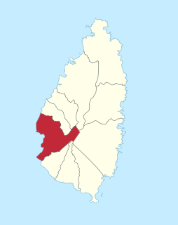
Soufrière is a district on the Southwest coast of Saint Lucia in the West Indies. Soufrière was the former capital of Saint Lucia during times of French rule. It is now a small fishing port with an emerging tourism industry. It has several tourist sites, including a "drive-in" volcano, the Diamond Botanical Gardens with waterfall and historic mineral baths, plus the nearby beaches of Anse Chastanet to the north and Malgretout to the south.

The island nation of Saint Lucia is divided into 10 districts. The name Quarters or Quartiers originally came from the French period in Saint Lucia. The 2001 and 2010 Census of Saint Lucia refers to the first level administrative divisions as districts. The FIPS and ISO standards regularly called these divisions quarters or quartiers in French. The former district of Dauphin Quarter was merged into Gros Islet District and the former district of Praslin Quarter was merged into Micoud District.

Castries District is one of 10 districts on the Caribbean island nation of Saint Lucia. According to the 2012 census, the population of the district was 80,573, having shown a slow but steady increase over the past ten years. The capital of Saint Lucia, the city of Castries, is located in this district. During the Saint Lucia Jazz Festival, the city of Castries plays host to several stages.

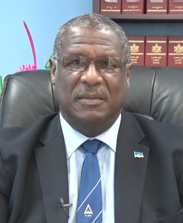
Philip Joseph Pierre is a Saint Lucian politician currently serving as the prime minister of Saint Lucia since 28 July 2021. Pierre serves as the Minister for Finance, Economic Development and the Youth Economy. He is the Leader of the Saint Lucia Labour Party since 18 June 2016. He has represented the Castries East constituency in the House of Assembly since 1997.

Stephenson King is the former Prime Minister of Saint Lucia. He is the Senior Minister and Minister for Infrastructure, Ports, Transport, Physical Development, and Urban Renewal. King was the former candidate for the United Workers Party (UWP). He now represents the constituency of Castries North as an Independent candidate as of July 2021 after resigning from the UWP.

The Cul De Sac River is a river in Castries Quarter of the island country of Saint Lucia. It flows north and then west from the central highlands in the south of the island, reaching the Caribbean Sea in Grand Cul de Sac Bay, south of the capital, Castries. It is one of the longest rivers in Saint Lucia.
Verena Marcelle Felicien is a former Saint Lucian cricketer who represented the West Indies in one Test and 36 One Day Internationals, including the 1997 World Cup in India and the 2005 World Cup in South Africa.

Babonneau is one of the regions of the Caribbean island nation of Saint Lucia. Babonneau is located in the north of the island in the Castries Quarter. There are extensive rain forests in the region, which is an important source of fresh water for Saint Lucia. Babonneau is also an electoral constituency of Saint Lucia represented in the House of Assembly of Saint Lucia, which extends into Gros Islet District.

Canaries is a populated place located on the West Coast of Saint Lucia in the Canaries Quarter. It is a small fishing village and it is nestled along the West Coast road, between the towns of Anse La Raye and Soufriere, and there are scenic views from both the Northern and Southern approaches.

The Castries River is a river in Castries Quarter on the island county of Saint Lucia.

Anse La Raye or Anse-La-Raye is the largest town and seat of the Anse la Raye District of Saint Lucia. It is located on the island's western side, near Marigot Bay, and has several examples of French and English colonial architecture.

Ti Rocher is a town in the Micoud District of the island nation of Saint Lucia. It is also a 2nd level division in Micoud District.

Barre Denis is a second-order administrative division in Castries District on the island nation of Saint Lucia. It has a population of 699. The town within Barre Denis is called Berre Denis. Barre Densis is located at the northern end of the island towards its heart, between Deglos and Tourat.

Vanard is a community on the island of Saint Lucia; it is located towards the heart of the island, near Sarot. The region of Vanard is in both Anse la Ray and Castries Districts.

The following is an alphabetical list of topics related to the nation of Saint Lucia.
Ti Rocher is the name of the geographic items:


