Tickle Cock Bridge

Last updated

View from the south side Tickle Cock Bridge April 2017.jpg
View from the south side

Tickle Cock Bridge is a pedestrian underpass in Castleford, England, under a railway line originally built by the York and North Midland Railway between York and Normanton. Built in 1890, the thoroughfare now connects the town's main residential area with the Carlton Lanes Shopping Centre, and is used by 50,000 pedestrians each week. The original Victorian structure, described by the shopping centre's manager as "small, narrow, very low and gloomy" and "frightening to walk through", was replaced in 2008 as part of an urban regeneration scheme. [1]

Contents

The replacement bridge was initially renamed Tittle Cott. After a protest organised by a local over-50s group, Wakefield Council reversed its decision and a plaque bearing the original name, Tickle Cock, was installed.

History and etymology

The word "cock" was first recorded in use as a vulgar term for the penis in the 16th century. Since roosters have also been dubbed "cocks", the term derives from the "tap-like shape" of a rooster's head and in "its function in 'pouring' semen", according to Cassell's Dictionary of Slang. [2] It was once common in England for areas to be given names that reflected their function or the activity taking place within them. [3] Local historian Brian Lewis believes that may be the explanation for the name that locals gave to the bridge during the late 19th or early 20th century: "[the underpass] would function in the same way as any 'monkey run', where you paraded up and down to find a boyfriend or girlfriend". [4] [lower-alpha 1]

Replacement

Original 1890 structure Tittle Cott Bridge - geograph.org.uk - 11129.jpg
Original 1890 structure
Prefabricated tunnel installed and waiting to be landscaped, 2005 TickleCockBridge.jpg
Prefabricated tunnel installed and waiting to be landscaped, 2005

The new underpass was designed by architects Deborah Saunt and Sam Potter of DSDHA (Deborah Saunt David Hills Architects) in collaboration with Brian Lewis and artist Martin Richman. Funding for the project was provided jointly by Wakefield Council, the Neighbourhood Renewal Fund, Network Rail, and the Arts Council England, Yorkshire. [6] [7]

After a competition in 2003, design and planning work continued until 2007. [7] The Victorian underpass was replaced by a prefabricated concrete tunnel, twice the width and 2 feet (0.61 m) taller than the original, by construction engineers Jane Wernick Associates in December 2005. As the installation took place under a live railway that was supported by the underpass, work was planned to cause the minimum disruption to train services; the line had to be closed for only two days around Christmas 2005. [1] The bridge's surroundings were improved in 2008, with better lighting, a new green space, and an angular seating shelter facing south-west to catch the sun in the evening. [1] Richman worked on the lighting scheme, [7] and the designers decided to line the walls of the underpass with a "tactile red flock" material, as an allusion to its "colourful history". [1]

The new bridge was opened on 27 June 2008 by Councillor Denise Jefferey. [8] The Times described the £200,000 structure as a "piece of sophisticated concrete geometry". [9] Saunt commented that it "is about cheering up those spots planning usually forgets about". [9] The replacement of the underpass was one of twelve elements in the Castleford Regeneration Project, originally proposed in 2001. It was featured in a four-part television series, Kevin McCloud and the Big Town Plan, broadcast by Channel 4 in August–September 2008. [10] [11]

Naming controversy

Plaque commemorating the opening of the new bridge TCPlaque2010.jpg
Plaque commemorating the opening of the new bridge

The council decided to name the new underpass Tittle Cott, a move that was met with dismay by local residents. The Castleford Area Voice for the Elderly, an over-50s group, organised a campaign to have the name Tickle Cock restored. The group's chairman, Margaret Shillito, was quoted in The Telegraph as saying, "The old plaque was wrong, it had the wrong name on and we were offended by it". Brian Lewis was quoted as saying "I feel we should never alter names and Tickle Cock has a very clear message behind it". A public meeting was held at which a "large majority" voted in favour of reverting to the original name, a decision that persuaded the council to replace the bridge's plaque with one bearing the legend Tickle Cock. [12]

See also

Related Research Articles

<span class="mw-page-title-main">Yorkshire and the Humber</span> Region of England

Yorkshire and the Humber is one of nine official regions of England at the first level of ITL for statistical purposes. The population in 2011 was 5,284,000 with its largest settlements being Leeds, Sheffield, Bradford, Hull, and York.

<span class="mw-page-title-main">West Yorkshire</span> County in Yorkshire and the Humber, England

West Yorkshire is a metropolitan and ceremonial county in the Yorkshire and the Humber region of England. It is an inland and upland county having eastward-draining valleys while taking in the moors of the Pennines. West Yorkshire came into existence as a metropolitan county in 1974 after the reorganisation of the Local Government Act 1972 which saw it formed from a large part of the West Riding of Yorkshire. The county had a population of 2.3 million in the 2011 census making it the fourth-largest by population in England. The largest towns are Huddersfield, Castleford, Batley, Bingley, Pontefract, Halifax, Brighouse, Keighley, Pudsey, Morley and Dewsbury. The three cities of West Yorkshire are Bradford, Leeds and Wakefield.

<span class="mw-page-title-main">Castleford</span> Town in West Yorkshire, England

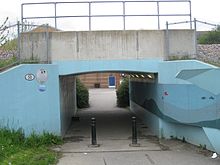
Castleford is a town within the City of Wakefield, West Yorkshire, England. It had a population of 45,106 at a 2021 population estimate. Historically in the West Riding of Yorkshire, to the north of the town centre the River Calder joins the River Aire and the Aire and Calder Navigation. It is located north east of Wakefield, north of Pontefract and south east of Leeds. Castleford is the largest town in the Wakefield district after Wakefield itself.

<span class="mw-page-title-main">River Aire</span> River in Yorkshire, England

The River Aire is a major river in Yorkshire, England, 92 miles (148 km) in length. Part of the river below Leeds is canalised, and is known as the Aire and Calder Navigation.

<span class="mw-page-title-main">Wakefield</span> City in West Yorkshire, England

Wakefield is a cathedral city in West Yorkshire, England located on the River Calder. The city had a population of 109,766 in the 2021 census, up from 99,251 in the 2011 census. The city is the administrative centre of the wider City of Wakefield metropolitan district, which had a 2021 population of 353,368, the 23rd most populous district in England. It is part of the West Yorkshire Built-up Area and the Yorkshire and The Humber region.

<span class="mw-page-title-main">Otley</span> Market town and civil parish in West Yorkshire, England

Otley is a market town and civil parish at a bridging point on the River Wharfe, in the City of Leeds metropolitan borough in West Yorkshire, England. Historically a part of the West Riding of Yorkshire, the population was 13,668 at the 2011 census. It is in two parts: south of the river is the historic town of Otley and to the north is Newall, which was formerly a separate township. The town is in lower Wharfedale on the A660 road which connects it to Leeds.

<span class="mw-page-title-main">Pontefract</span> Market town in West Yorkshire, England

Pontefract is a historic market town in the Metropolitan Borough of Wakefield in West Yorkshire, England, east of Wakefield and south of Castleford. Historically part of the West Riding of Yorkshire, it is one of the towns in the City of Wakefield District and had a population of 30,881 at the 2011 Census. Pontefract's motto is Post mortem patris pro filio, Latin for "After the death of the father, support the son", a reference to the town's Royalist sympathies in the English Civil War.

<span class="mw-page-title-main">City of Wakefield</span> City in West Yorkshire, England

The City of Wakefield is a local government district with the status of a city and metropolitan borough in West Yorkshire, England. Wakefield, the largest settlement, is the administrative centre of the district. The population of the City of Wakefield at the 2011 Census was 325,837. The district includes the Five Towns of Castleford, Featherstone, Knottingley, Normanton and Pontefract. Other towns include Hemsworth, Horbury, Ossett, South Elmsall and South Kirkby. The city and district are governed by Wakefield Metropolitan District Council from the County Hall.

<span class="mw-page-title-main">Wakefield Kirkgate railway station</span> Railway station in West Yorkshire, England

Wakefield Kirkgate railway station is a railway station in Wakefield, West Yorkshire, England. Unlike the nearby Wakefield Westgate railway station, Kirkgate is unstaffed. The station is managed by Northern but also served by Grand Central. It is on the Hallam, Pontefract and Huddersfield lines. It has a limited number of services to London King's Cross.

<span class="mw-page-title-main">Knottingley railway station</span> Railway station in West Yorkshire, England

Knottingley railway station serves the town of Knottingley in West Yorkshire, England. It lies on the Pontefract Line, operated by Northern, and is 16 miles (26 km) south east of Leeds railway station.

Stephen Norton, also known by the nickname of "Knocker", is an English former professional rugby league footballer who played in the 1970s and 1980s, and coached in the 1990s. He played at representative level for Great Britain, England and Yorkshire, and at club level for Fryston ARLFC, Castleford, Hull F.C. and Wakefield Trinity, as a second-row or loose forward, and coached at club level for Barrow.

<span class="mw-page-title-main">New Fryston</span> Village in West Yorkshire, England

New Fryston is a small former coal mining village in Castleford, West Yorkshire, England, located in a river bend on the south bank of the River Aire.

The Sheffield Town Trust, formerly officially known as the Burgery of Sheffield, is a charitable trust operating in Sheffield, South Yorkshire, England.

The Yorkshire ECB County Premier League was the top level of competition for recreational club cricket in Yorkshire, England, and between 1999 and 2015 was a designated ECB Premier League.

<span class="mw-page-title-main">Castleford bus station</span> Bus station in West Yorkshire, England

Castleford Bus Station serves the town of Castleford, West Yorkshire, England. The bus station is owned and managed by West Yorkshire Metro.

Kevin Beardmore was an English professional rugby league footballer who played in the 1970s, 1980s and 1990s. He played at representative level for Great Britain, England and Yorkshire, and at club level for Castleford, as a hooker or prop, i.e. number 9, or, 8 or 10.

<span class="mw-page-title-main">River Calder, West Yorkshire</span> River in West Yorkshire, England

The River Calder is a river in West Yorkshire, in Northern England.

<span class="mw-page-title-main">Oldham Mumps railway station</span> Former railway station in England

Oldham Mumps was a railway station, opened in 1847, which served the town of Oldham, Greater Manchester, England. The station was a primary station located on the Oldham Loop Line 7+12 miles (12 km) northeast of Manchester Victoria. At the time of closure, it was operated and managed by Northern Rail.

Renato Benedetti is a Canadian born and educated architect. He studied at the University of Waterloo and has practiced in London since 1989. He founded Benedetti Architects in 2016 following twenty years of partnership with Jonathan McDowell as co-directors of the multi award-winning practice McDowell+Benedetti. Celebrated projects by McDowell+Benedetti include Scale Lane Bridge in Hull and Castleford Bridge in Yorkshire.

References

Notes

  1. "Monkey run" was a British slang term for streets "where groups of young people paraded up and down, usually at weekends, in the hope of 'clicking' with somebody". [5]

Citations

  1. 1 2 3 4 Bloor, Caroline (29 August 2008), The Big Town Plan: The Underpass, Channel 4, archived from the original on 16 January 2010, retrieved 19 February 2010
  2. Green, Jonathon (2005). Cassell's Dictionary of Slang (2nd ed.). London: Sterling Publishing Company. p. 305. ISBN   978-0-304-36636-1.
  3. Holt & Baker 2001 , pp. 204–205
  4. Ginley, Joanne (11 March 2006), "Residents cock-a-hoop after winning fight to keep saucy underpass name", Yorkshire Post , archived from the original on 25 December 2013
  5. Humphries 1988, p. 38
  6. Shahmanesh-Banks, Nargess (14 July 2008), "Castleford Reveals its Redesigned Underpass", Building, retrieved 13 March 2023
  7. 1 2 3 "Castleford Project, Yorkshire Building", e-architect, 9 July 2008, archived from the original on 20 November 2008, retrieved 12 March 2010
  8. Etherington, Rose (10 July 2008), "Tickle Cock Bridge underpass by DSDHA", Dezeen, archived from the original on 11 April 2022, retrieved 19 March 2022
  9. 1 2 Dyckhoff, Tom (2 August 2008), "Kevin McCloud's big town plan for Castleford" , The Times , archived from the original on 24 October 2020, retrieved 27 October 2020
  10. Brown, Maggie (4 September 2008), "Kevin McCloud and the Big Town Plan: a heroic failure?", The Guardian , archived from the original on 16 January 2018, retrieved 13 March 2023
  11. "Kevin McCloud and the Big Town Plan", Channel 4, archived from the original on 9 December 2022, retrieved 13 March 2023
  12. Stokes, Paul (18 February 2010), "Tickle Cock Bridge Returned to Original Name after Row" , The Telegraph , archived from the original on 21 February 2010, retrieved 19 February 2010

Bibliography

  • Holt, Richard; Baker, Nigel (2001), "Indecent Exposure – Sexuality, Society and the Archaeological Record", in Bevan, Lynne (ed.), Towards a Geography of Sexual Encounter: Prostitution in English Medieval Towns, Glasgow: Cruithne Press, ISBN   978-1-873448-19-9
  • Humphries, Stephen (1988), Secret World of Sex, Sidgwick & Jackson, ISBN   978-0-283-99553-8

Coordinates: 53°43′30″N1°21′05″W / 53.725118°N 1.351402°W / 53.725118; -1.351402