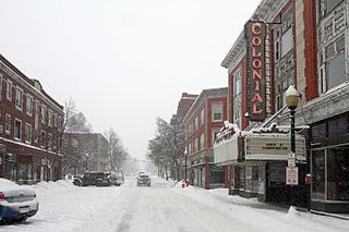
Laconia is a city in Belknap County, New Hampshire, United States. The population was 16,871 at the 2020 census, up from 15,951 at the 2010 census. It is the county seat of Belknap County. Laconia, situated between Lake Winnipesaukee and Lake Winnisquam, includes the villages of Lakeport and Weirs Beach. Each June, the city hosts Laconia Motorcycle Week, also more simply known as "Bike Week", one of the country's largest rallies.

Sanbornton is a town in Belknap County, New Hampshire, United States. The population was 3,026 at the 2020 census. It includes the villages of North Sanbornton and Gaza.
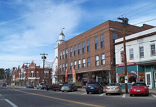
Tilton is a town on the Winnipesaukee River in Belknap County, New Hampshire, United States. The population was 3,962 at the 2020 census, up from 3,567 at the 2010 census. It includes the villages of Tilton and Lochmere and part of the village of Winnisquam. Tilton is home to the Tilton School, a private preparatory school.

Franklin is a city in Merrimack County, New Hampshire, United States. At the 2020 census, the population was 8,741, the least of New Hampshire's 13 cities. Franklin includes the village of West Franklin.

New Hampshire Route 132 is a 40.012-mile-long (64.393 km) north–south highway in Belknap and Merrimack counties in central New Hampshire. NH 132 runs from Concord north to Ashland in the Lakes Region, parallel to Interstate 93.

The Winnipesaukee River is a 10.5-mile-long (16.9 km) river that connects Lake Winnipesaukee with the Pemigewasset and Merrimack rivers in Franklin, New Hampshire. The river is in the Lakes Region of central New Hampshire. The river's drainage area is approximately 488 square miles (1,264 km2).
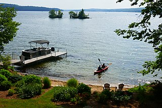
Lake Winnisquam is in Belknap County in the Lakes Region of central New Hampshire, United States, in the communities of Meredith, Laconia, Sanbornton, Belmont, and Tilton. At 4,214 acres (1,705 ha), it is the fourth-largest lake entirely in New Hampshire. The lake is roughly triangular in shape, with the vertexes pointing north, east, and south. The lake lies along the path of the Winnipesaukee River, which enters the lake from its eastern corner and carries water from Lake Winnipesaukee via Paugus Bay and Opechee Bay. The river also flows south out of Winnisquam's southern corner, eventually joining the Merrimack River. The lake extends several miles north from the course of the Winnipesaukee River, which forms the lake's southeastern side, with the northern point being formed by the confluence of several smaller creeks near the village of Meredith Center. The lake has a maximum depth of 155 feet (47 m).
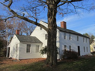
The Parsons, Shepherd, and Damon Houses Historic District is a historic district on the east side of downtown Northampton, Massachusetts encompassing a 2.5-acre (1.0 ha) property that was first laid out in 1654. Now owned by Historic Northampton, the property includes three houses built between 1730 and 1830. The district was added to the National Register of Historic Places in 2001.

Northfield Union Church is a historic church on Sondogardy Pond Road in Northfield, New Hampshire. Built in 1883, it is a fine example of modest Carpenter Gothic architecture, designed by Edward Dow, one of New Hampshire's leading late-19th century architects. It was added to the National Register of Historic Places in 1984.

The Memorial Arch of Tilton, sometimes referred to as Tilton's Folly, is a historic arch on Elm Street in Northfield, New Hampshire, United States, on a hill overlooking the town of Tilton. The 55-foot-tall arch (17 m) was built by Charles E. Tilton in 1882; it was modeled after the Arch of Titus in Rome, its surfaces, however, modeled in the rustication that was currently a fashionable feature of Romanesque revival building. The Memorial Arch of Tilton was added to the National Register of Historic Places in 1980.
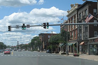
The Downtown Main Street Historic District encompasses a well-preserved historical section of downtown East Hartford, Connecticut, United States. It extends along Main Street from between Burnside Avenue and Governor Street, and along Chapman Street to Chapman Place. Developed between about 1890 and 1945, its architecture encapsulates the town's transition from a main agrarian community to a modern suburb. The district was listed on the National Register of Historic Places in 1996.

The Hall Memorial Library is the public library of Tilton and Northfield, New Hampshire. It is located at 18 Park Street in Northfield, in an 1887 Richardsonian Romanesque building. The building, one of the most architecturally distinguished in the region, was listed on the National Register of Historic Places in 1978.
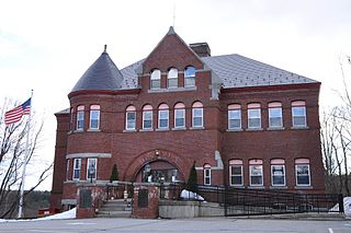
The Pittsfield Center Historic District encompasses the civic and commercial heart of Pittsfield, New Hampshire. This area is defined by a roughly square bend in the Suncook River, whose power provided an impetus for the development of the town in the 19th century. The dominant feature of the district is the 1827 Joy Cotton Mill, a four-story brick building at the base of Main Street. There are three churches, including the 1863 Gothic Revival St. Stephen's Episcopal Church, and the town office building, a significantly altered 1789 meeting house. The district also includes the main commercial district and some of the surrounding residential areas. It was listed on the National Register of Historic Places in 1980.

The Charlestown Main Street Historic District encompasses the historic heart of Charlestown, New Hampshire. It is located along Main Street, roughly between Lower Landing Road and Bridge Street, and encapsulates more than two hundred years of the town's history. The district was listed on the National Register of Historic Places in 1987.

The Charles E. Tilton Mansion, now the Lucian Hunt Library, stands on the campus of the Tilton School in Tilton, New Hampshire, United States. Built in the 1860s and enlarged several times in the 19th century, it is one of the state's most architecturally eclectic houses. It was built by banker and philanthropist Charles E. Tilton, for whose family the town is named. The building was listed on the National Register of Historic Places in 1982. It was acquired by the Tilton School in 1962 and adapted for use as its library, which is named for Lucius Hunt, a teacher of Classics at the school.

The Tilton Island Park Bridge is a foot bridge in Tilton, New Hampshire. It spans a portion of the Winnipesaukee River just east of downtown Tilton, providing access to Tilton Island Park, located on an island in the river. Built in 1881, it is a rare surviving example of a bridge with cast iron components, designed by a distinctive patent issued in 1858 to Lucius Truesdell. The bridge was listed on the National Register of Historic Places in 1980.

The Sanbornton Square Historic District encompasses the historic center of Sanbornton, New Hampshire. The town, granted in 1748 and incorporated in 1777, is the mother town of Franklin and Tilton, and was one of the first to be established by the Masonian proprietors. Unlike towns settled earlier, no specific plan was made for a town center, with the result that Sanbornton Square arose organically as the principal site of civic and religious life in the town. The district was listed on the National Register of Historic Places in 1980.

The Monument Square Historic District of Alton, New Hampshire, encompasses the 19th-century heart of the town, a roughly triangular open space formed by the junction of Main Street and Old Wolfeboro Road between Factory Street and Church Street. It is notable for its well-preserved 19th-century buildings, and for its relatively uncommon shape, born out of the area's origin as a major road junction. The district was listed on the National Register of Historic Places in 1984.

The Bethel Village Historic District encompasses the historic core of the village of Bethel in the town of Bethel, Vermont, USA. The L-shaped district extends along Main and Church Streets, including many of the village's commercial and civic buildings, as well as a significant number of 19th and early 20th-century residences. The district was listed on the National Register of Historic Places in 1976, and was slightly enlarged in 1990.
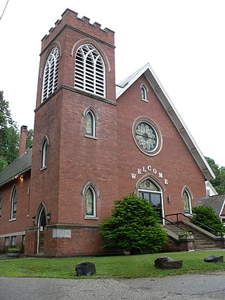
The Springfield Downtown Historic District encompasses the historic central business district of the town of Springfield, Vermont. Located in a narrow valley on the banks of the Black River, the town's architecture is primarily reflective of its importance as a manufacturing center in the late 19th and early-to-mid 20th centuries, with a cluster of commercial buildings surrounded by residential and industrial areas. It was listed on the National Register of Historic Places in 1983, and enlarged slightly in 1986.


