Dhar is a city located in Dhar district of the Malwa region in the state of Madhya Pradesh, India. The city is the administrative headquarters of the Dhar district. Before Indian independence from Great Britain, it was the capital of the Dhar princely state.
Indore division is an administrative geographical unit of Madhya Pradesh state of India. Indore is the administrative headquarters of the division.

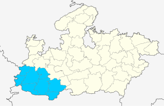
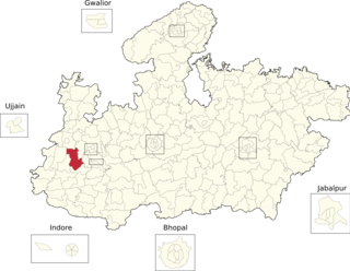
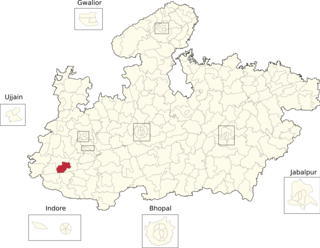
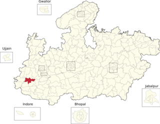
Dhar district is a district of Madhya Pradesh state in central India. The historic town of Dhar is administrative headquarters of the district.
Badnawar (or Badnavar) is a Town, former pargana and a Nagar Parishad of the Dhar district in the state of Madhya Pradesh, India. This is a tehsil place having 170 villages. Badnawar is around 95 km from Indore - the business capital of Madhya Pradesh.
Dharampuri is a town and headquarters of a tehsil in Dhar district in the state of Madhya Pradesh, India. It is situated on banks of river Narmada. It is a place of some historical and archaeological interest.
Manawar is a town with tehsil in Dhar district in the Indian state of Madhya Pradesh. The name Manawar came from name of river Mān that flows at southern edge of the town. Pin code of Manawar is 454446.
Khalghat is a small town and a gram panchayat in Dhar district in the state of Madhya Pradesh, India. It is located on the north bank of the Narmada, at an important ford where the Agra-Bombay national highway crosses the river. Hindi and Nimadi and Malvi are the primary languages spoken in the area.

Dhar State was a princely state. It was a salute state in the colonial sway of the Central India Agency. Dhar began as one of the states during Maratha dominance in India about 1730. In 1941 it had an area of 1,798 square miles (4,660 km2) and a population of 253,210. Dhar was the capital of the state since 1732 (from the 1728 foundation, the Raja's first seat had been at Multhan in Dhar district. In 1948, it became part of Madhya Bharat.

Dhar Lok Sabha constituency is one of the 29 Lok Sabha constituencies in the Indian state of Madhya Pradesh. This constituency is reserved for the Scheduled Tribes. This constituency came into existence in 1967. It covers the entire Dhar district and part of Indore district.
Dehrisaray is a town in Dhar district in the Malwa zone portion of the Madhya Pradesh state of India. It is also known as Ghatabillod.
Bandheri is a town, near Dhar city in Dhar district of Madhya Pradesh, India.

Kukshi Assembly constituency is one of the 230 Vidhan Sabha constituencies of Madhya Pradesh state in central India. It was founded in 1951 as one of the 79 Vidhan Sabha constituencies of the erstwhile Madhya Bharat state. It is reserved for candidates of the Scheduled tribes.
Nalchha also known as Nalcha is a small town in Dhar district in the state of Madhya Pradesh, India. It is situated 25 km away from Dhar, which is both district & sub-district headquarter of Nalchha village. The total geographical area of village is 1598.8 hectares.

Dr. Ambedkar Nagar-Mhow Assembly constituency is one of the 230 Vidhan Sabha constituencies of Madhya Pradesh state in central India.
Bidwal is a village and former jagir in Madhya Pradesh, western India.
Badnawar Assembly constituency is one of the 230 assembly constituencies of Madhya Pradesh a centre Indian state. Badnawar is also part of Dhar Lok Sabha constituency.

Dhar Assembly constituency is one of the 230 Vidhan Sabha constituencies of Madhya Pradesh state in central India.

Dharampuri Assembly constituency is one of the 230 Vidhan Sabha constituencies of Madhya Pradesh state in central India.
Manawar Assembly constituency is one of the 230 Vidhan Sabha constituencies of Madhya Pradesh state in central India.
Gandhwani Assembly constituency is one of the 230 Vidhan Sabha constituencies of Madhya Pradesh state in central India.
