Chuquiananta is a mountain in the Andes of southern Peru, about 5,300 metres (17,388 ft) high. It is situated in the Moquegua Region, Mariscal Nieto Province, Torata District, and in the Tacna Region, Candarave Province, Camilaca District. Chuquiananta lies south-west of Tutupaca volcano, south-east of Pomani.
Pomani is a mountain in the Andes of southern Peru, about 5,300 metres (17,388 ft) high. It is situated in the Moquegua Region, Mariscal Nieto Province, Torata District. Pomani lies south-west of the volcano Tutupaca and north-west of the mountain Chuquiananta. The Asana River originates near the mountain.
Paxsi Awki is a mountain in the Andes of southern Peru, about 5,344 metres (17,533 ft) high. It is situated in the Moquegua Region, Mariscal Nieto Province, Carumas District, and in the Tacna Region, Candarave Province, Candarave District.
Challuma is a 5,187-metre-high (17,018 ft) mountain in the Andes of southern Peru near a lake of the same name. It is situated in the Moquegua Region, Mariscal Nieto Province, Carumas District, and in the Tacna Region, Candarave Province, Candarave District. It lies northeast of the mountain Churilaca.
Churilaca is a 5,260-metre-high (17,257 ft) mountain in the Andes of southern Peru. It is situated in the Moquegua Region, Mariscal Nieto Province, Carumas District, and in the Tacna Region, Candarave Province, Candarave District. Churilaca lies south-west of the mountain Challuma.
Warintapani is a 5,060-metre-high (16,601 ft) mountain in the Andes of southern Peru. It is situated in the Moquegua Region, Mariscal Nieto Province, Carumas District, and in the Tacna Region, Candarave Province, Candarave District.
Vizcachas is a 5,354-metre-high (17,566 ft) mountain in the Andes of southern Peru. It is situated in the Moquegua Region, Mariscal Nieto Province, Carumas District, and in the Tacna Region, Candarave Province, Candarave District. The mountain lies south-east of Vizcachas Lake.
Huañuma is a mountain in the Andes of southern Peru, about 5,200 metres (17,060 ft) high. It is located in the Moquegua Region, Mariscal Nieto Province, Torata District, and in the Tacna Region, Candarave Province, Camilaca District. Huañuma lies south of Limani, Apacheta Limani and Tutupaca, west of the Tutupaca volcano, north of Chuquiananta and northeast of Pomani.
Apacheta Limani is a mountain in the Andes of southern Peru, about 5,300 metres (17,388 ft) high. It is located in the Moquegua Region, Mariscal Nieto Province, Torata District, and in the Tacna Region, Candarave Province, Camilaca District. Apacheta Limani is situated south of the mountain Limani, northwest of the Tutupaca volcano, Chuquiananta and Huañuma, and northeast of Pomani. The Asana River originates near Apacheta Limani. It flows to the southwest.
Waytiri is a mountain in the Andes of southern Peru, about 5,000 metres (16,404 ft) high. It is situated in the Moquegua Region, Mariscal Nieto Province, Carumas District, and in the Tacna Region, Candarave Province, Candarave District. Waytiri lies northeast of the mountain Warintapani.
Wila Wilani or Ch'ankha Qullu is a mountain in the Andes of southern Peru, about 4,900 metres (16,076 ft) high. It is located in the Moquegua Region, Mariscal Nieto Province, Carumas District, and in the Tacna Region, Candarave Province, Candarave District. It lies west of a lake named Aqhuya Ch'alla, northwest of Paxsi Awki and east of Churi Laq'a, Ch'alluma and Ch'ankhani.
Pacocollo also known as Chancane, is a 5,113-metre-high (16,775 ft) mountain in the Andes of southern Peru. It is located in the Moquegua Region, Mariscal Nieto Province, Carumas District, and in the Tacna Region, Candarave Province, Candarave District. Pacocollo lies west of a lake named Pasto Grande or Ajuachaya and Wila Wilani.
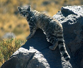
Yunkani is a 4,943-metre-high (16,217 ft) mountain in the Andes of southern Peru. It is situated in the Moquegua Region, Mariscal Nieto Province, Carumas District, and in the Tacna Region, Candarave Province, Candarave District. Yunkani lies southwest of the mountain Paxsi Awki and northwest of the mountain Wisk'acha and Wisk'acha Lake.
Iru Uma is a 5,055-metre-high (16,585 ft) mountain in the Andes of southern Peru. It is situated in the Moquegua Region, Mariscal Nieto Province, Carumas District, and in the Tacna Region, Candarave Province, Candarave District. Iru Uma lies southeast of Wisk'acha Lake and southwest of the mountain Wisk'acha.
Qupa Phuju is a 5,400-metre-high (17,717 ft) mountain in the Andes of southern Peru. It is located in the Moquegua Region, Mariscal Nieto Province, Carumas District, and in the Tacna Region, Candarave Province, Candarave District. Qupa Phuju lies southwest of the lake Lurisquta, southeast of Wisk'acha Lake and the mountain Wisk'acha and east of Iru Uma.
Quinaquinani is a mountain in the Andes of Peru, about 5,200 metres (17,060 ft) high. It is situated in the Moquegua Region, Mariscal Nieto Province, Carumas District, and in the Puno Region, Puno Province, Acora District. It lies south of the mountain Arichua.
Achucallani is a mountain in the Andes of southern Peru, about 5,000 metres (16,404 ft) high. It is situated in the Moquegua Region, Mariscal Nieto Province, Torata District. Achucallani lies southwest of Humajalso, Iruma and Surehuayco.
Surehuayco and from Quechua Suri Wayq'u) is a mountain in the Andes of southern Peru, about 4,800 metres (15,748 ft) high. It is situated in the Moquegua Region, Mariscal Nieto Province, Torata District. It lies southwest of the mountain Iruma and east of Achucallani. Surehuayco is also the name of an intermittent stream north of the mountain.
Chinchillani is a mountain in the Andes of southern Peru, about 4,800 m (15,700 ft) high. It is situated in the Moquegua Region, Mariscal Nieto Province, Torata District, and in the Tacna Region, Candarave Province, Camilaca District. Chinchillani lies southwest of Chuquiananta.
Sirka Sirka is a mountain in the Peruvian Andes, about 5,200 m (17,100 ft) high. It is located in the Moquegua Region, Mariscal Nieto Province, Carumas District, and in the Puno Region, Puno Province, Acora District. It lies southeast of Q'iwiri.