
Downsview is a neighbourhood in the north end of Toronto, Ontario, Canada, located in the district of North York. The area takes its name from the Downs View farm established around 1842 near the present-day intersection of Keele Street and Wilson Avenue. It now extends beyond the intersection of Sheppard Avenue and Dufferin Street, though it is popularly seen as including the areas to the north right up to the Toronto city limit at Steeles Avenue. The area includes several large post-World War II subdivisions. Within the area is Downsview Airport, the former site of Canadian Forces Base Downsview, which has since been largely converted following the end of the Cold War into an urban park known as Downsview Park. The airport is still used as a manufacturing and testing facility for Bombardier Aerospace.
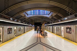
William R. Allen Road, also known as Allen Road and the Allen, is a short expressway and arterial road in Toronto, Ontario. It starts as a controlled-access expressway at Eglinton Avenue West, heading north to just south of Transit Road, then continues as an arterial road north to Kennard Avenue, where it continues north as the northern portion of Dufferin Street. Allen Road is named after late Metro Toronto chairman William R. Allen and is maintained by the City of Toronto. Landmarks along the road include the Lawrence Heights housing project, Yorkdale Shopping Centre and Downsview Park, and Downsview Airport. A section of the Toronto subway Line 1 Yonge–University is located within its median from Eglinton Avenue to north of Wilson Avenue, and briefly runs parallel to it underground in the vicinity of Sheppard Avenue.
Bathurst Manor is a neighbourhood located in the North York district of Toronto, Ontario, Canada. It sits on a plateau bounded on the north by Finch Avenue West, on the west by Dufferin Street, on the east by the Don River, and on the south by Sheppard Avenue West. The area is also regarded as part of the Downsview postal area as designated by Canada Post. It is part of the former City of North York, which merged with five other municipalities and a regional government to form the new "City of Toronto" in 1998. It is part of the federal and provincial electoral district York Centre, and Toronto electoral ward 10: York Centre (East). In 2006, it had a population of 14,615.
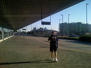
Sheppard West is a subway station on Line 1 Yonge–University in Toronto, Ontario, Canada. The station, which is located at the southeast corner of Sheppard Avenue West–Allen Road intersection, opened in 1996 in what was then the City of North York, and the large commuter parking lot, accessible via Allen Road and Sheppard Avenue, opened in July 2005. It was the northern terminus of the western branch of the line until the opening of the six stations of the line's extension north to the City of Vaughan's new downtown core on December 17, 2017.

Sheppard Avenue is an east–west principal arterial road in Toronto, Ontario, Canada. The street has two distinct branches near its eastern end, with the original route being a collector road leading to Pickering via a turnoff, and the main route following a later-built roadway which runs south to Kingston Road. To avoid name duplication, the Toronto portion of the northern branch was renamed Twyn Rivers Drive. The section of the street entirely in Toronto is (34.2 km) in length, while the Pickering section and Twyn Rivers Dr. is (5.4 km) long.

Downsview Park is a large urban park located in the Downsview neighbourhood of Toronto, Ontario, Canada. The park's name is officially bilingual due to it being federally owned and managed, and was first home to de Havilland Canada, an aircraft manufacturer, and later was a Canadian Forces base. The park still contains Downsview Airport. In 1999, the Government of Canada declared it as "Canada's first urban national park." However, unlike the Rouge National Urban Park in eastern Toronto, Downsview Park is managed by the federal Crown corporation Canada Lands Company rather than Parks Canada. As of 2017, little development has taken place, and the park remains mostly untouched.

Dufferin Street is a major north–south street in Toronto, Vaughan and King, Ontario, Canada. It is a concession road, two concessions (4 km) west of Yonge Street. The street starts at Exhibition Place, continues north to Toronto's northern boundary at Steeles Avenue with some discontinuities and continues into Vaughan, where it becomes York Regional Road 53. The street is named for Frederick Hamilton-Temple-Blackwood, 1st Marquess of Dufferin and Ava, who served as Governor General of Canada from 1872 to 1878. Prior to 1878 the street was labelled as Western City Limits or Sideline Road south off Bloor. In 2003 and 2007, it was voted as one of "Ontario's Worst 20 Roads" in the Ontario's Worst Roads poll organized by the Canadian Automobile Association.

Downsview Airport is located in the North York district of Toronto, Ontario, Canada. An air field, then air force base, it has been a testing facility for Bombardier Aerospace since 1994. Bombardier has sold the facility and manufacturing plant and its future is uncertain.
Barker Field was one of several airfields in the Yorkdale area of Toronto, Ontario, Canada.

Leaside Aerodrome was an airport in the Town of Leaside, Ontario. It opened in 1917 as a Royal Flying Corps airfield during the First World War.
Long Branch Aerodrome was an airfield located west of Toronto, Ontario and just east of Port Credit, now Mississauga, and was Canada's first aerodrome. The airport was opened by the Curtiss Flying School, part of the Curtiss Aeroplane and Motor Company, as a pilot training school in 1915. In 1917 the airport was run by the Royal Flying Corps (RFC), and then closed in 1919. It is recognized by the existence of Aviation Road in the Lakeview, Mississauga community and a historical plaque.

Black Creek is a river in the Golden Horseshoe region of Ontario, Canada. It flows from the city of Vaughan in the Regional Municipality of York to the Humber River in Toronto. Black Creek is smaller than most of the waterways in the Greater Toronto Area.
Edenvale Airport is located 2.8 nautical miles west of Edenvale, Ontario, Canada.
Canadian Forces Base Toronto is a former Canadian Forces base in Toronto, Ontario. The airfield is currently operated as Toronto / Downsview Airport.

Clanton Park is a Neighbourhood in the North York area of Toronto, Ontario, Canada. It is part of federal and provincial electoral district York Centre, and Toronto electoral wards 9: York Centre (West) and 10: York Centre (East). In 2006, it had a population of 13,035.

Lieutenant-Colonel George Taylor Denison III Armoury, commonly known as Denison Armoury, is a Canadian Armed Forces facility located at 1 Yukon Lane in Toronto, Ontario, Canada. It is in the northeastern corner of Downsview Airport, just west of the W.R. Allen Expressway on Sheppard Avenue West.
De Lesseps Field was a small, but important airfield in early aviation in Toronto, Ontario, Canada.
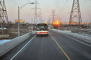
The York University Busway is a bus-only roadway in Toronto, Ontario, Canada, which stretches 1.8 kilometres (1.1 mi) from Finch West station to Dufferin Street. It is used by the Toronto Transit Commission's 939B Finch Express bus route.
