
Uummannaq Fjord is a large fjord system in the northern part of western Greenland, the largest after Kangertittivaq fjord in eastern Greenland. It has a roughly south-east to west-north-west orientation, emptying into the Baffin Bay in the northwest.

Kaiser Franz Joseph Fjord is a major fjord system in the NE Greenland National Park area, East Greenland.

Independence Fjord or Independence Sound is a large fjord or sound in the eastern part of northern Greenland. It is about 200 km (120 mi) long and up to 30 km (19 mi) wide. Its mouth, opening to the Wandel Sea of the Arctic Ocean is located at 82°15′N21°54′W.

Appat Island is an uninhabited island in the Avannaata municipality in northwestern Greenland. At 211 km2 (81.5 sq mi), it is one of the larger islands in the Uummannaq Fjord system, located in its north-central part. It is the site of the former settlements of Ritenbenck and Qaqortuatsiaq.
Akuliaruseq Island is an uninhabited island in the Avannaata municipality in northwestern Greenland.
Torsukattak may refer to the following landforms in Greenland, from north to south:
Torsukattak Strait is a strait in Avannaata municipality in northwestern Greenland.

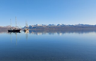
The Prince Christian Sound is a waterway in Southern Greenland. It separates the mainland from Sammisoq and other islands of the Cape Farewell Archipelago near the southernmost tip of Greenland. The name was given in honour of the prince, later king Christian VIII of Denmark.

Cape Farewell Archipelago is an island group located at the southern end of Greenland in Kujalleq municipality. The archipelago takes its name from Cape Farewell, a headland of Egger Island.
Upernattivik – also known as Upernarsuak – is an uninhabited island in King Frederick VI Coast, southeastern Greenland. Administratively it is part of the Sermersooq municipality.

Kangerlussuaq Fjord is a fjord in eastern Greenland. It is part of the Sermersooq municipality.

Umivik Bay, also known as Umiivik and Umerik, is a bay in King Frederick VI Coast, southeastern Greenland. It is part of the Sermersooq municipality.

Torsukattak is a fjord in western Greenland. Administratively it is part of Avannaata municipality.
Ingolf Fjord, also known as Ingolf Sound, is a fjord of Greenland's northeastern coast in northern King Frederick VIII Land.
Skaer Fjord, is a fjord in King Frederick VIII Land, northeastern Greenland.

Ofjord is a fjord in King Christian X Land, eastern Greenland. This fjord is part of the Scoresby Sound system. Administratively it lies in the area of Sermersooq municipality.
Hurry Inlet is a fjord in King Christian X Land, eastern Greenland. This fjord is part of the Scoresby Sound system. Administratively it lies in the area of Sermersooq municipality.

Torgilsbu was a Norwegian hunting, meteorological and radio station located on the King Frederick VI Coast, Southeastern Greenland.


